Data Sets (41)
|
1 of 3
Prev
|
Next
|
Delta Urban-Rural Population and Land Area Estimates, v1 (1990, 2000, 2014, 2015)Low Elevation Coastal Zone (LECZ)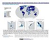
To provide country-level estimates of populations and land areas in river delta- and non-delta contexts for the years 1990, 2000, 2014, and 2015 for 246 statistical areas, focusing on greater-risk zones using the global extent of low elevation zones contiguous to the coast bounded by either 5 meters or 10 meters. |
Groundswell Africa Spatial Population and Migration Projections at One-Eighth Degree According to SSPs and RCPs, v1 (
|
|
U.S. Social Vulnerability Index Grids, v1.01 (2000, 2010, 2014, 2016, 2018, 2020)U.S. Census Grids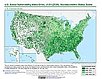
To provide a 1 km grid of the CDC Social Vulnerability Index (SVI) aligned with CIESIN's Gridded Population of the World, Version 4, Revision 11 (GPWv4.11) with a mask for water and no population. |
Environmental Performance Index, 2022 Release (
|
|
Groundswell Spatial Population and Migration Projections at One-Eighth Degree According to SSPs and RCPs, v1 (
|
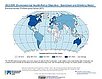
Urban-Rural Population and Land Area Estimates, v3 (1990, 2000, 2015)Low Elevation Coastal Zone (LECZ)
To provide estimates of urban and rural populations and land areas for the years 1990, 2000, 2015 for 234 countries and statistical areas with contiguous coastal elevations of less than or equal to 5m above sea level, 5-10m above sea level, and national totals using multiple updated data sources for comparative analysis. |
|
Environmental Performance Index, 2020 Release (
|
Subset of OpenStreetMap Roads, v1 (2014)West Africa Coastal Vulnerability MappingTo provide roads linking rural production to urban markets in the coastal zone of West Africa that represent an important exposed infrastructure asset. |
|
Subset of Global Mammal and Amphibian Richness Grids, 2015 Release (2013)West Africa Coastal Vulnerability MappingTo provide areas of higher richness of threatened species which may be at risk from climate stressors in the coastal zone of West Africa. |
Subset of High and Low Resolution Altimeter Corrected Elevations 2 (ACE2), v1 (
|
|
Social Vulnerability Indices, v1 (1997, 2005, 2008, 2010, 2013)West Africa Coastal Vulnerability MappingTo provide a measure of social vulnerability and "defenselessness" in the face of climate stressors in the coastal zone of West Africa. |
Subset of JRC Map of Accessibility, v1 (
|
|
Mangrove Forests Distribution Polygon, v1 (2000)West Africa Coastal Vulnerability MappingTo provide mangrove forests in the coastal zone of West Africa that may be exposed to the threats of sea level rise and storm surge. |
GPWv4 Population Growth Preliminary Release, v1 (
|
|
Population Projections, v1 (2030, 2050)West Africa Coastal Vulnerability MappingTo provide areas in West Africa that may be particularly exposed to climate stressors owing to future high population growth. |
GPWv4 Population Density Preliminary Release, v1 (2010)West Africa Coastal Vulnerability MappingTo provide areas in the coastal zone of West Africa that may be particularly exposed to climate stressors owing to high population density. |
|
Demographic and Health Survey Data Sets, v1 (
|
Gridded Subset of Sub-national Poverty and Extreme Poverty Prevalence, v1 (2005)West Africa Coastal Vulnerability MappingTo provide poverty levels in the coastal zone of West Africa. |
|
Deforestation, v1 (
|
Subset of DMSP-OLS Nighttime Lights for Economic Activity, v1 (2010)West Africa Coastal Vulnerability MappingTo provide a measure of economic activity in the coastal zone of West Africa based on nighttime lights. |

|
1 of 3
Prev
|
Next
|