Socioeconomic Data and Applications Center (
sedac
)
A Data Center in NASA's Earth Observing System Data and Information System (
EOSDIS
) — Hosted by
CIESIN
at
Columbia University
Search SEDAC
Data
Data Sets
Maps
Web Pages
search
Data
· Data Sets
· Data Collections
· Featured Data Uses
· Data Citations
· Citations Database
· Data Submission
Maps
· Map Gallery
· Map Viewer
· Map Services
· Mapping Tools
Themes
· Agriculture
· Climate
· Conservation
· Governance
· Hazards
· Health
· Infrastructure
· Land Use
· Marine and Coastal
· Population
· Poverty
· Remote Sensing
· Sustainability
· Urban
· Water
Resources
· Guides
· Multimedia
· Networks
· News
· Publications
· Related Sites
· Remote Sensing
· Tools
Social Media
· Twitter
· FaceBook
· YouTube
· Flickr
· Blog Posts
· Communities
About
· About SEDAC
· User Working Group
· Privacy
· User Registration
Help
Map Gallery
(548)
Follow Us:
Twitter
Follow Us on Facebook
YouTube
Flickr
| Share:
Twitter
Facebook
Search
All Fields:
search
Theme
Agriculture
(229)
Climate
(344)
Conservation
(157)
Framework Data
(1)
Governance
(166)
Hazards
(63)
Health
(234)
Infrastructure
(42)
Land Use
(79)
Marine and Coastal
(93)
Population
(140)
Poverty
(32)
remote sensing
(6)
Remote Sensing
(58)
Sustainability
(399)
Urban
(74)
Water
(95)
Maps
»
Region: Global
Remove Facet
4 of 18
Prev
|
Next
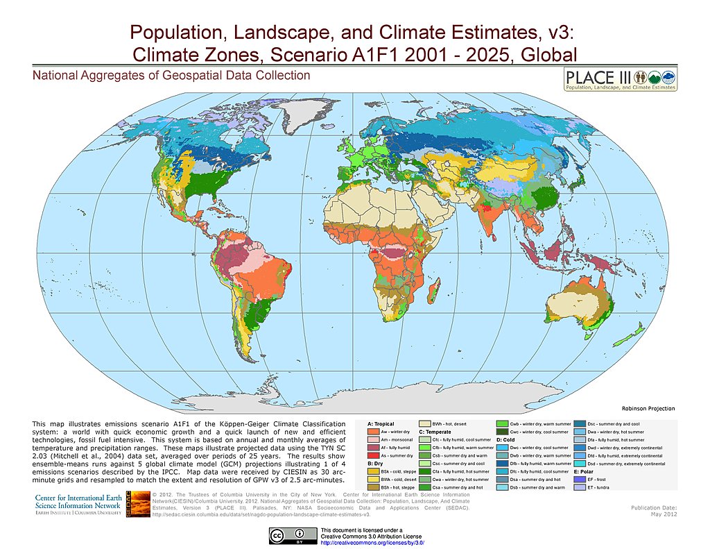
A1F1 - Climate Zones (2001-2025)
A2 - Climate Zones (2001-2025)
B1 - Climate Zones (2001-2025)
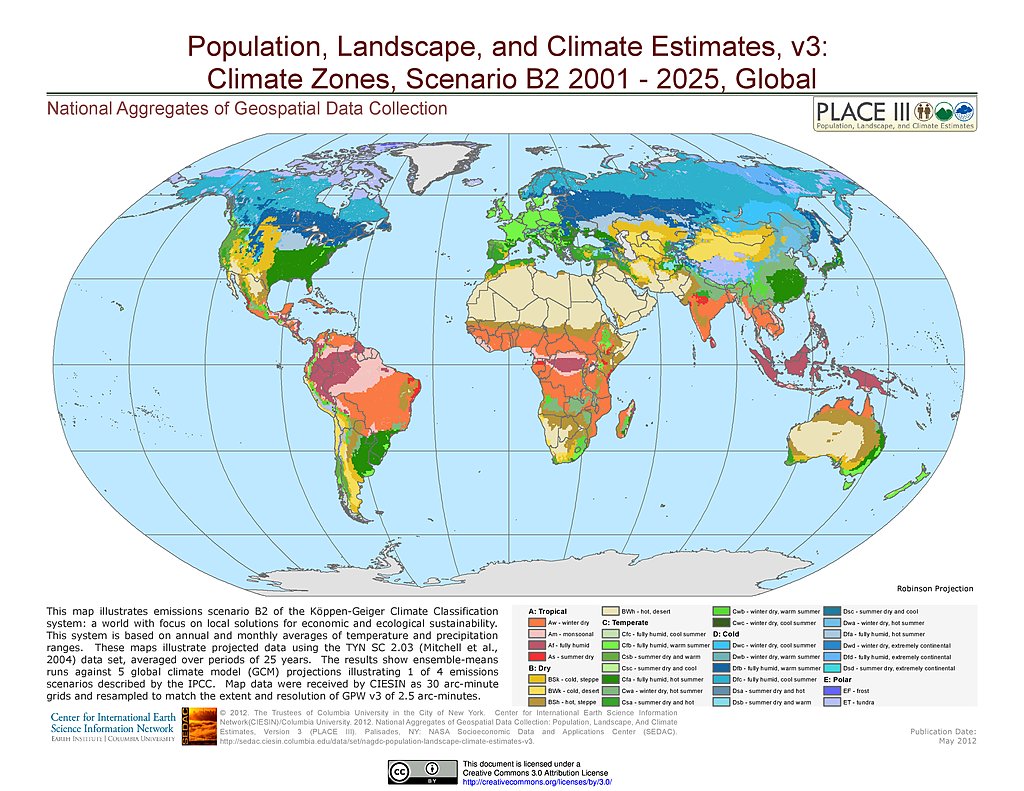
B2 - Climate Zones (2001-2025)
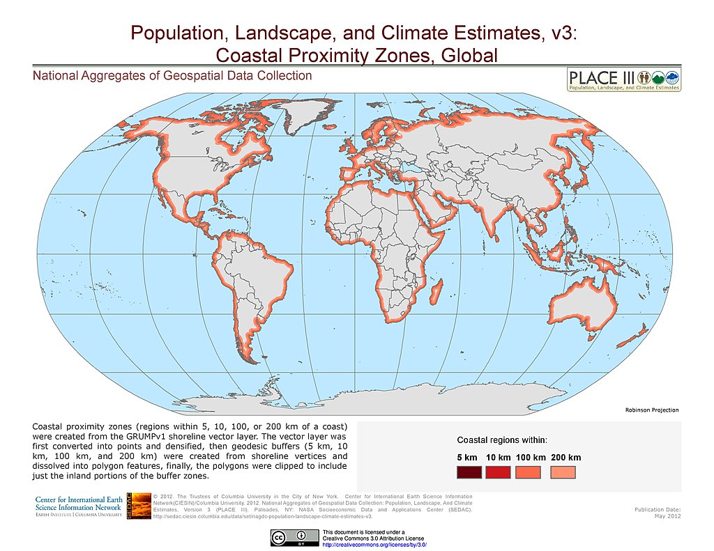
Coastal Proximity Zones
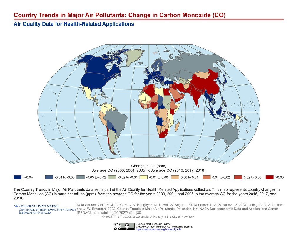
Country Trends Major Air Pollutants: CO Change
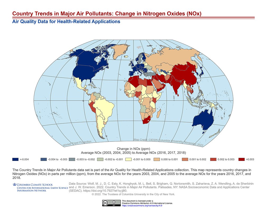
Country Trends Major Air Pollutants: NOx Change
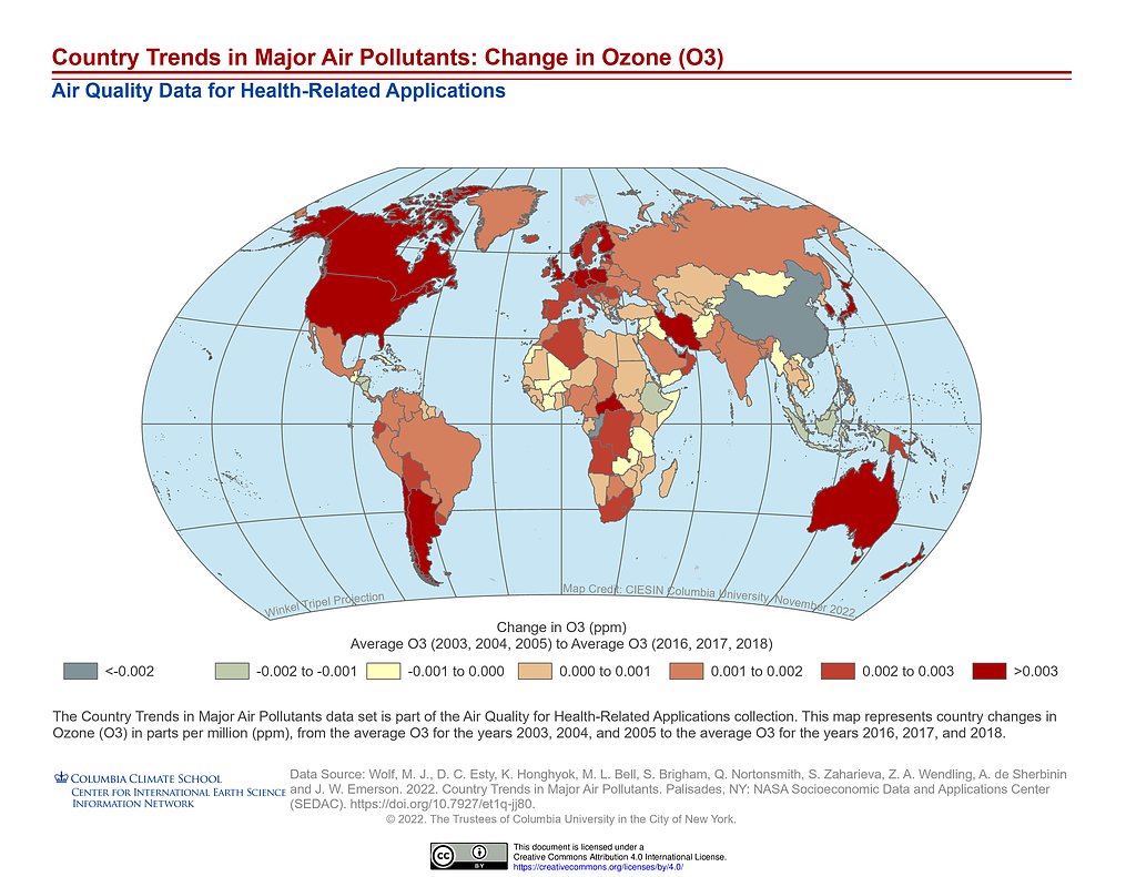
Country Trends Major Air Pollutants: O3 Change
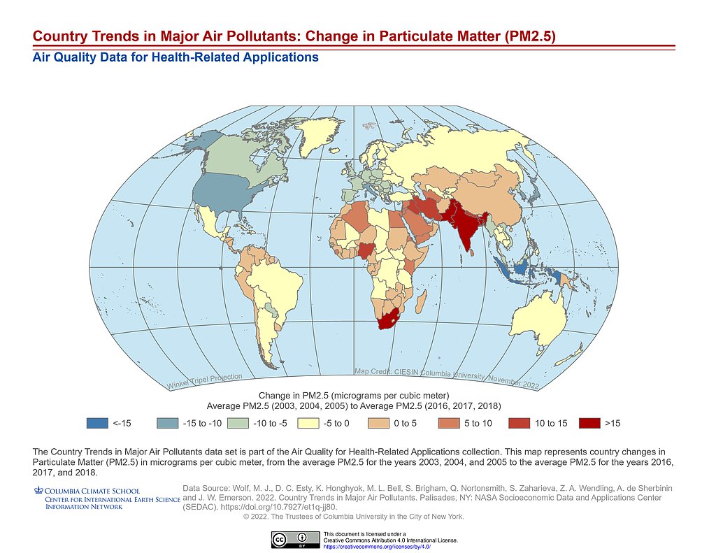
Country Trends Major Air Pollutants: PM2.5 Change
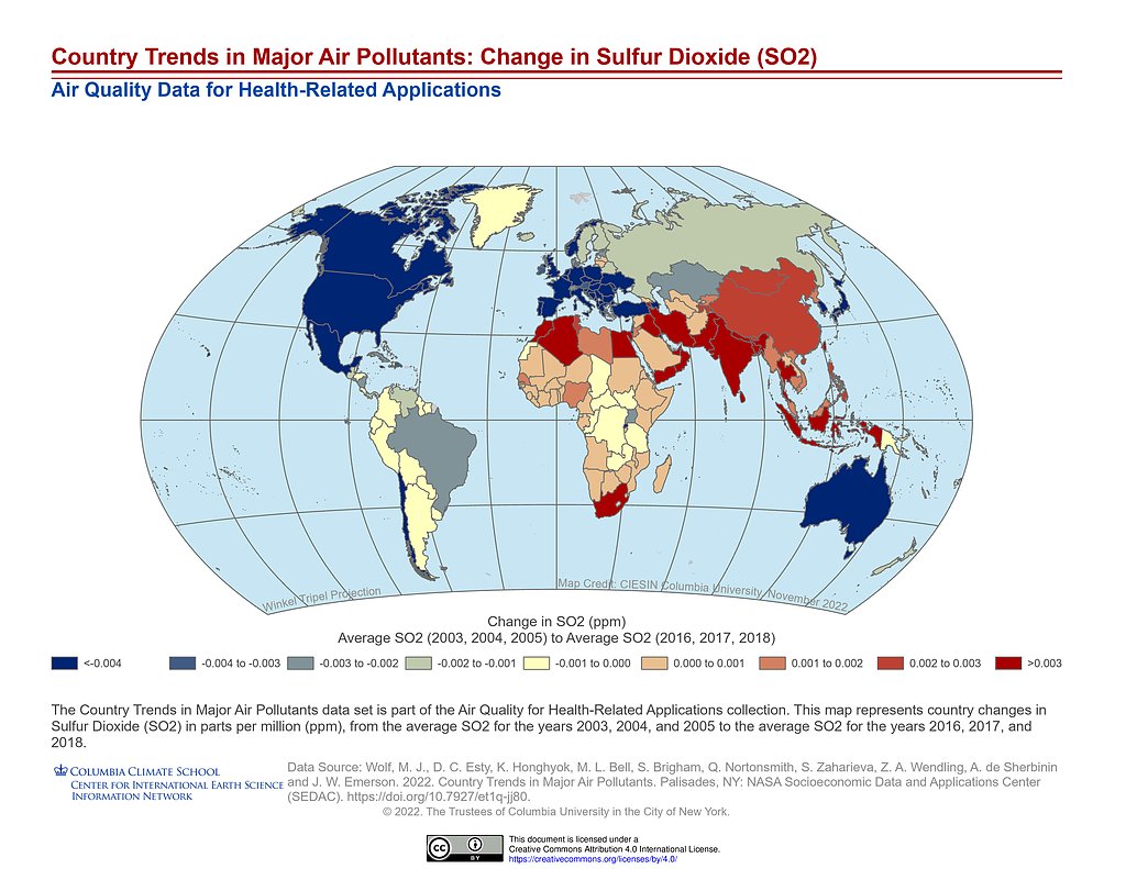
Country Trends Major Air Pollutants: SO2 Change
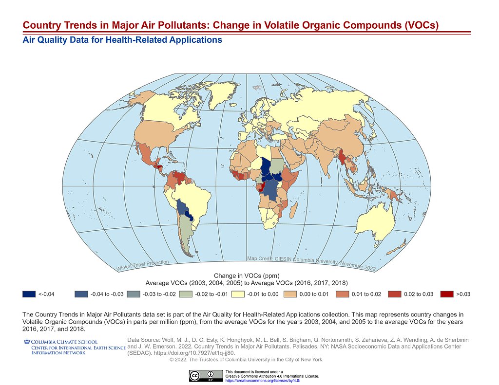
Country Trends Major Air Pollutants: VOCs Change
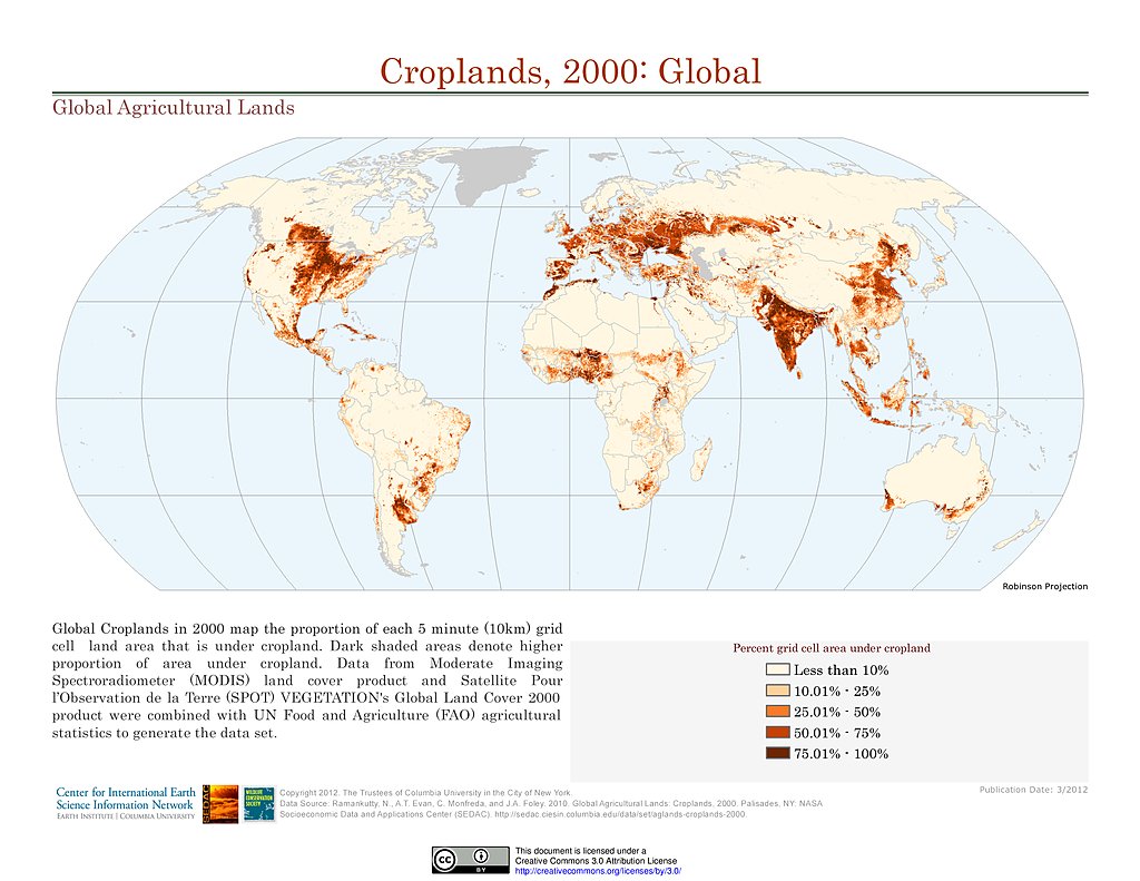
Croplands (2000)
GPWv4 Rev11: Data Context (2010)
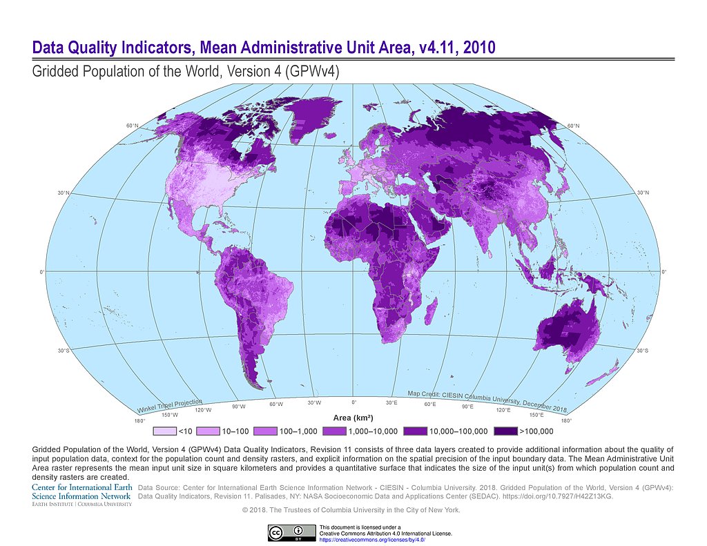
GPWv4 Rev11: Mean Administrative Unit Area (2010)
GPWv4 Rev11: Water Mask (2010)
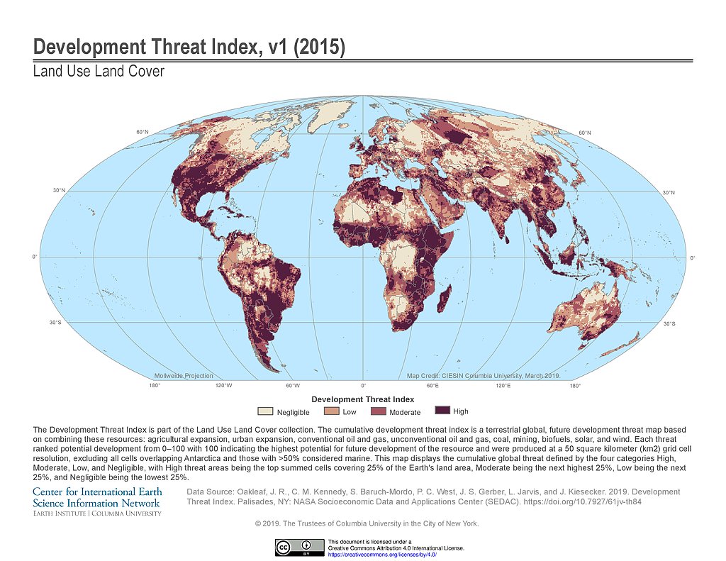
Development Threat Index (2015)
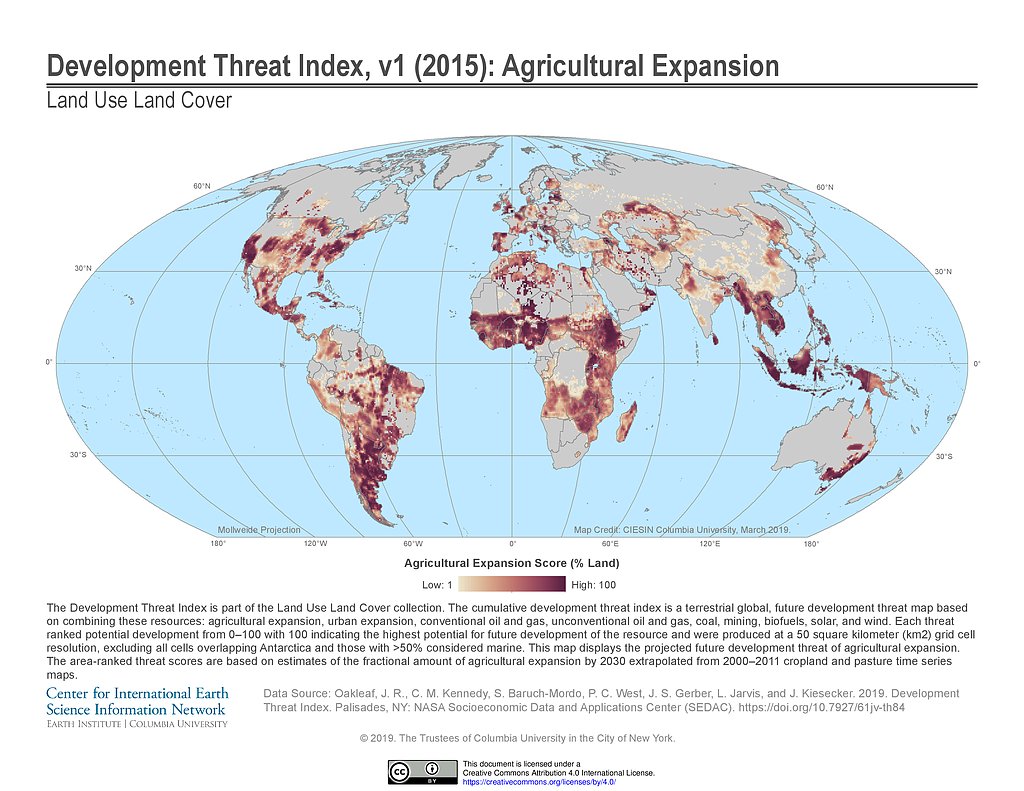
Development Threat Index (2015): Agricultural Expansion
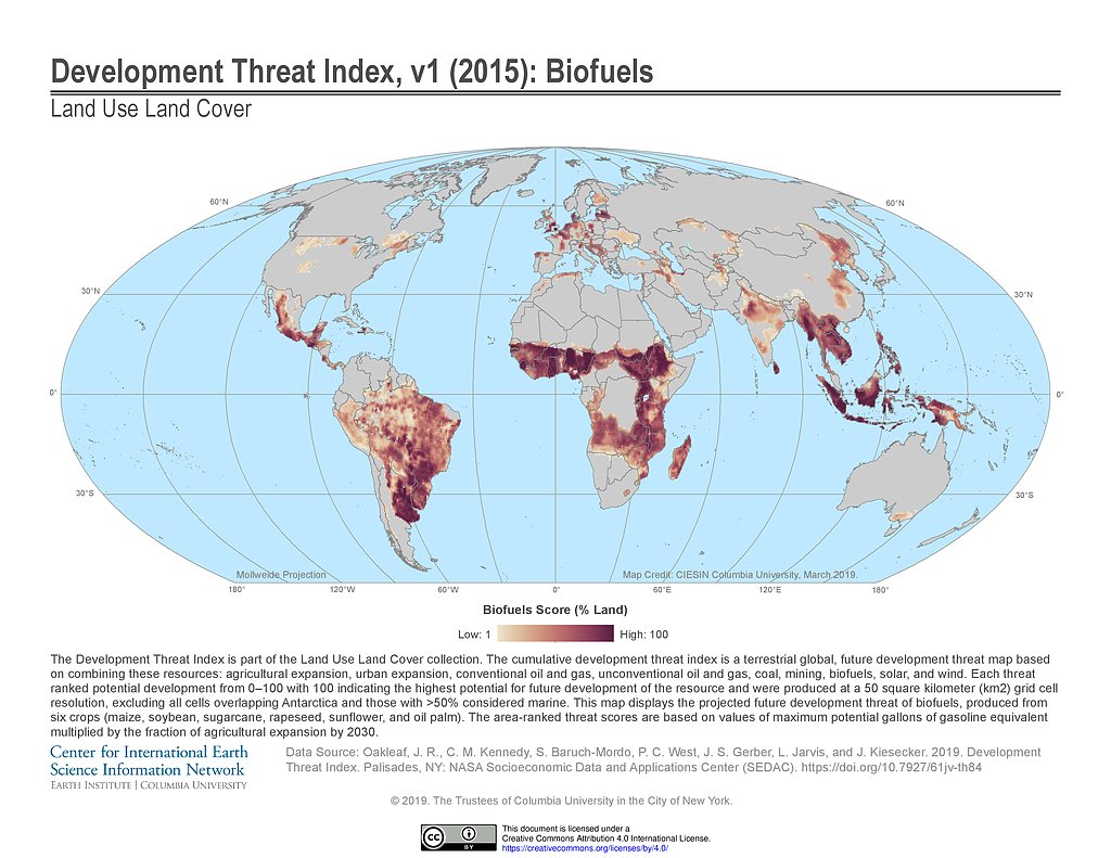
Development Threat Index (2015): Biofuels
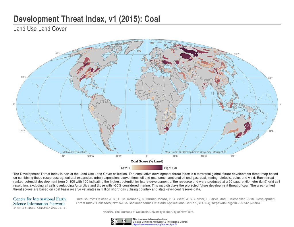
Development Threat Index (2015): Coal
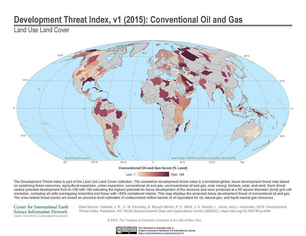
Development Threat Index (2015): Conventional Oil and Gas
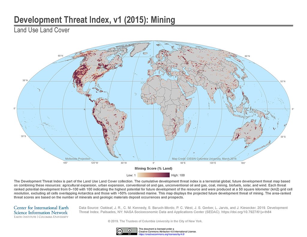
Development Threat Index (2015): Mining
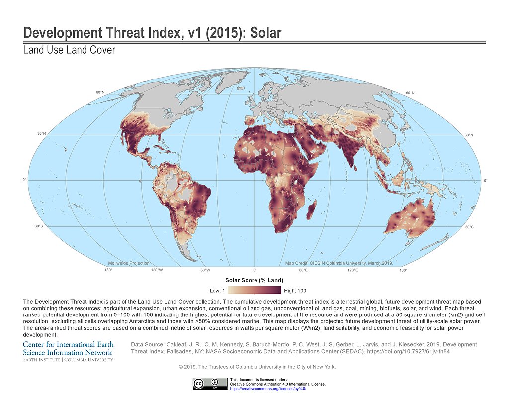
Development Threat Index (2015): Solar
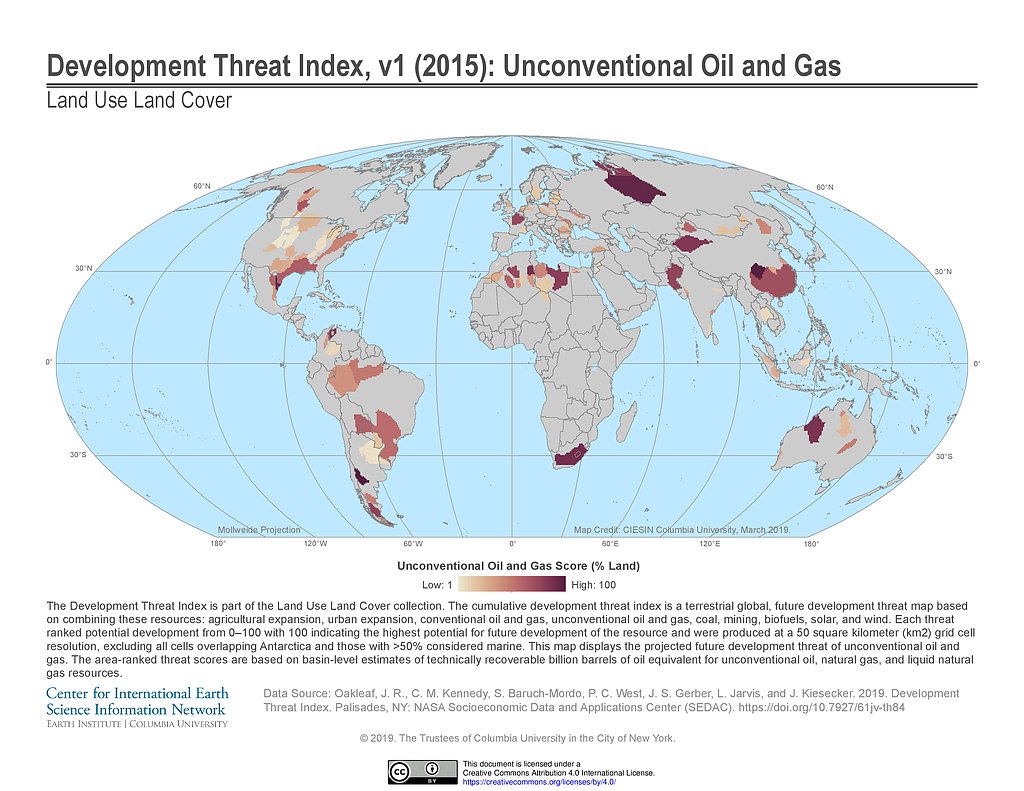
Development Threat Index (2015): Unconventional Oil and Gas
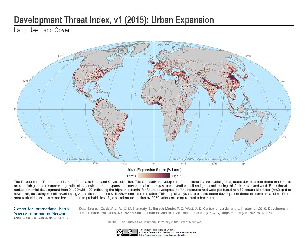
Development Threat Index (2015): Urban Expansion
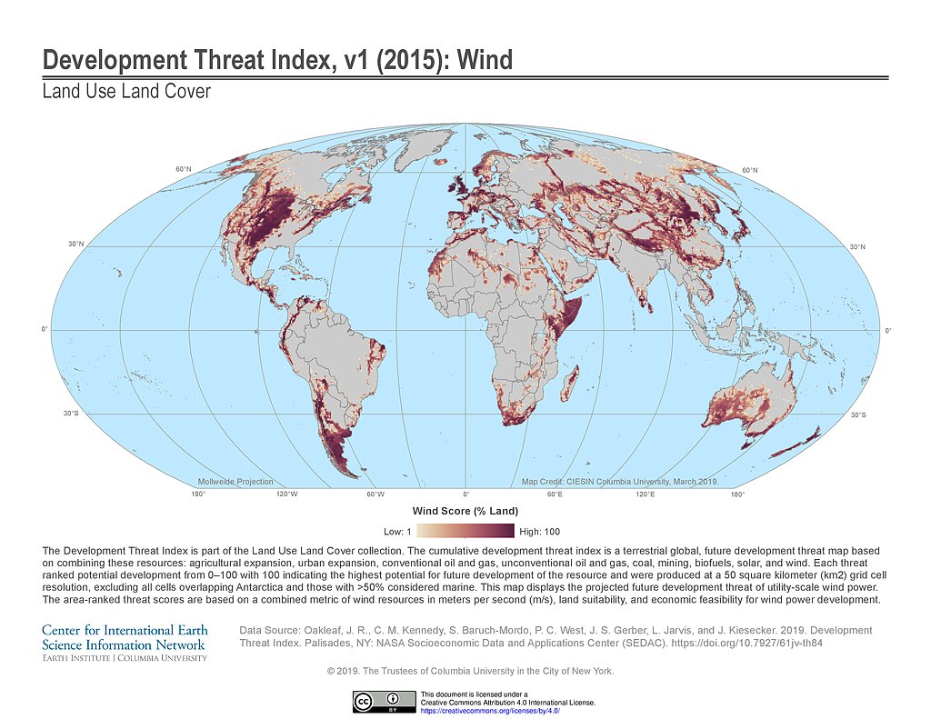
Development Threat Index (2015): Wind
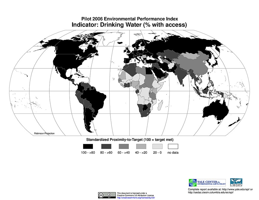
Drinking Water, Pilot EPI 2006
Ecoregion Protection, Pilot EPI 2006
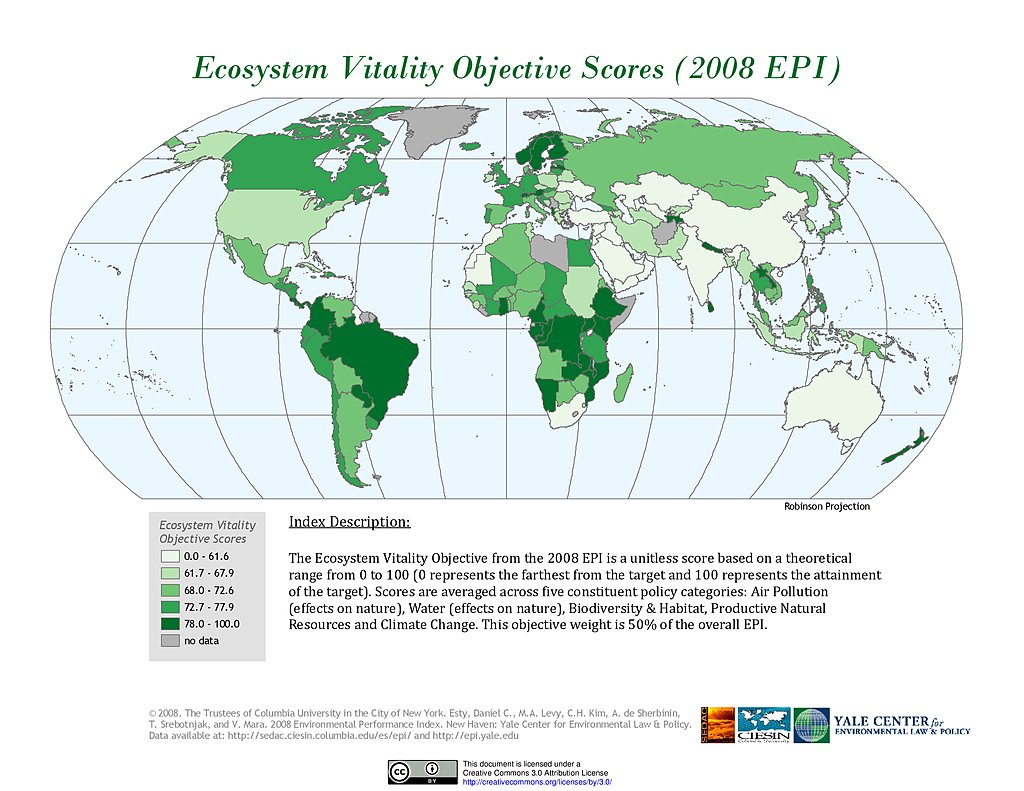
Ecosystem Vitality , EPI 2008
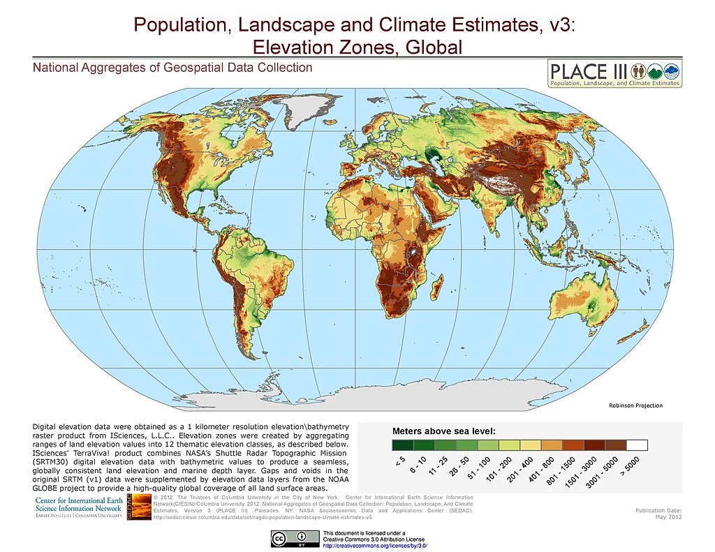
Elevation Zones
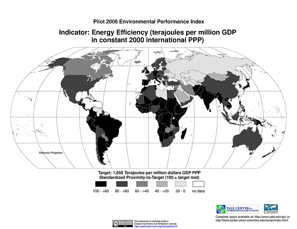
Energy Efficiency, Pilot EPI 2006
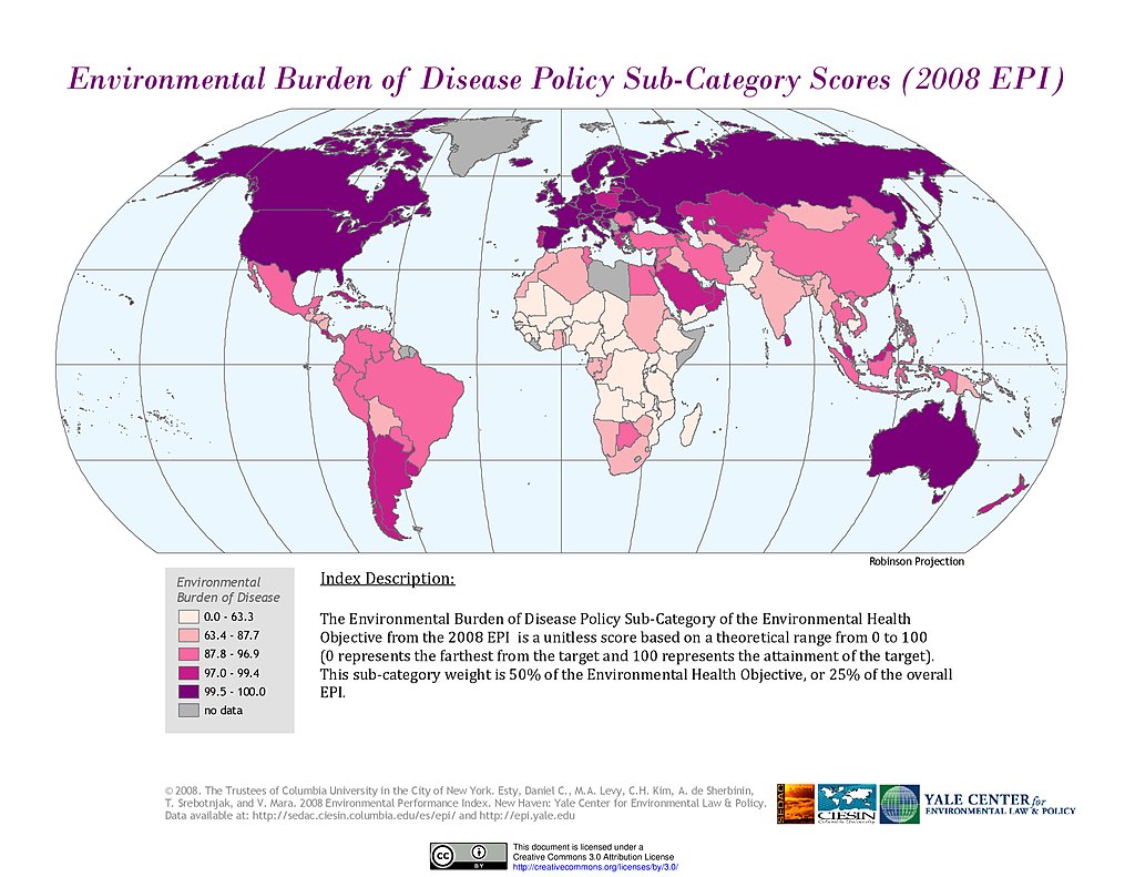
Environmental Burden of Disease, EPI 2008
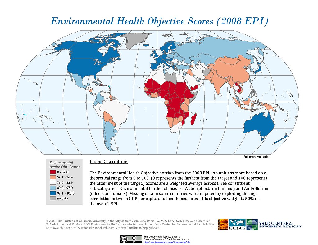
Environmental Health, EPI 2008
Maps
»
Region: Global
Remove Facet
4 of 18
Prev
|
Next