CIESIN deputy director Marc Levy participated in an expert workshop, “Highest Priority Researchable Questions for Agricultural and Food System Security in the 21st Century,” held May 14–16 at the University of Oxford, England. Chaired by Molly Jahn of the University of Wisconsin and Charles Godfray of Oxford, the workshop was convened to provide input to the CGIAR Mid-Term Review Panel led by Sir John Beddington, who participated in the workshop. The panel is an independent body of reviewers assessing progress in reforming the CGIAR, a global partnership of organizations engaged in research for a food secure future.
Resources »  News
News
| 26 of 36 |
Role of Streets in Urban Development Addressed in Guest Lecture
May 9, 2014Gora Mboup, the chief of the Global Urban Observatory (GUO) at the United Nations Human Settlements Programme (UN-Habitat), gave a talk on streets as public spaces and drivers of urban prosperity at a brownbag seminar May 8 at Columbia′s Morningside Heights campus. Mboup summarized the results of a recent study released by UN-Habitat that demonstrates the importance of allocating sufficient urban land to streets and supporting multiple functions to enhance urban productivity, prosperity, and quality of life. The lecture was co-hosted by CIESIN and the Center for Sustainable Urban Development (CSUD). Mboup has collaborated with CIESIN for a number of years on projects related to mapping of urban slum development and exposure to earthquakes.
Sea Level Rise and Extreme Storms Threaten Aging Coastal Infrastructure
May 8, 2014The “triple threat” posed by rising sea levels, extreme storms such as Hurricane Sandy, and aging coastal infrastructure was a key focus of a May 7 Business Summit at the New York Academy of Sciences Conference Center in Manhattan. CIESIN director Robert Chen moderated a session on this topic, which included presentations by Cynthia Rosenzweig of the NASA Goddard Institute for Space Studies and the Earth Institute, and by Mary Munson of the Organization of Coastal States. The Summit, organized by the National Institute for Coastal & Harbor Infrastructure (NICHI), brought together key stakeholders from both the private and public sectors to address not only the risks posed by climate change to coastal cities and infrastructure, but also opportunities to invest in resilient multi-purpose coastal infrastructure. The Consortium for Climate Risk in the Urban Northeast (CCRUN), in which CIESIN is a partner, was one of the sponsors.
CIESIN Welcomes Three New Staff Members
April 21, 2014Olena Borkovska, Jane Mills, and John Squires have joined CIESIN's Geospatial Applications Division as research staff assistants. Borkovska, who has a BA in environmental policy and management from the Geography Department of Hunter College, City University of New York, is working on the fourth version of the Gridded Population of the World (GPWv4) dataset for the NASA Socioeconomic Data and Applications Center (SEDAC) and on an ecological assessment project funded by the Nature Conservancy. Squires, who received his BA in sustainable development from Columbia University, is contributing to the same projects and to a National Science Foundation-funded project on the Bronx River "sewershed" led by Prof. Patricia Culligan of Columbia's Department of Civil Engineering and Engineering Mechanics. Mills has a BA in applied mathematics from Barnard with a minor in environmental science. She is supporting the Hudson River Flood Hazard Decision Support System project, as well as SEDAC's GPWv4 effort.
Earth Science Community Mourns Loss of Metadata Pioneer Lola Olsen
April 20, 2014Lola Olsen of the NASA Goddard Space Flight Center passed away April 19 in North Carolina. Olsen spearheaded the development of the Global Change Master Directory (GCMD), one of the largest public data catalogs in the world and a key element of the NASA Earth Observing System Data and Information System. Olsen was known as a dedicated metadata champion and a lively member of the Earth science data management community. She pioneered the use of keywords and vocabularies for Earth science data and mentored many staff and students now involved in data management. Memorial donations may be made to www.unitingagainstlungcancer.org or Hospice of the Chesapeake.
The GCMD enables discovery and facilitates access to all of NASA’s Earth science data sets and services, including those provided by the NASA Socioeconomic Data and Applications Center (SEDAC).
New Sources and Applications of Soil Moisture Data Examined at Boulder Workshop
April 19, 2014CIESIN senior research staff assistant Kimberly Peng participated in the Third Soil Moisture Active Passive (SMAP) Workshop in Boulder, Colorado, April 8–10. NASA's SMAP mission, scheduled to be launched in October 2014, will provide unique new measurements of surface soil moisture and freeze-thaw state that will help improve understanding of regional water cycles, ecosystem productivity, and processes linking the water, energy, and carbon cycles. Peng attended a short course on soil moisture and ocean salinity (SMOS) April 8. At the workshop April 9–10, she presented a poster on the integration of remote sensing data to support agricultural applications, based on work by the Africa Soil Information Service (AfSIS) and the NASA Socioeconomic Data and Applications Center (SEDAC). The workshop was co-hosted by the National Center for Atmospheric Research (NCAR), the National Snow and Ice Data Center (NSIDC), and EXELIS Inc.
Human Transformation of the Biosphere and Coastal Exposure Focus of Recent Data Releases
April 18, 2014The NASA Socioeconomic Data and Applications Center (SEDAC) operated by CIESIN has released several new datasets on anthropogenic transformation of the terrestrial biosphere over three centuries and on population and land area in the Low-Elevation Coastal Zone (LECZ).
Version 2 of Anthropogenic Biomes of the World, developed by Erle C. Ellis of the University of Maryland, Baltimore County and colleagues (Ellis et al., 2010), consists of 4 datasets that characterize changes in terrestrial ecosystems over the time period 1700 to 2000 caused by sustained direct human interactions such as urbanization and agriculture. The datasets depict 21 global anthropogenic biomes or "anthromes" derived from analysis of a range of historical data on land use/land cover, agriculture, and population.
Version 2 of the Urban-Rural Population and Land Area Estimates, part of SEDAC's LECZ collection, provides aggregate estimates of land area and urban, rural, and total population for 202 statistical areas (countries and other UN recognized territories). Population and land area estimates are subdivided by elevation zones derived from NASA's Shuttle Radar Topography Mission (SRTM) elevation data at two spatial resolutions, approximately 90 meters and approximately 1 kilometer, providing a range of estimates. Data are provided for the years 1990, 2000, and 2010 along with a long-term projection to the year 2100. Pivot tables enable grouping and filtering of data by country, region, continent, income level, elevation zone, and other attributes.
Students from France Contribute to CIESIN Projects
April 17, 2014Three students from École Polytechnique, the prestigious French university located near Paris, have begun three-month internships at CIESIN beginning in early April. The interns, Amine Allouah, Nicolas Ma, and Emilie Maysonnave, are third-year students enrolled in a four-year program that leads to the equivalent of a U.S. masters degree. Allouah, who is majoring in applied mathematics, is helping to develop an updated Environmental Sustainability Index (ESI) for 2015 as part of a team led by senior research associate Alex de Sherbinin. Ma is majoring in optimization, combining computer science and applied mathematics, and is assisting program manager Alex Fischer and staff associate Paola Kim-Blanco with spatial analysis of Haiti's national infrastructure and facilities inventory data. Maysonnave, who is majoring in environmental sciences, is working with deputy director Marc Levy to develop tools and data to assist Tanzania in sustainable agricultural management. These recent arrivals increase the total to 20 French students hosted by CIESIN since 2008 under the auspices of the Alliance program, a joint venture between Columbia University, École Polytechnique, Sciences Po, and the Université de Paris 1 Panthéon Sorbonne.
Climate Indicators and Vulnerability Discussed in Washington DC Meetings
April 16, 2014CIESIN senior research associate Alex de Sherbinin participated in the NASA National Climate Assessment (NCA) Indicators Team meeting April 8–9 at NASA headquarters in Washington DC, where he represented a joint Battelle Memorial Institute-CIESIN project that is developing heat stress indicators for the city of Philadelphia. The overall aim of the NCA indicators system is to help policy-makers and citizens understand key aspects of our changing climate. Returning to DC April 15–16, de Sherbinin and CIESIN associate research scientist Sylwia Trzaska attended an experts' meeting on the utility and uptake of climate vulnerability assessments organized by the African and Latin American Resilience to Climate Change (ARCC) Program of the U.S. Agency for International Development. At this meeting Trzaska facilitated a roundtable on communicating uncertainty and de Sherbinin presented CIESIN work on vulnerability assessment in Mali.
CIESIN Associate Director Joins Global Spatial Data Infrastructure Association Board
April 15, 2014Sri Vinay, associate director for information technology at CIESIN, has been appointed a member of the Board of the Global Spatial Data Infrastructure (GSDI) Association, serving as the representative of GSDI Related Global Initiatives. He replaces Mark Becker, former CIESIN associate director for geospatial applications, who passed away in late February.
Human Dimensions of Global Change Focus of Meetings in Latin America
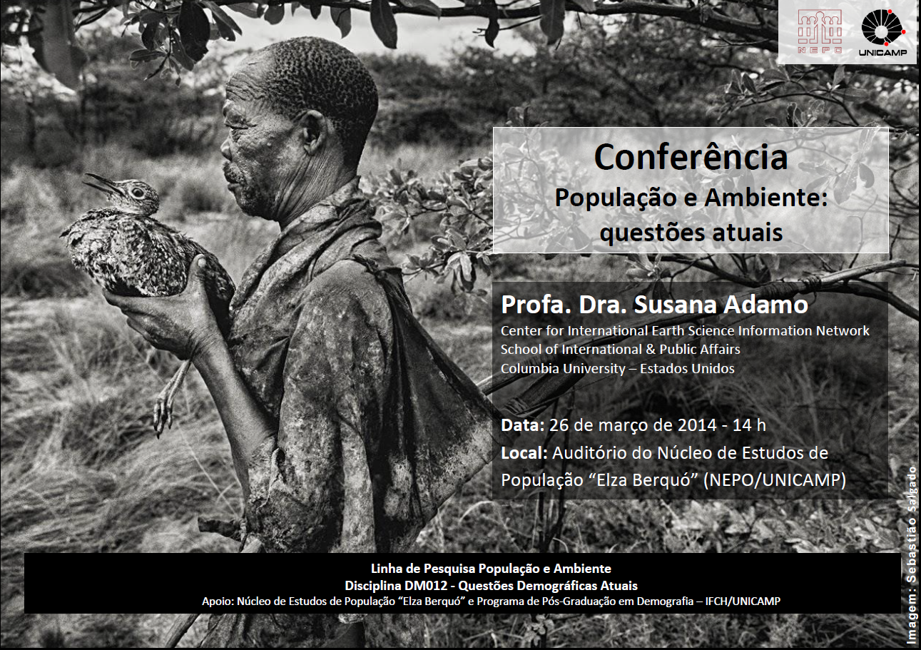
April 4, 2014Susana Adamo, associate research scientist at CIESIN, recently returned from three meetings in Uruguay, Brazil, and Guatemala. On March 22-23 she participated as a member in a meeting of the Scientific Advisory Committee of the Inter-American Institute for Global Change Research (IAI) in Montevideo, Uruguay. The IAI is an intergovernmental organization supported by 19 countries in the Americas that is working to increase the understanding of global change phenomena and their socio-economic implications. She then visited the University of Campinas (UNICAMP) March 25-26 in São Paulo state, Brazil to participate in a dissertation defense in the Demography Department and give a class lecture on the topic of population and the environment. CIESIN has worked closely with the Population Studies Unit (NEPO) at UNICAMP since 2008.
Adamo also attended a one-day national workshop held April 2 in Guatemala to present and discuss the report Climate Change, Rainfall Patterns, Livelihoods and Migration in Cabricán, Guatemala. The workshop was organized by the United Nations University Institute for Environment and Human Security (UNU-EHS) and Guatemala’s Ministry of Environment and Natural Resources (MARN) and sponsored by the John D. and Catherine T. MacArthur Foundation. Her presentation addressed the links between dynamics of demographic and climate change in Central America, based on the study, Where the Rain Falls: Climate Change, Food and Livelihood Security, and Migration, led by CARE France, the UNU-EHS, and CIESIN.
Mapping Vulnerability in Sub-Saharan Africa
April 3, 2014CIESIN senior research associate Alex de Sherbinin attended a meeting of the US Agency for International Development (USAID) Africa climate change officers technical meeting in Nairobi, Kenya April 1–4. The meeting featured speakers presenting a variety of climate adaptation projects and programs in Africa, with a particular focus on agriculture and livelihoods. He gave a presentation on an assessment of climate vulnerability in Mali, produced by CIESIN using data from the NASA Socioeconomic Data and Applications Center (SEDAC) combined with third-party and remote-sensing data sources. He also discussed ongoing efforts in Niger to build capacity for vulnerability mapping. These activities are supported by the USAID program on African and Latin American Resilience to Climate Change (ARCC), for which CIESIN and TetraTech/ARD are providing technical support in climate science and vulnerability assessment.
See:
Environmental Treaties and Resource Indicators Data Services Updated
April 2, 2014The Environmental Treaties and Resource Indicators (ENTRI) database and the ENTRI Conference of the Parties (COP) Decision Search Tool, interactive services provided by the NASA Socioeconomic Data and Applications Center (SEDAC) operated by CIESIN, have been updated with recent data on international environmental treaties. ENTRI enables users to assess country participation in multilateral environmental agreements through simple database queries; the update includes treaty status information through August 2012. The ENTRI COP Decision Search Tool now reflects resolutions and decisions related to selected treaties through 2013. The underlying data were produced by the International Union for the Conservation of Nature and Natural Resources (IUCN) Environmental Law Center in support of the ECOLEX gateway to environmental law.
IPCC Report: Managing the Risks of Climate Change is Critical
March 31, 2014
|
| IRIN |
The Working Group II contribution to the Intergovernmental Panel on Climate Change (IPCC) Fifth Assessment Report (WGII AR5), Climate Change 2014: Impacts, Adaptation, and Vulnerability, was released March 31 in Yokohama, Japan. The Report concludes that the effects of climate change can already be seen and the world is not well-prepared for risks that may result from climate change. High levels of warming will challenge opportunities for response.
The Working Group identified three elements contributing to risk from climate change: vulnerability (lack of preparedness) and exposure (people or assets in harm’s way), overlapping with hazards (triggering climate events or trends). Observed impacts of climate change have already affected agriculture, human health, ecosystems on land and in the oceans, water supplies, and some people’s livelihoods. Observed impacts are found worldwide, throughout diverse climates and from small islands to large continents, in wealthy countries as well as poor.
CIESIN deputy director, Marc Levy, was a lead author of chapter 12 on human security, a topic highlighted in the Report for the first time. Among this chapter's key findings are that societies in conflict are more vulnerable to climate change; that migration is a widely used strategy for adapting to climate impacts; that climate change is likely to amplify conflict risk; and that climate change threatens to disrupt geopolitical security dynamics.
Levy was among 309 coordinating lead authors, lead authors, and review editors, drawn from 70 countries, who produced the report. The IPCC further enlisted the help of 436 contributing authors and a total of 1,729 expert and government reviewers. CIESIN senior research associate Valentina Mara was a contributing author for chapter 13, on livelihoods and poverty. CIESIN data and reports, as well as journal articles written by CIESIN staff, were cited in several chapters of the report.
For the past two decades, IPCC’s Working Group II has developed assessments of climate change impacts, adaptation, and vulnerability. The latest Working Group I report, which focused on the physical science dimension of climate change, was released in September 2013. The Working Group III report, which focuses on mitigation, is scheduled for release in April 2014. The IPCC Fifth Assessment Report cycle concludes with the publication of its Synthesis Report in October 2014.
The Intergovernmental Panel on Climate Change (IPCC) was established by the United Nations Environmental Programme (UNEP) and the World Meteorological Organization (WMO) in 1988 to assess the scientific, technical and socio-economic information relevant for the understanding of human induced climate change, its potential impacts and options for mitigation and adaptation. CIESIN co-manages the IPCC Data Distribution Centre (DDC), which makes available data from IPCC assessments and other reports, and contributes on an ongoing basis to the IPCC Task Group on Data and Scenario Support for Impact and Climate Analysis (TGICA).
CIESIN Staff Participate in DC-Area Technical Meetings
March 28, 2014Robert Downs, CIESIN senior digital archivist, participated in the 2014 meeting of the NASA Earth Science Data System Working Groups (ESDSWG) at the Goddard Space Flight Center in Greenbelt, Maryland, March 24–26. At the meeting, he served as co-chair of the open source working group and presented the poster, "Workflow for Evaluating SEDAC Data for Dissemination," based on processes developed for the NASA Socioeconomic Data and Applications Center (SEDAC) operated by CIESIN.
Nearby in Crystal City, Virginia, CIESIN associate director for Information Technology, Sri Vinay, attended the Open Geospatial Consortium (OGC) Technical Committee (TC) meeting March 25–27. He participated in the kick-off discussion for the Global Earth Observing System of Systems (GEOSS) Architecture Implementation Pilot phase 7 (AIP-7), where he raised the possibility of integrating the SEDAC Population Estimation Service (PES) with mobile applications. Vinay also attended sessions related to OGC Web services, metadata, and the National Science Foundation's EarthCube initiative. CIESIN is a University member of OGC.
Mark Becker’s Life and Work Celebrated and Student Scholarship Fund Announced
March 27, 2014More than 300 friends, colleagues, students, and family members gathered at the Dolce Palisades Conference Center in Palisades, New York, March 23 for a memorial service and celebration of the life of Mark Becker, CIESIN associate director for Geospatial Applications who died in a multi-vehicle accident February 26 at the age of 53. The event highlighted Becker′s efforts over three decades to protect the watershed in northern New Jersey through the Bergen Save the Watershed Action Network (Bergen SWAN), which he co-founded with his partner of 30 years, Lori Charkey. CIESIN director Robert Chen chronicled Becker′s many professional accomplishments in 15 years at CIESIN, including collaborations across Columbia University and major contributions to a diverse set of research activities. Other speakers included CIESIN colleagues Kytt MacManus and Jim Carcone, who spoke of their colleague′s unique ability as a mentor for both students and staff and his significant impact on many lives and on the environment. The service incorporated stories and readings by friends and family, a video of Becker playing guitar with his grand-nephew, and remembrances of his love of music, water, plants, chimes, and stones. The public memorial was followed by a private reception at Columbia’s Lamont campus.
A student scholarship fund in honor of Mark Becker has been established at the Earth Institute. The fund will be used to support student training and education in geospatial methods and technologies. Becker′s family has also suggested donations in his memory to Bergen SWAN or to other charitable organizations.
See:
CIESIN Scientists Publish on Climate and Population Issues
March 25, 2014The journal Population and Environment has released a special issue on "Population and Climate: Research Innovations and Bridges to Policy" based on a panel held at the Australian National University (ANU) in Canberra, Australia in November 2012. The issue begins with an introduction written by Adrian Hayes of ANU and CIESIN associate research scientist Susana Adamo. Adamo has also co-authored a chapter with senior research associate Alex de Sherbinin on “Migration and Environmental Change in North America” in the volume, People on the Move in a Changing Climate: The Regional Impact of Environmental Change on Migration, edited by Etienne Piguet and Frank Laczo.
Alex de Sherbinin is also author of “Environmental Treaties,” a contribution to the Encyclopedia of Remote Sensing edited by Eni Njoku. With Anthony Oliver-Smith, professor emeritus from the University of Florida, he co-authored “Resettlement in the 21st century,” for the “Crisis” issue of Forced Migration Review.
Digging for Historical Data in Washington DC
March 7, 2014
|
|
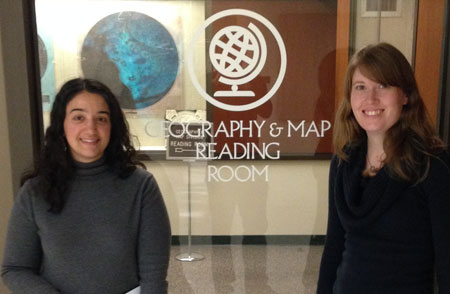
CIESIN Geographic Applications Division team members Linda Pistolesi and Erin Doxsey-Whitfield at the United States Library of Congress Geography and Map Reading Room, Washington DC, February 26. The Geography and Map Division has custody of the world's largest and most comprehensive cartographic collection in the world. |
CIESIN geographic information specialist Linda Pistolesi and senior research staff assistant Erin Doxsey-Whitfield joined David Van Riper of the University of Minnesota in Washington DC February 24–26 to search for historical population and administrative data for the Terra Populus project. Terra Populus, or TerraPop for short, is an innovative effort to integrate census data, including samples of individual and household records, with a range of other environmental and socioeconomic datasets including land cover, climate, and human infrastructure. Funded by the U.S. National Science Foundation, TerraPop is led by the Minnesota Population Center’s (MPC) in partnership with CIESIN and the Inter-university Consortium for Political and Social Research (ICPSR) at the University of Michigan.
Much of the visit took place at the International Collection of the United States Census Bureau Library and the United States Library of Congress Geography and Map Reading Room, where the team accessed historical maps and census tables for more than 50 countries. These resources will be used to extend the spatial and temporal coverage of the TerraPop database. The team also met February 26 with staff from the Census Bureau's Population Division to share information about related data development efforts, including the Global Roads Open Access Data Set (gROADS) and version four of the Gridded Population of the World (GPW) data collection.
CIESIN Researcher Reinforces Collaboration with Universities
March 4, 2014
|
|
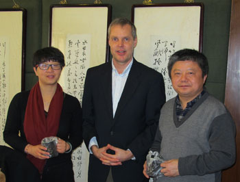
CIESIN Alex de Sherbinin (center) with director of the National Research Center for Resettlement, Shi Guoqing (right), and vice director, Chen Shaojun (left), Nanjing, China, February 27, 2014. The visit was one of several de Sherbinin made to locations in Asia to research links between climate change and resettlement. |
CIESIN senior research associate Alex de Sherbinin travelled to Vietnam, Malaysia, and China February 15–28. In Vietnam and China he conducted field visits associated with ongoing work on climate change resettlement. He visited the Mekong Delta with the assistance of Le Thanh Sang of the Southern Institute of Social Sciences (SISS), the Vietnam Academy of Social Sciences (VASS) and in China, observed the Three Gorges Dam and China South-North Water Transfer project resettlement with former CIESIN visiting scholar Ruishan Chen of the National Research Center for Resettlement (NRCR) of Hohai University, Nanjing. While in China, de Sherbinin was appointed a visiting professor at Hohai University and a senior advisor for teaching and scientific research at NRCR.
In Malaysia, de Sherbinin participated in the launch workshop February 20 of the Malaysia Environmental Performance Index (EPI) in Kuala Lumpur, and made a presentation on the 2014 Global EPI for senior staff of the Malaysian Ministry of Natural Resources and Environment, held in Putrajaya February 21. The visit to Malaysia was conducted as part of a broader Memorandum of Understanding between CIESIN and the University of Technology Malaysia (UTM), where de Sherbinin is a former visiting scholar.
Improved SEDAC Web Site Released
February 20, 2014The NASA Socioeconomic Data and Applications Center (SEDAC) operated by CIESIN has released an updated Web site incorporating a number of design and layout modifications and an updated Environmental Treaties and Resource Indicators (ENTRI) database. The SEDAC home page now features an interactive map carousel that highlights a selection of SEDAC data uses, maps from the SEDAC Map Gallery, useful SEDAC tools and applications, major topical themes, and other relevant resources. A new mapping tools page improves access to a range of interactive mapping applications that use SEDAC data and services, including the National Priorities List (NPL) Superfund Footprint Mapper, the Climate and Health Analysis for Global Education (CHANGE) Viewer, and the NASA Worldview tool. This is the fourth in a series of planned updates to the SEDAC Web site aimed at improving data access, ease of use, and functionality.
See:
| 26 of 36 |