CIESIN deputy director, Marc Levy, and senior research staff assistant Kimberly Peng traveled recently to Nairobi, Kenya, to meet with partners in the Africa Soil Information Service (AfSIS) project, including representatives from the Columbia Global Centers | Africa, the International Centre for Research in Agroforestry (ICRAF), and ISRIC-World Soil Information. The February 10–11 meetings focused on progress and activities during the project′s transition phase. CIESIN efforts to build information systems for collection, analysis, and dissemination of soils data to end users was presented by Peng during meetings that took place February 12–13. Funded by the Bill & Melinda Gates Foundation and AGRA (Alliance for a Green Revolution), AfSIS aims to develop continent-wide digital soil maps for sub-Saharan Africa using innovative soil analysis and statistical methods.
Resources »  News
News
| 27 of 36 |
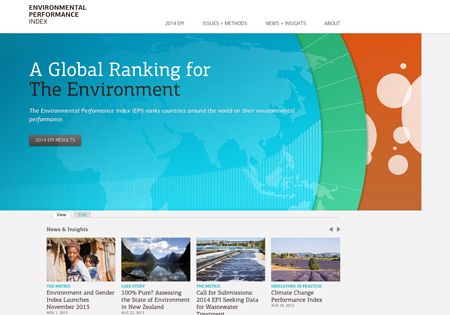
2014 Environmental Performance Index Introduces New Indicators
January 25, 2014
|
Measurement aligned with management practices can support significant progress in achieving environmental performance goals. This is one of the core messages to emerge from the sixth iteration of the Environmental Performance Index (EPI), released at the annual meeting of the World Economic Forum in Davos, Switzerland, on January 25 by CIESIN deputy director, Marc Levy, a co-author of the report with Angel Hsu, lead author, and Kim Samuel, co-creator of the project.
The 2014 EPI Report also highlights how lack of monitoring and proper management can cause natural and human systems to suffer—as seen in the negative state of fish stocks around the world—and how some elements of sustainability are better supported by the high density of urban areas.
Produced every two years by a research team from the Yale Center for Environmental Law and Policy and CIESIN, Columbia University, the EPI this year evaluates 178 countries, with new additions, in large part, from Small-Island Developing States and sub-Saharan Africa. Innovations in this year’s release include: a new wastewater treatment indicator, which is a major driver of ecosystem water quality; a new approach to climate change indicators, which evaluates emissions relative to a country’s economic development; and two new satellite-derived indicators for air quality and forests, which more accurately depict environmental policy performance than did previous models and national reports.
The EPI ranks country performance on high-priority environmental issues in two broad policy areas, protection of human health from environmental harm and protection of ecosystems. The 2014 EPI innovations help inform, among other things, ongoing discussion surrounding the United Nation’s Sustainable Development Goals (SDGs). The full report and redesigned Web site are available at http://epi.yale.edu.
Strategies for Addressing Interdisciplinary Global Challenges Discussed at NASA
January 24, 2014The NASA Applied Sciences Advisory Committee (ASAC) met January 22–23 at NASA headquarters in Washington, DC, to review activities of its Applied Sciences Program and solicit scientific and technical information relevant to program planning. One topic discussed at the meeting was how NASA-supported earth science could help address key global challenges such as food security, water resources management, and disasters through both interdisciplinary research and practical applications at the nexus of natural, economic, and social systems. CIESIN director Robert Chen, in his capacity as manager of the NASA Socioeconomic Data and Applications Center (SEDAC), gave a presentation on SEDAC’s role in supporting human dimensions research, applications, and decision making. Chris Weaver of the U.S. Global Change Research Program (USGCRP) and Meredith Lane of the National Research Council’s Board on Environmental Change and Society (BECS) also participated in the session and subsequent panel discussion, which highlighted the important role of the social sciences in understanding and addressing global societal challenges.
The ASAC provides strategic and programmatic guidance to the NASA Earth Science Division and Applied Sciences Program. Currently chaired by Kass Green of Kass Green and Associates, the ASAC reports to the Earth Science Subcommittee of the NASA Advisory Council (NAC) Science Committee and operates in accordance with the Federal Advisory Committee Act (FACA, Public Law 92–463, as amended).
International Earth Observation Community Gathers in Geneva
January 20, 2014The Group on Earth Observations (GEO), a voluntary intergovernmental organization with more than 90 governmental members and over 70 participating organizations, held its tenth plenary session and sixth ministerial summit January 15–17 in Geneva, Switzerland. CIESIN director Robert Chen was a member of the International Council for Science (ICSU) delegation in his capacity as a co-chair of the GEO Data Sharing Working Group (DSWG), and he also represented the Earth Institute as an observer at the Plenary. He co-chaired a working meeting of the DSWG on January 12 and the next day he organized and co-moderated an open side event on capacity building for data sharing. In a side event, “Visualizing the World’s Food System,” held January 14, he gave a presentation on emerging data resources at the nexus of agriculture, environment, and security, reflecting work by CIESIN, the Agriculture and Food Security Center, the International Research Institute on Climate and Society, and other partners. GEO reviewed progress over its first ten years in developing the Global Earth Observation System of Systems (GEOSS) and in expanding the accessibility, interoperability, and use of remote sensing and other geospatial data. GEO members renewed their commitment to further implementation and expansion of GEOSS for a second decade beginning in 2015.
Research Priorities and Opportunities for Scientific Data Infrastructure Discussed at DC Meetings
January 10, 2014Research priorities for the science data enterprise were the focus of a planning workshop held January 7 in Washington DC, aimed at framing a study on the challenges and opportunities associated with scientific data infrastructure. Robert Downs, CIESIN senior digital archivist, was a member of the workshop steering committee and participated in the workshop. He then attended the 2014 Winter ESIP Federation Meeting, also held in DC, where he gave presentations entitled “Scientific Data Infrastructure: Research Opportunities and Challenges” and “Ongoing Evaluation to Inform the Development of an Online Resource Center” (the latter co-authored with Robert Chen, director of CIESIN). He also presented a poster paper, “A Comparative Analysis of Scientific Data Publication Opportunities.” During the ESIP Federation business meeting on January 9, Downs represented the NASA Socioeconomic and Data Applications Center (SEDAC) operated by CIESIN, a Type I member of the ESIP Federation. At that time, he was elected to serve as the ESIP representative on the Board of Directors for the Foundation for Earth Science, which manages the ESIP Federation.
Interdisciplinary Data Stewardship and Integration Addressed at Earth Science Conference
December 16, 2013More than 20,000 scientists and educators gathered in San Francisco for the annual meeting of the American Geophysical Union (AGU) held December 9–13. CIESIN director Robert Chen and senior digital archivist Robert Downs participated actively in the conference, giving oral presentations on the need for sustainable stewardship of data vital to promoting sustainable development and the scientific impact of integrating socioeconomic and remote sensing data. They also presented poster papers on recent and ongoing CIESIN projects related to earthquake risk assessment and geospatial data preservation, and at the NASA exhibit booth gave live demonstrations of two of CIESIN′s online visualization tools. The fall AGU meeting represents a unique opportunity to interact with a broad range of earth scientists from around the world not only on scientific and technical issues but also on the use of earth science data and results to tackle pressing societal and environmental problems.
New Responses to Disaster-Related Cross-Border Displacement
December 9, 2013Associate research scientist Susana Adamo participated in a Nansen Initiative Regional Consultation, “Disasters and Cross-Border Displacement in Central America: Emerging Needs, New Responses,” held in San Jose, Costa Rica, December 2–4. The conference focused on the surrounding region and particular issues it faces related to disasters and displacement, and aimed at developing specific policy and program outcomes. Adamo gave a presentation on climate change, migration and urbanization as part of a panel on slow-onset disasters and environmental degradation.
Supported by the European Commission, the Consultation was jointly organized by the Costa Rican National Emergency Commission (Comisión Nacional de Prevención de Riesgos y Atención de Emergencias-CNE), the Coordination Centre for the Prevention of Natural Disasters in Central America (Centro de Coordinación para la Prevención de los Desastres Naturales en América Central-CEPREDENAC), and the Nansen Initiative Secretariat in Geneva. The Nansen Initiative is an organization that works to develop strategies to help people displaced across borders because of natural disasters and the adverse effects of climate change.
Online Research Network Serves Population-Environment Research Community
December 6, 2013
|
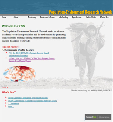
Many online networks for researchers or other communities of interest were begun around the year 2000, but the Population-Environment Research Network (PERN) is one of the few to have stood the test of time. For more than a decade PERN has been serving the research community focused on the interdisciplinary study of coupled human-environment systems, with particular emphasis on how demographic variables impact and are in turn affected by environmental factors. PERN now has more than 2,000 members from all over the world, divided evenly between low- and high-income countries. It has hosted 20 online seminars that resulted in five articles in high impact journals such as Population & Environment and Global Environmental Change. PERN’s online eLibrary of peer-reviewed and gray literature, which has customized key word search capabilities to get at the literature most desired, features close to 3,000 citations. Finally, PERN produces a What’s New bulletin three times a year, with a separate conference calendar and job/funding opportunities list, and hosts a discussion list for members to post announcements.
PERN is a collaboration between the International Union for the Scientific Study of Population (IUSSP), the International Human Dimensions Programme on Global Environmental Change (IHDP), and the Center for International Earth Science Information Network (CIESIN) at Columbia University. The co-coordinators, Susana Adamo and Alex de Sherbinin, are both researchers at CIESIN, as is the network assistant, Lisa Lukang. Basic maintenance for the Web site is underwritten by the NASA Socioeconomic Data and Applications Center (SEDAC), managed by CIESIN.
Webinar Held on Integrating Socioeconomic and Remote Sensing Data
November 21, 2013
|
|
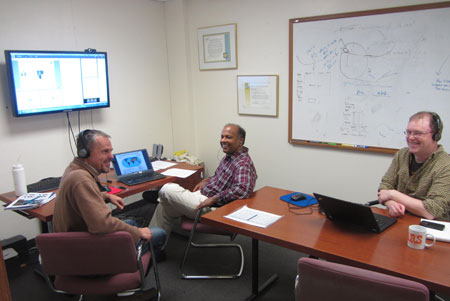
SEDAC staff members Alex de Sherbinin, Sri Vinay, and Joe Schumacher prepare for the November 20 NASA EarthData Webinar. |
The integration of socioeconomic and remote sensing data to examine human-environment interactions was the focus of an online web-enabled seminar November 20 that featured the online data and tools available at the NASA Socioeconomic Data and Applications Center (SEDAC) operated by CIESIN. Part of NASA's EarthData Webinar series, the Webinar featured SEDAC deputy manager Alex de Sherbinin, who described SEDAC data sets and approaches to data integration, and Sri Vinay, SEDAC systems engineer, who introduced the SEDAC Web site and its web mapping tools. Vinay demonstrated how one tool, the Population Estimation Service, can be used to estimate the number of persons affected in the New York area by Superstorm Sandy. A question-and-answer segment with the online participants followed the presentations.
Climate Change, Health, and Hazards Focus of Recent Visits
November 15, 2013Experts from Viet Nam, Hawaii, and the Netherlands have recently visited CIESIN scientists in New York to discuss collaboration in the areas of climate change and health and disaster risk management. On November 6, CIESIN director Robert Chen, Geospatial Applications Division associate director Mark Becker, and senior research associate Meredith Golden met with Prof. Luu Ngoc Hoat, vice-president of Hanoi Medical University, and six colleagues who came to Columbia University to explore available data, tools, and methods for climate change and health research and applications. On November 15, CIESIN hosted Heather Bell, director of Applied Science at the Pacific Disaster Center (PDC) in Hawaii, and Richard Sliuzas of the Geo-Information Science and Earth Observation (ITC) of the University of Twente, Netherlands. Sliuzas gave a talk on flood risk management strategies in Kampala, based on a study for UN-HABITAT′s Cities and Climate Change Initiative. Bell met with CIESIN staff to explore potential areas of collaboration with the PDC on disaster data and tool development.
Cyberseminars Highlight Key Needs in International Assessment of Climate Change
November 15, 2013The Population-Environment Research Network (PERN) hosted by CIESIN recently hosted two online cyberseminars to facilitate discussion of key challenges in the assessment of the impacts of climate change. The first cyberseminar, held October 7–14, highlighted international efforts to develop new scenarios of future socioeconomic development, which are needed not only to characterize human drivers of climate change but also to assess future exposure and vulnerability to climate impacts. The discussion focused on the new process for developing Shared Socioeconomic Pathways (SSP), initiated in support of the Intergovernmental Panel on Climate Change (IPCC). Leiwen Jiang of the National Center for Atmospheric Research (NCAR) moderated the seminar together with Susana Adamo, PERN co-coordinator and CIESIN associate research scientist.
The second PERN cyberseminar was held October 28–November 5 and focused on new efforts to characterize climate-related "loss and damage" in the context of the United Nations Framework Convention on Climate Change (UNFCCC). This cyberseminar was co-organized by PERN and the United Nations University-Institute for Environment and Human Security (UNU-EHS) in Bonn, Germany. Moderated by David Wrathall of UU-EHS, participants discussed growing evidence of significant losses from extreme events, and sought to chart a research agenda in anticipation of discussions at the UNFCCC Conference of Parties 19 being held this week in Warsaw.
Background papers and statements and the individual posts for both cyberseminars are available on the PERN web site.
Workshop on Climate Change Indicators and Monitoring Held at Hunter College
November 14, 2013CIESIN senior research associate Alex de Sherbinin served as a panelist in a workshop on monitoring and indicators of climate change, held November 13 at Hunter College of the City University of New York. The workshop was organized by the New York City Panel on Climate Change (NPCC2), which is advising the Mayor and the New York City Climate Change Adaptation Task Force on issues related to climate change and adaptation. de Sherbinin gave a presentation on urban heat island indicators, based on work in progress under a NASA grant with Battelle Memorial Institute. Other workshop topics included the New York City CoolRoofs program, the New York City urban heat stress health monitoring system, and studies of impacts of climate change on the local hydrological cycle.
Collaboration on Spatial Data Development Furthered at UN Technical Meeting
November 12, 2013
|
|
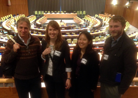
CIESIN associate director Mark Becker, senior research staff assistant Erin Doxsey-Whitfield, and geographic information specialists Tricia Chai-Onn and Kytt MacManus at the United National Assembly Meeting Room, New York City, November 8. |
Staff members from the United Nations (UN) Cartographic Section and Population Division met with CIESIN associate director Mark Becker, geographic information specialists Kytt MacManus and Tricia Chai-Onn, and senior research staff assistant Erin Doxsey-Whitfield November 8 in New York City to continue collaborative efforts related to spatial data sharing and development. Becker provided an update on relevant activities such as Terra Populus and the CODATA Task Group on Global Roads Data Development. MacManus described the methods and data being used to develop version 4 of the Gridded Population of the World (GPWv4) dataset, as part of the NASA Socioeconomic Data and Applications Center (SEDAC) operated by CIESIN. Discussion included plans to establish internships at the UN for Columbia students and to collaborate on improving and using open access intercity roads data.
Improvements in SEDAC Web Site Implemented
November 8, 2013Several new features have been added to the SEDAC Web site. Users may now download recommended citations to bibliography or research management software such as EndNote and Zotero in two standard formats. A reference is also provided to the original scientific publication about a data set when available. These enhancements are aimed at making it easier for users to properly cite data accessed through SEDAC and to acknowledge the data authors.
The SEDAC Map Gallery has been enhanced, and is now available at the data set level. The gallery supports faceted search to make it easier for users to find maps of interest. A new Ramsar Map Client has also been developed to support visualization of the recently released dataset, Sea Level Rise Impacts on Ramsar Wetlands of International Importance v1. The client displays Ramsar wetland site locations and, where available, boundaries, and enables users to access information about their potential vulnerability to sea level rise.
Data Integration and Climate Hotspots Mapping Examined in Recent Presentations
October 17, 2013CIESIN senior research associate and SEDAC deputy manager Alex de Sherbinin participated in the 2013 HyspIRI Science Workshop at the California Institute of Technology in Pasadena October 15–17. He presented a poster on the integration of remote sensing and socioeconomic data. The NASA Hyperspectral Infrared Imager (HyspIRI) mission will observe the world′s ecosystems and provide critical information on natural disasters.
While in California, de Sherbinin also participated in parts of the NASA Databridge workshop, which brought together leaders in citizen science to consider how to meet societal needs using NASA earth science data. He also gave a lecture October 18 to the Climate Hazards Group and the Geography Department at the University of California, Santa Barbara, on the subject of climate hotspots mapping.
Special Issues of Climatic Change Feature Work by CIESIN Scientists
October 11, 2013A special issue of the journal Climatic Change,"Climate and Security: Evidence, Emerging Risks, and a New Agenda" features a paper by CIESIN senior research associate Alex de Sherbinin, “Climate Change Hotspots Mapping: What Have We Learned?” The article focuses on “hotspots” of climate change–regions especially vulnerable to current or future climate impacts where human security may be at risk. CIESIN deputy director Marc Levy is second author of another paper, “Enhancing the Relevance of Shared Socioeconomic Pathways for Climate Change Impacts, Adaptation and Vulnerability Research,” by Bas J. van Ruijven, Levy, and 22 other colleagues. This paper appears in another Climatic Change special issue, "A Framework for the Development of New Socio-economic Scenarios for Climate Change Research.”
CIESIN Staff Fly South for Data
October 4, 2013Three cities in the southeast United States were the destination of CIESIN staff members participating in data-related meetings. In Columbia, South Carolina, associate research scientist Susana Adamo attended the second meeting of the Disaster Loss Data Working Group of the Integrated Research on Disaster Risk (IRDR) program, which was hosted September 29–October 1 at the University of South Carolina. IRDR is an international research program aimed at the challenges of natural disasters, mitigating their impacts and improving related policy-making mechanisms. It is co-sponsored by the International Council for Science (ICSU), the International Social Science Council (ISSC), and the United Nations International Strategy for Disaster Reduction (UNISDR).
On October 2, geospatial information specialist Kytt MacManus participated in a workshop on urbanization, population, and sustainability in Chattanooga, Tennessee, held in conjunction with the Society of Environmental Journalists Conference. He demonstrated the application of CIESIN data and services to an audience of approximately 40 journalists.
CIESIN director Robert Chen attended the fall meeting of the Board of Directors of the National Ecological Observatory Network (NEON), held in Gainesville, Florida, October 2–4. NEON is a continental-scale ecological observation system for examining critical ecological issues funded by the National Science Foundation.
New Faces at CIESIN
October 3, 2013Several visiting scholars and new research assistants have joined CIESIN recently. Here for the fall semester is Lina Eklund, a graduate student from the Center for Middle Eastern Studies (CMES) at the Department of Earth and Ecosystem Sciences, Lund University, Sweden. Eklund is conducting independent research using remote sensing and other types of data such as surveys and secondary data to investigate urbanization in Kurdistan and its effects on land use, rural development, and urban-rural migration. Visiting CIESIN for a year and a half is Yuanyuan Yang, a doctoral student in land use management from Jilin University in China. Her research focuses on changes in farmland ecosystems in Northern China in response to climate warming over the past century. Yang also has a BS in land resource management from Jilin. Xiaoteng Cen is a doctoral student in land use & land use policy at Zhejiang University, China, who will be at CIESIN for one year. He is researching land use changes driven by land use policy in the Zhejiang coastal region.
Olena Borkovska and John Squires have joined the CIESIN team as research assistants for version 4 of the Gridded Population of the World. Borkovska has a BA in environmental policy and management from the Geography Department of Hunter College, City University of New York. Squires, who is also working on the project Developing Global Building Exposure for Disaster Forecasting, Mitigation, and Response, recently received his BA in sustainable development from Columbia. Jane Mills is working on the Hudson River Flood Hazard Decision Support System project, and creating maps of Haiti's governmental offices as part of CIESIN’s activities in Haiti. Mills has a BA in applied mathematics from Barnard and a minor in environmental science.
NASA Earth Science Data Access Affected by Federal Government Shutdown
October 2, 2013Due to the lapse in Federal government funding, selected Web sites and data services from the NASA Earth Observing System Data and Information System (EOSDIS) are temporarily unavailable or operating with limited support. This includes many of the sites linked from the NASA Earth Data menu bar on the SEDAC Web site. If you have questions or concerns, you may wish to contact one of the data centers not based at a NASA facility, such as the Alaska SAR Facility (ASF), the National Snow and Ice Data Center (NSIDC), the Global Hydrology Resource Center (GHRC), or SEDAC.
Modeling and Predicting the Global Distribution of Population
September 24, 2013The state-of-the-art in projecting global patterns of population distribution was the focus of a September 20 workshop organized by the Urbanization and Global Environmental Change project and the Institute for Sustainable Cities (CISC) at the City University of New York (CUNY). The meeting identified methods and approaches for generating spatial population projections with 50- to 100-year time horizons for use in climate impact assessment and ecological research. CIESIN associate research scientist Susana Adamo and senior research associate Alex de Sherbinin participated in a panel moderated by former CIESIN scientist Deborah Balk, now with of the Institute for Demographic Research at the City University of New York. They presented CIESIN′s work on gridding population data, spatial population projections, estimation of net migration, and urban growth patterns.
| 27 of 36 |