Some 300 scientists and disaster management professionals from diverse backgrounds and countries gathered in Beijing, China, October 31–November 2 for the first conference of the Integrated Research on Disaster Risk (IRDR) program of the International Council for Science (ICSU). On November 1, CIESIN director Robert Chen moderated a session on integrated disaster data, and gave a presentation on CIESIN’s extensive experience in developing and integrating data on hazards with data on exposure and vulnerability to hazards. IRDR is a 10-year research initiative of ICSU, with an International Program Office hosted by the Center for Earth Observation and Digital Earth (CEODE) of the Chinese Academy of Sciences.
Resources »  News
News
| 33 of 36 |
Population Change Over Time Highlighted at Geostatistics Conference in Lisbon
October 18, 2011Associate research scientist Susana Adamo was a keynote speaker for the European Forum for Geostatistics Conference in Lisbon, Portugal, October 12–14. She gave a presentation, “A Comparison of Vector and Raster Population Time Series: Population Change in Latin America and the Caribbean, 1990-2010,” which examined the use of both gridded and vector-based population data for analyzing population change at the subnational level. Senior staff associate Liana Razafindrazay assisted in preparing the presentation.
Project Studies Extreme Heat Events and Societal Vulnerability
October 12, 2011In his role as a member of the Project Advisory Committee for the System for Integrated Modeling of Metropolitan Extreme Heat Risk (SIMMER) project, CIESIN senior research associate Alex de Sherbinin attended the project meeting at the National Center for Atmospheric Research (NCAR) in Boulder, Colorado, October 10–11. The NASA-funded project is modeling extreme heat events, both present and future (through the use of climate scenarios), and mapping societal vulnerability in two major cities: Houston, Texas, and Toronto, Canada. Stakeholders from health departments in both cities attended the meeting. Houston experienced a 1 in 10,000-year heat wave this past summer, and the health department is planning to use project outputs to better understand differential vulnerability to extreme heat and to plan heat mitigation and health interventions.
See:
Annual Open House Reaches Broad Audience
October 4, 2011More than 3,000 people from around the greater New York metropolitan area came to the Lamont campus of Columbia University on Saturday, October 2 for its annual Open House. Launched decades ago to educate the public about the unique research activities at Lamont, the Open House featured a variety of exhibits, hands-on demonstrations, lectures, and other activities organized by hundreds of Earth Institute scientists, staff, and students, including many from CIESIN. The CIESIN tent focused on the use of spatial data to address issues of local and regional concern, such as the impact of Hurricane Irene, the proximity of populations to nuclear power plants, land cover change in New York's Jamaica Bay, and climate risks in the urban northeast. Hands-on demonstrations of Change Viewer, a new mapping tool that visualizes climate change prediction data and population information, were also offered to science teachers and others. CIESIN has participated actively in the Open House since 1998.
See:
SEDAC Releases Major Spatial Population Data Collection
September 30, 2011Urbanization poses both challenges and opportunities for sustainable development and environmental management. Improved data on patterns of human settlement and trends in population can help researchers and policy makers better understand differences between urban and rural areas in terms of their impacts on the environment and vulnerability to environmental variability and change. The newly released Global Rural-Urban Mapping Project, Version 1 (GRUMPv1) data collection is a valuable resource both for researchers studying human-environment interactions and for applied users working to address critical environmental and societal issues.
Developed by the NASA Socioeconomic Data and Applications Center (SEDAC) operated by CIESIN, GRUMPv1 consists of eight global data sets: population count grids, population density grids, urban settlement points, urban-extents grids, land/geographic unit area grids, national boundaries, national identifier grids, and coastlines. All grids are provided at a resolution of 30 arc-seconds (~1km), with population estimates normalized to the years 2000, 1995, and 1990. All eight data sets are available for download as global products, and the first five data sets are also available as continental, regional, and national subsets.
The population density and population count grids build on SEDAC’s Gridded Population of the World, Version 3 data set (GPWv3), which does not distinguish between urban and rural areas. GRUMPv1 identifies urban areas based in part on observations of lights at night collected by a series of Department of Defense meteorological satellites over several decades. The night-light data were carefully processed by the U.S. National Geophysical Data Center (NGDC) in Boulder, Colorado. SEDAC then used these and other supplementary data to develop an urban-rural “mask,” or urban extents grid, which identifies those areas of the Earth’s land surface that appear to be urbanized. GRUMPv1 also includes a geo-referenced database of urban settlements with populations greater than 5,000 persons, which may be downloaded in both tabular and shapefile formats.
'Eye on Earth' Summit Will Address Global Data Access Issues
September 15, 2011CIESIN is playing a leading role in the organization of the Eye on Earth Summit, to be held December 12–15 in Abu Dhabi. At the Summit global leaders, innovators, and decision-makers will focus on how to ensure effective access to the world’s expanding pool of environmental and societal data by all who need it. Facilitated by the Abu Dhabi Global Environmental Data Initiative (AGEDI) and hosted by Environment Agency-Abu Dhabi (EAD) in partnership with the United Nations Environment Programme (UNEP), the Eye on Earth Summit will strengthen existing efforts and inspire a search for unified, global solutions to the issues that preclude access to data. Marc Levy, CIESIN deputy director, is co-chair of Working Group 2 on content and user needs, and Alex de Sherbinin, senior research associate, serves on Working Group 1 on policy and networking.
See:
New Observing System Explored at Oxford Meeting
September 13, 2011CIESIN senior research associate Alex de Sherbinin participated in a meeting organized by the International Geosphere-Biosphere Programme (IGBP) to design a new Global Integrated Observing Strategy. This meeting, held September 6–8 in Oxford, England, included many experts in Earth System Science modeling and ecological field research. As a representative of the social science data and observations community, de Sherbinin provided suggestions on how to design an observation system that will improve monitoring of coupled human-environment systems. The strategy will focus on under-observed regions in Africa and Asia.
SEDAC Encourages Responses to NASA User Satisfaction Survey
September 9, 2011NASA conducts an annual survey of users of the Earth Observing System Data and Information System (EOSDIS) to assess their satisfaction with the data, tools, and support provided by EOSDIS data centers and services. The Socioeconomic Data and Applications Center (SEDAC) operated by CIESIN, which serves a wide range of basic and applied users interested in the integration of remote sensing and socioeconomic data, is one of the NASA EOSDIS centers evaluated by the survey.
During the week of September 12, users registered with SEDAC will receive an email invitation from the Claes Fornell International (CFI) Group on behalf of NASA, asking them to participate in an anonymous, Web-based survey about the quality and utility of SEDAC products and services, and the ease of access to SEDAC resources. The questionnaire takes approximately 10 minutes to complete, and optional comment fields are provided to address user concerns. Anyone who has used any SEDAC data or information resources, including online services available through the SEDAC website as well as offline tools like the TerraViva SEDAC viewer, may take the survey. Those who do not receive an invitation directly are welcome to contact the CFI Group at nasasurvey@cfigroup.com, providing an email address and self-identifying as a SEDAC data user. Invitations should not be forwarded to others, but others may be referred to the above email address.
SEDAC encourages all of its users to participate in the survey. Feedback affects future performance, identifies high priority user needs and concerns, and helps to justify NASA's continuing investment in EOSDIS data services and support. Past surveys have provided important inputs into the development of the redesigned SEDAC Web site, and user comments help to further improve SEDAC data and services.
Global Data for Global Science Focus of Conference in Kyoto
September 7, 2011

|
|
Participants at the first ICSU World Data System Conference held September 3-6, 2011 at Kyoto University in Kyoto, Japan. |
Typhoon Talas provided a stormy backdrop for the first ICSU World Data System Conference in Kyoto, Japan, September 3–6, which drew more than 150 representatives of data centers and services and other interested organizations from around the world. CIESIN director Robert Chen participated in his capacity as secretary general of the Committee on Data for Science and Technology (CODATA) of the International Council for Science (ICSU) and as manager of the NASA Socioeconomic Data and Applications Center (SEDAC). He gave a plenary presentation on past, present, and future cooperation between the ICSU World Data System (WDS) and CODATA, which have complementary roles on scientific data issues under the ICSU umbrella. He also co-chaired an open forum for WDS members and partners with Ruth Neilan of the NASA Jet Propulsion Laboratory to discuss organizational and strategic issues.
The ICSU World Data System is working to strengthen and expand the network of international scientific data centers and services originally formed after the International Geophysical Year of 1957–58. It will serve as a globally interoperable data system that incorporates emerging technologies and new scientific data activities in support of global science.
Summer Interns and Research Assistants Contribute to Key Research Efforts at CIESIN
September 2, 2011A group of Earth Institute interns and research assistants originating from such diverse locations as Venezuela, China, India, Hawaii, North Carolina, Maryland, and New York collaborated with CIESIN researchers on a variety of projects this summer. Earth Institute interns Sriram Jayaprakash and Jimeng Du both worked with information scientist Xiaoshi Xing developing and improving emissions data. Jayaprakash evaluated, mapped, and gridded global sulfur emissions from energy use, and Du analyzed and processed the data using ArcGIS and other tools. Jayaprakash has a B.A. in Technology from SASTRA University and is working on a M.A. in Public Administration from the School of International and Public Affairs. Du received a dual B.A. in Applied Mathematics and Economics from Wuhan University and is working toward an M.S. in Operations Research in December 2011.
Kimberly Peng, also an Earth Institute Intern, worked on the Haiti Regeneration Initiative (HRI), with staff associate Paola Kim Blanco, assisting with the planning and preparation of the socioeconomic household baseline study for the southwestern part of Haiti. She also helped with the multi-sector facilities inventory in Haiti and the coordination and preparation of training material and field-testing of tools. Peng has a B.A. in Economics from the University of Maryland and is enrolled in the Earth Institute's M.A. Program in Climate and Society.
Josef Bronfenmajer also worked on the HRI, working with program manager Alex Fischer and fellow research assistant Jihye Lee in creating audiovisual media, including a 5-minute project background video. Josef has a B.S. in Film Studies from Hofstra University, and anticipates an M.S. from Columbia University in Negotiation and Conflict Resolution in 2012. Jihye Lee was responsible for multi-media data visualization and 3-D landscape modeling. Lee has a B.S. in Architecture from Seoul National University, and graduated this past May with an M.S. in Architecture and Urban Design from the Columbia Graduate School of Architecture, Planning and Preservation.
Yang Sui, a dual masters candidate in Computer Science and Journalism, performed Web site development and content management for both the Africa Soils Information Project (AfSIS) and the HRI, working with senior research associate Sonya Ahamed and Kim Blanco. Sui has a B.S. in Computer Science and B.A. in English from Tianjin University, China. Michelle DeCurtis, a rising junior majoring in architecture at Barnard College, worked with CIESIN associate director Mark Becker developing content for the Web site of the Consortium for Climate Risk in the Northeast (CCRUN), building a GIS database and creating climate change maps for the region. Arianna Feinberg, a rising senior majoring in sustainable development at Columbia College, also worked with Becker on the Global Climate Change Education Project, where she helped create a curriculum and interactive mapping tool about climate change and human health. Evan Drewry, a rising junior majoring in computer science at the Columbia School of Engineering and Applied Science, worked with senior geospatial developer Greg Yetman and associate research scientist Susana Adamo to obtain and organize census and boundary data for the next version of the Gridded Population of the World (GPW) data set.
SEDAC Wears a New Hat
August 22, 2011The NASA Earth Observing System Data and Information System (EOSDIS) “Top Hat” has been added to the Web site of the Socioeconomic Data and Applications Center (SEDAC). The Top Hat is a visual appliance located on the top of SEDAC Web pages that provides direct access to the broad EOSDIS network of data centers and services. It enables EOSDIS users to easily search and access the wide range of NASA Earth science data and information products and services from any EOSDIS data center.
The Top Hat, along with the newly redesigned EOSDIS Web site, is part of a NASA initiative to ensure a coherent EOSDIS Web presence. With more than a dozen data centers and important services like the Global Change Master Directory (GCMD) and the Land Atmosphere Near real-time Capability for EOS (LANCE), EOSDIS archives and distributes many petabytes of Earth science and related data from NASA satellites and other platforms, supporting tens of thousands of users each month. SEDAC’s primary role in EOSDIS is to facilitate interdisciplinary research and applications of remote sensing data with key socioeconomic data and information resources and services.
Areas of High Environmental Vulnerability Discussed at Chile Meeting
August 19, 2011CIESIN associate research scientist Susana Adamo presented a paper at the ECLAC-CELADE (Economic Commission for Latin America and the Caribbean-Population Division) Expert Group Meeting on Population, Territory and Sustainable Development held in Santiago, Chile, August 16–17. The paper, “Areas of High Environmental Vulnerability,” was presented for discussion under the activities of the ECLAC Special Committee on Population and Development. It identifies areas of high environmental vulnerability in Latin America and the Caribbean using data from CIESIN’s Socioeconomic Data and Applications Center (SEDAC) operated by NASA, including the data sets Global Rural-Urban Mapping Project (GRUMP), version 1; Natural Disaster Hotspots; and Global Infant Mortality. In addition to the presentation of papers, the Expert Group revised and discussed the document, “Population, Territory and Sustainable Development,” to be presented at the next meeting of the Special Committee in early 2012.
Recently Updated Map Viewer Highlighted for Educational, Research Uses
August 12, 2011The recently updated TerraViva! SEDAC Viewer was featured at two venues recently. In Austin, Texas, at the annual meeting of the Ecological Society of America (ESA) held August 7–12, CIESIN geographic information specialist Malanding Jaiteh delivered an overview of SEDAC data products that included a tutorial on the use of TerraViva!, a map viewer and data analysis software application that enables the visualization and integration of hundreds of socioeconomic and environmental variables and layers. The presentation was part of the NASA EOSDIS pre-conference workshop, “Finding, Accessing and Using NASA Data and Tools for Ecology Research.”
At Dickinson College in Carlisle, Pennsylvania, CIESIN senior research associate Alex de Sherbinin provided hands-on training to educators from area community colleges in the use of TerraViva!. The training was part of a NASA Global Climate Change Education workshop held August 8–11, “Cooling the Curriculum: A Learning Community for Climate Change Education.” It was organized around data products developed by the NASA Socioeconomic Data and Applications Center (SEDAC) operated by CIESIN and climate scenarios data generated by the NASA Goddard Institute for Space Studies and other groups, all of which are included in the 2011 release of the TerraViva! SEDAC Viewer.
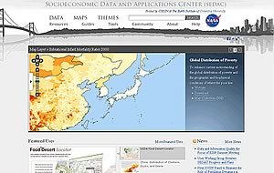
SEDAC Web Site Receives Major Overhaul
August 1, 2011
|
A complete redesign of the Web site of the NASA Socioeconomic Data and Applications Center (SEDAC) operated by CIESIN has been released. The goal of the new SEDAC Web site is to facilitate the discovery and access of SEDAC data and information resources through improved search tools, a map gallery, thematic slices into SEDAC content, and Internet mapping tools. The site employs the latest information technologies, including a backend content management system based on Bluenog/Hippo, a map gallery using Flickr, Web mapping services supported by Geoserver/OpenLayers, and social networking tools. As part of SEDAC’s efforts to support its diverse community of users, the site encourages user comments via a tool that allows anonymous feedback.
See:
Annual User Conference Aims to Better 'Understand our World'
July 19, 2011CIESIN geographic information specialist Tricia Chai-Onn attended the 2011 Esri International User Conference in San Diego, California July 11–15, which had as its theme this year “Understanding Our World.” Chai-Onn authored a poster showcased in the conference map gallery, “Global Reservoir and Dams (GRanD), v.1.01,” featuring 6,862 records of reservoirs and their associated dams. The poster was based on data recently released by the Socioeconomic Applications and Data Center (SEDAC). Another poster on display, “Haiti: Spatial Analysis of Vulnerability,” was co-authored by senior staff associate Liana Razafindrazay, CIESIN Earth Institute fellow Alexandra Morel, and senior staff associate Sandra Baptista. More than 13,000 geographic information system (GIS) professionals from more than 100 countries attended the conference.
See:
Data and Information Quality the Focus of ESIP Summer Meeting
July 13, 2011CIESIN staff travelled to Santa Fe, New Mexico to attend the 2011 Summer Meeting of the Federation of Earth Science Information Partners (ESIP) held July 12–15. The theme was “data and information quality.” On July 12, senior digital archivist Robert Downs presented a workshop for teachers, “Introduction to the 2011 TerraViva! SEDAC Viewer.” The workshop audience included middle- and high-school teachers as well as representatives from museums and educational programs. On July 13, Downs presented a poster authored with Robert Chen on “User-Centered Design of a Resource Center about Geospatial Data Preservation.” John Scialdone, manager of CIESIN’s data services group, also attended. Former CIESIN associate director W. Christopher Lenhardt, now at Oak Ridge National Laboratory, is the current president of the ESIP Federation.
User Working Group Reviews SEDAC Progress and Plans
July 8, 2011The User Working Group (UWG) of SEDAC, the NASA Socioeconomic Data and Applications Center operated by CIESIN, met recently at Columbia's Lamont Campus in Palisades, New York and at the Morningside Campus in Manhattan. The UWG provides strategic guidance regarding the data and information needs of the users served by SEDAC as well as feedback on new and planned SEDAC data and services. Specific topics at the meeting on June 22–23 included SEDAC’s potential role in supporting new NASA satellite missions and strategies for reaching out to new and potential users of SEDAC's data and services using social media and other approaches. As part of the meeting, Kenneth Crews, director of Columbia's Copyright Advisory Office, met with the UWG to discuss intellectual property issues related to scientific data and the development of open access approaches to data and information.
Chaired by Molly Macauley of Resources for the Future, the UWG includes experts from the social, natural, health, and information sciences. Five new UWG members have recently begun four-year terms: Paul Bartel of the Humanitarian Information Unit at the U.S. Department of State; Linda Billings of the School of Media and Public Affairs at George Washington University; Erle Ellis of the Department of Geography and Environmental Systems at the University of Maryland-Baltimore County; Chandra Giri of the US Geological Survey (USGS) Earth Resources Observations and Science (EROS) Center; and Kyle McDonald of the Division of Earth and Atmospheric Sciences at the City College of New York (formerly with the NASA Jet Propulsion Laboratory).
New IUSSP Panel to Examine the Role of Population Dynamics in Climate Change
July 6, 2011The International Union for the Scientific Study of Population (IUSSP) has named CIESIN associate research scientist Susana Adamo to a new panel exploring the role of population dynamics in climate change. Adamo, a demographer originally from Argentina, will serve with population researchers Leiwen Jiang (China), Wolfgang Lutz (Austria), and panel chair Adrian Hayes (Australia). Through cross-disciplinary research, meetings, and other activities, the panel will aim to expand a network of population researchers working in the area of climate change, contribute to greater understanding of how population processes interact with climate change, and share findings with the research and policy making communities. In addition, panel members will examine conditions for such cross-disciplinary research and what this might mean for demographic training. The panel has been established through 2014.
Users Invited to Test New SEDAC Web Site
July 1, 2011The NASA Socioeconomic Data and Applications Center (SEDAC) operated by CIESIN is a unique source of interdisciplinary data and information and services related to the human dimensions of global environmental change. To help users more effectively find, access, and use these resources, SEDAC has redesigned its Web site with enhanced search tools, interactive mapping tools, a map gallery, topical views of SEDAC content, and examples of uses of SEDAC data in research, applications, and education. The new site builds on the latest Internet technologies, including a content management system, Flickr, open source Web mapping services, and social networking tools. During the user testing period in July, users are encouraged to provide feedback on the site’s organization and ease of use and suggestions about new features and content. Comments may be submitted anonymously through a tool available on the lower right corner of each Web page.
Updated Map Viewer Enables Visualization of Socioeconomic and Earth Science Data
June 23, 2011TerraViva! SEDAC Viewer, a map viewer and standalone software application, has been updated for 2011 with the addition of several new SEDAC data sets, including climate change scenario data and indicator collections with hundreds of variables. TerraViva! contains map data and GIS functions in one package, compatible with the Microsoft Windows operating system. An excellent tool for educators, as well as for researchers and analysts working in a variety of disciplines, TerraViva! has a library of maps organized by theme and a built-in gazetteer, and can create dynamic color-coded maps and customizable maps and charts, among other features. It was produced through a collaboration between ISciences and the NASA Socioeconomic Data and Applications Center (SEDAC) operated by CIESIN. For more information or to order a free DVD, go to http://sedac.ciesin.columbia.edu/terraVivaUserWeb/.
| 33 of 36 |