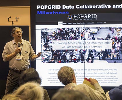
The 2020 Summer Meeting of the Earth Science Information Partners (ESIP) was held virtually July 14–24, rather than in Burlington, Vermont, as originally planned. The meeting theme was “Putting Data to Work: Building Public-Private Partnerships to Increase Resilience & Enhance the Socioeconomic Value of Data.” In line with the theme, CIESIN collaborated with ISciences LLC, CASE Consultants international, and the U.S. Army Corps of Engineers (USACE) to organize two linked sessions July 23 on open source environment-security analytics. The first session featured talks by CIESIN alumnus Tom Parris, president of ISciences; Mark Wahl of the USACE Engineer Research and Development Center (ERDC); and CIESIN director Robert Chen. Chen highlighted numerous public-private partnerships involving CIESIN over more than two decades, including diverse initiatives dealing with environment-security crises, disaster risk management, climate change, and population data. In the second session, senior systems analyst/GIS developer Kytt MacManus led a hands-on subgroup, “Employing Python and R for Explorations of Gridded Demographic Data using Web Services.” Other technical subgroups were led by ISciences and ERDC staff, building in part on a USACE-funded Small Business Technology Transfer Research (STTR) project to develop Data ANalytics and Tools for Ecosecurity (DANTE).
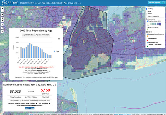
Senior digital archivist Robert Downs was also very active in the ESIP summer meeting. He co-organized the pre-meeting workshop, “Developing Community Guidelines for Consistently Curating and Representing Dataset Quality Information,” and gave a presentation, “GEOSS Data Management and Data Sharing Principles and TRUST,” on July 13. He co-organized the sessions, “Exploring New Perspectives and Formulating Best Practices for Data Uncertainty Information (Parts 1 & 2)” offered July 15, and “Citizen Science Data and Information Quality” and “Challenges of Consistently Curating and Representing Fair Dataset Quality Information,” held July 22. During the Live Research Showcase sessions July 17 and 23, he presented the poster, “Meeting the Challenges of the TRUST Principles for Digital Repositories.” He also arranged for a number of mapping tools developed by the NASA Socioeconomic Data and Applications Center (SEDAC) to be demonstrated and reviewed by teachers in the 2020 ESIP Teacher Workshop, “Putting Data to Work for Earth Science Education,” July 14 and 15. SEDAC is a Type I member of ESIP.