|
|
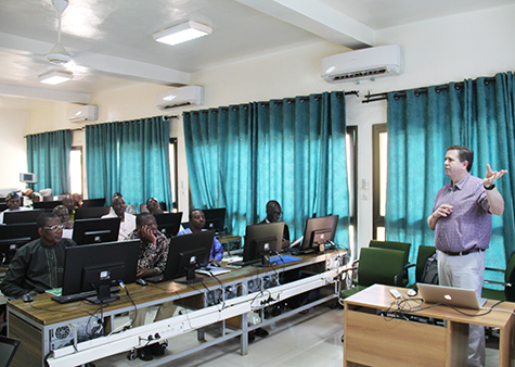
Greg Yetman, associate director for Geospatial Applications, led a two-day training workshop August 14–15 for partners in the West Africa hub of the SERVIR project, a joint venture between NASA and the U.S. Agency for International Development. The workshop included attendees from Ghana, Mali, Nigeria, and Niger. |
Greg Yetman, CIESIN associate director for Geospatial Applications, led a two-day geographic information system (GIS) training workshop August 14–15 in Niamey, Niger, for partners in the West Africa hub of the SERVIR project. Attendees from Ghana, Mali, Nigeria, and Niger learned about applications of GIS technologies to studies in hydrology, desertification, and environmental change in tropical forests and rangelands. SERVIR, a joint venture between NASA and the U.S. Agency for International Development, provides satellite-based Earth monitoring data, geospatial information, and tools to help improve environmental decision-making in developing countries. CIESIN and the International Research Institute for Climate and Society (IRI) are contributing to the development of applications of NASA data products to support regional decision-making and are conducting technical training for regional partners. CIESIN and IRI are subcontractors to Tetra Tech/ARD, who manages the West Africa hub for USAID and NASA.