Search » Data Sets (58)
| 2 of 3 |
ATSDR Hazardous Waste Site Polygon Data with CIESIN Modifications, v2 (2010)Superfund Site FootprintsTo provide an easily accessible, corrected data set of polygons for hazardous waste sites in the United States which can be used to identify nearby populations and assess their potential risk. |
U.S. EPA National Priorities List Sites with CIESIN Modifications, v2 (2014)Superfund Site Footprints
To provide an easily accessible, corrected EPA data set of the geo-referenced locations displayed as points for all the National Priorities List (NPL) Superfund sites in the United States, Puerto Rico, and other territories. |
|
ATSDR Hazardous Waste Site Polygon Data, v2 (2010)Superfund Site FootprintsTo provide the ATSDR polygon data set of hazardous waste sites in the United States, Puerto Rico, and other territories which can be used to identify nearby populations and assess their potential risk. |
Complete Collection, v1.01 (
|
|
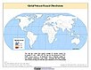
Global Flood Hazard Frequency and Distribution, v1 (
|
Global Landslide Mortality Risks and Distribution, v1 (2000)Natural Disaster Hotspots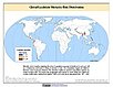
To provide a means of assessing global landslide mortality risks and distribution. |
|
Global Multihazard Total Economic Loss Risk Deciles, v1 (2000)Natural Disaster Hotspots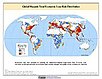
To identify areas of the world that are at greater risk of multihazard total economic loss. |
Global Multihazard Frequency and Distribution, v1 (2000)Natural Disaster Hotspots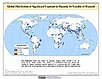
To provide insight into the frequency and distribution of multihazard events. |
|
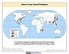
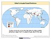
Global Cyclone Hazard Frequency and Distribution, v1 (
|
Global Volcano Hazard Frequency and Distribution, v1 (
|
|
Global Drought Total Economic Loss Risk Deciles, v1 (2000)Natural Disaster Hotspots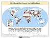
To provide a spatial surface of the total economic impacts of global drought hazard. |
Global Multihazard Mortality Risks and Distribution, v1 (2000)Natural Disaster Hotspots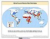
To identify areas of the world at multihazard mortality risk and to gain insight into the nature of this risk posed. |
|
Global Volcano Proportional Economic Loss Risk Deciles, v1 (2000)Natural Disaster Hotspots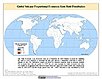
To provide a spatial surface of the proportional economic impacts of global volcano hazard. |
Global Earthquake Proportional Economic Loss Risk Deciles, v1 (2000)Natural Disaster Hotspots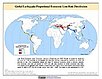
To provide a spatial surface of the proportional economic impacts of global earthquake hazard. |
|
Global Landslide Total Economic Loss Risk Deciles, v1 (2000)Natural Disaster Hotspots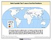
To provide a spatial surface of the total economic impacts of global landslide hazard. |
Global Multihazard Proportional Economic Loss Risk Deciles, v1 (2000)Natural Disaster Hotspots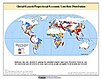
To identify areas of the world that are at greater risk of multihazard proportional economic loss. |
|
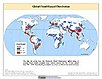
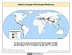
Global Earthquake Hazard Frequency and Distribution, v1 (
|
Global Earthquake Hazard Distribution - Peak Ground Acceleration, v1 (
|
|
Global Landslide Proportional Economic Loss Risk Deciles, v1 (2000)Natural Disaster Hotspots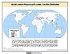
To provide a spatial surface of the proportional economic impacts of global landslide hazard. |
Global Volcano Total Economic Loss Risk Deciles, v1 (2000)Natural Disaster Hotspots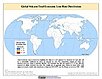
To provide a spatial surface of the total economic impacts of global volcano hazard. |
| 2 of 3 |