Search » Data Sets (88)
| 4 of 5 |
Global Flood Hazard Frequency and Distribution, v1 (
|
Global Drought Total Economic Loss Risk Deciles, v1 (2000)Natural Disaster Hotspots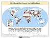
To provide a spatial surface of the total economic impacts of global drought hazard. |
|
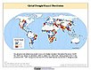
Global Drought Proportional Economic Loss Risk Deciles, v1 (2000)Natural Disaster Hotspots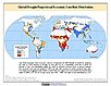
To provide a spatial surface of the proportional economic impacts of global drought hazard. |
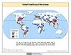
Global Drought Mortality Risks and Distribution, v1 (2000)Natural Disaster Hotspots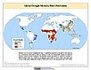
To provide a means of assessing global drought mortality risks and distribution. |
|
Global Flood Total Economic Loss Risk Deciles, v1 (2000)Natural Disaster Hotspots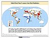
To provide a spatial surface of the total economic impacts of global flood hazard. |
Global Flood Proportional Economic Loss Risk Deciles, v1 (2000)Natural Disaster Hotspots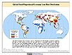
To provide a spatial surface of the proportional economic impacts of global flood hazard. |
|
Global Flood Mortality Risks and Distribution, v1 (2000)Natural Disaster Hotspots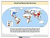
To provide a means of assessing global flood mortality risks and distribution. |
Global Drought Hazard Frequency and Distribution, v1 (
|
|
MA Climate and Land Cover, v1 (
|
MA Ecosystems, v1 (2000)Millennium Ecosystem Assessment (MA)To preserve access to the original ecosystems data used by the Millennium Ecosystem Assessment (MA) and other related research. |
|
Global Mangrove Forests Distribution, v1 (2000)Land Use and Land Cover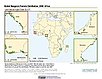
To provide data that can be used in global mangrove forest distribution modeling, land cover change analysis, global carbon accounting studies and to assist with policy-making in regards to human-environment interactions and future adaptive strategies. |
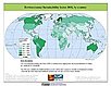
Environmental Sustainability Index, 2005 Release (
|
|
Global 15 x 15 Minute Grids of the Downscaled Population Based on the SRES B2 Scenario, v1 (1990, 2025)Socioeconomic Downscaled Projections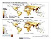
To provide a gridded data on country-level population and downscaled projections based on the SRES B2 marker scenario. |
Global 15 x 15 Minute Grids of the Downscaled GDP Based on the SRES B2 Scenario, v1 (1990, 2025)Socioeconomic Downscaled Projections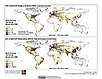
To provide gridded GDP data on country-level downscaled projections based on the SRES B2 marker scenario. |
|
Environmental Vulnerability Index (EVI), 2004 Release (
|
Country-Level GDP and Downscaled Projections Based on the SRES A1, A2, B1, and B2 Marker Scenarios, v1 (
|
|
Country-Level Population and Downscaled Projections Based on the SRES B2 Scenario, v1 (
|
Country-Level Population and Downscaled Projections Based on the SRES A1, B1, and A2 Scenarios, v1 (
|
|
Population, Landscape, And Climate Estimates (PLACE), v1 (1995)National Aggregates of Geospatial Data Collection (NAGDC)To provide tabular data on environmental conditions (elevations, climate, coastal) in which people reside. |
Environmental Sustainability Index, 2002 Release (
|
| 4 of 5 |