Search » Data Sets (62)
|
1 of 4
Prev
|
Next
|
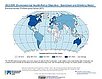
Delta Urban-Rural Population and Land Area Estimates, v1 (1990, 2000, 2014, 2015)Low Elevation Coastal Zone (LECZ)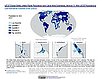
To provide country-level estimates of populations and land areas in river delta- and non-delta contexts for the years 1990, 2000, 2014, and 2015 for 246 statistical areas, focusing on greater-risk zones using the global extent of low elevation zones contiguous to the coast bounded by either 5 meters or 10 meters. |
SDG Indicator 7.1.1: Access to Electricity, 2023 Release (
|
|
SDG Indicator 11.2.1: Urban Access to Public Transport, 2023 Release (
|
SDG Indicator 9.1.1: The Rural Access Index (RAI), 2023 Release (
|
|
SDG Indicator 11.7.1: Urban Public Space, Availability and Access, 2023 Release (
|
Population, Landscape, And Climate Estimates (PLACE), v4 (2000, 2005, 2010, 2015, 2020)National Aggregates of Geospatial Data Collection (NAGDC)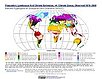
To provide tabular data to researchers without GIS capabilities who need data on population and land area by country across a range of physical characteristics. These include measures such as the number of persons living within coastal zones, the total area within a specific elevation strata, or the number of persons living within different climate zones. |
|
Environmental Performance Index, 2022 Release (
|
Groundswell Spatial Population and Migration Projections at One-Eighth Degree According to SSPs and RCPs, v1 (
|
|
Urban-Rural Population and Land Area Estimates, v3 (1990, 2000, 2015)Low Elevation Coastal Zone (LECZ)
To provide estimates of urban and rural populations and land areas for the years 1990, 2000, 2015 for 234 countries and statistical areas with contiguous coastal elevations of less than or equal to 5m above sea level, 5-10m above sea level, and national totals using multiple updated data sources for comparative analysis. |
||
Environmental Performance Index, 2020 Release (
|
Historical Urban Population, v1 (
|
|
Environmental Performance Index, 2018 Release (
|
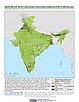
India Village-Level Geospatial Socio-Economic Data Set, v1 (1991, 2001)India Data Collection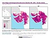
To provide data that can be used in independent spatial statistical analyses, construction of development-related indices, or in combination with remote sensing data in order to identify spatio-temporal patterns and/or changes in different demographic categories, such as male, female, urban, rural, level of education, etc. |
|
Natural Resource Protection and Child Health Indicators, 2017 Release (
|
||
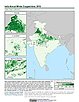
India Annual Winter Cropped Area, v1 (
|
Global Human Built-up And Settlement Extent (HBASE) Dataset From Landsat, v1 (2010)Global High Resolution Urban Data from Landsat
To provide high spatial resolution estimates of global urban extent derived from global 30m Landsat satellite data for the target year 2010 and a companion dataset to the Global Man-made Impervious Surface (GMIS) dataset. |
|
Global Man-made Impervious Surface (GMIS) Dataset From Landsat, v1 (2010)Global High Resolution Urban Data from Landsat
To provide high spatial resolution estimates of global man-made imperviousness for the target year 2010, derived from global 30m Landsat satellite data and a companion dataset to the Global Human Built-up And Settlement Extent (HBASE) dataset. |
Global Gridded Geographically Based Economic Data (G-Econ), v4 (1990, 1995, 2000, 2005)Spatial Economic Data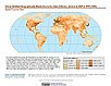
To provide global gridded Gross Domestic Product (GDP) data in both Market Exchange Rate (MER) and Purchasing Power Parity (PPP) to be used for socioeconomic, environmental, climate, and other related research. |


|
1 of 4
Prev
|
Next
|