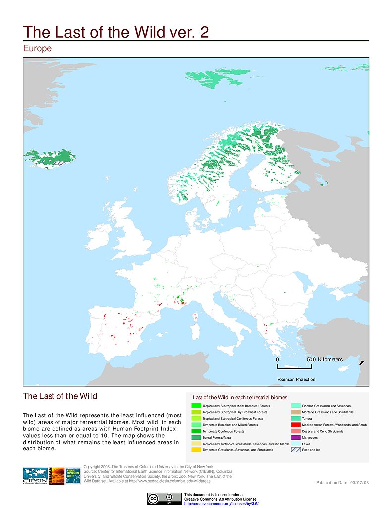
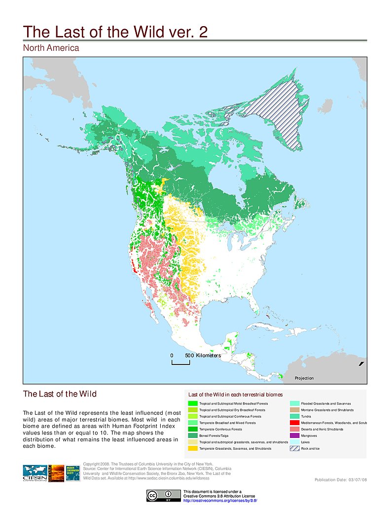
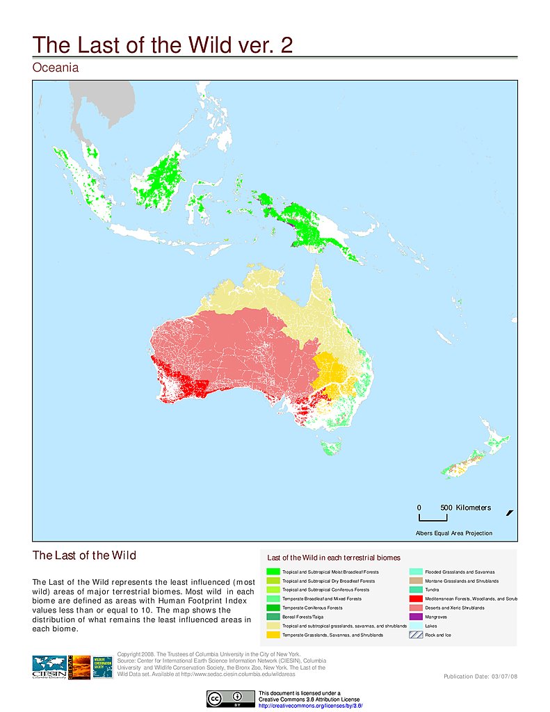
Last of the Wild, v2
|
1 of 1
Prev
|
Next
|


|
1 of 1
Prev
|
Next
|
|
1 of 1
Prev
|
Next
|
|
1 of 1
Prev
|
Next
|