Data Sets (158)
| 6 of 8 |
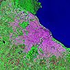
Urban Landsat: Cities from Space, v1 (
|
Synthetic Assessment of Global Distribution of Vulnerability to Climate Change, v1 (2005, 2050, 2100)Intergovernmental Panel on Climate Change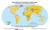
To provide geographical portraits of vulnerability designed to incorporate both exposure to climate change and national capacities to adapt. |
|
Pilot Environmental Performance Index, 2006 Release (
|
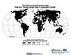
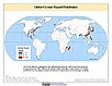
Global Flood Hazard Frequency and Distribution, v1 (
|
|
Global Landslide Mortality Risks and Distribution, v1 (2000)Natural Disaster Hotspots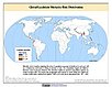
To provide a means of assessing global landslide mortality risks and distribution. |
Global Multihazard Total Economic Loss Risk Deciles, v1 (2000)Natural Disaster Hotspots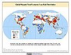
To identify areas of the world that are at greater risk of multihazard total economic loss. |
|
Global Multihazard Frequency and Distribution, v1 (2000)Natural Disaster Hotspots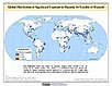
To provide insight into the frequency and distribution of multihazard events. |
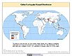
Global Cyclone Hazard Frequency and Distribution, v1 (
|
|
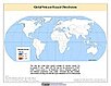
Global Volcano Hazard Frequency and Distribution, v1 (
|
Global Drought Total Economic Loss Risk Deciles, v1 (2000)Natural Disaster Hotspots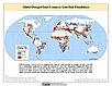
To provide a spatial surface of the total economic impacts of global drought hazard. |
|
Global Multihazard Mortality Risks and Distribution, v1 (2000)Natural Disaster Hotspots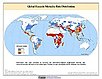
To identify areas of the world at multihazard mortality risk and to gain insight into the nature of this risk posed. |
Global Volcano Proportional Economic Loss Risk Deciles, v1 (2000)Natural Disaster Hotspots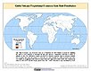
To provide a spatial surface of the proportional economic impacts of global volcano hazard. |
|
Global Earthquake Proportional Economic Loss Risk Deciles, v1 (2000)Natural Disaster Hotspots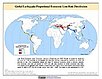
To provide a spatial surface of the proportional economic impacts of global earthquake hazard. |
Global Landslide Total Economic Loss Risk Deciles, v1 (2000)Natural Disaster Hotspots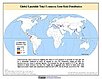
To provide a spatial surface of the total economic impacts of global landslide hazard. |
|
Global Multihazard Proportional Economic Loss Risk Deciles, v1 (2000)Natural Disaster Hotspots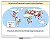
To identify areas of the world that are at greater risk of multihazard proportional economic loss. |
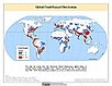
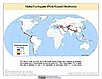
Global Earthquake Hazard Frequency and Distribution, v1 (
|
|
Global Earthquake Hazard Distribution - Peak Ground Acceleration, v1 (
|
Global Landslide Proportional Economic Loss Risk Deciles, v1 (2000)Natural Disaster Hotspots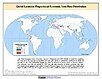
To provide a spatial surface of the proportional economic impacts of global landslide hazard. |
|
Global Volcano Total Economic Loss Risk Deciles, v1 (2000)Natural Disaster Hotspots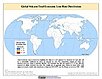
To provide a spatial surface of the total economic impacts of global volcano hazard. |
Global Drought Proportional Economic Loss Risk Deciles, v1 (2000)Natural Disaster Hotspots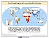
To provide a spatial surface of the proportional economic impacts of global drought hazard. |
| 6 of 8 |