Data Sets (158)
|
8 of 8
Prev
|
Next
|
Coastlines, v3 (2000)Gridded Population of the World (GPW), v3To provide a set of coastlines consistent with GPWv3 raster data for cartographic purposes. |
Subnational Administrative Boundaries, v3 (1990, 1995, 2000)Gridded Population of the World (GPW), v3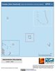
To provide maps of the input administrative units used in GPWv3. |
|
Population Density Grid Future Estimates, v3 (2005, 2010, 2015)Gridded Population of the World (GPW), v3To provide a time series of raster data on population projected to the year 2015 to facilitate data integration. |
Population Count Grid Future Estimates, v3 (2005, 2010, 2015)Gridded Population of the World (GPW), v3To provide a time series of raster data on population projected to the year 2015 to facilitate data integration. |
|
Population Density Grid, v3 (1990, 1995, 2000)Gridded Population of the World (GPW), v3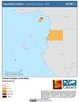
To provide a time series of raster data on population density to facilitate data integration. |
Land and Geographic Unit Area Grids, v3 (1990, 1995, 2000, 2005, 2010, 2015)Gridded Population of the World (GPW), v3To provide a quantitative measure of the input resolution of administrative units used for GPWv3. |
|
Centroids, v3 (1990, 1995, 2000, 2005, 2010, 2015)Gridded Population of the World (GPW), v3To provide a vector (point) version of the input administrative units used in GPWv3 for use in data integration. |
Environmental Sustainability Index, 2005 Release (
|
|
U.S. Population Grids (Summary File 1): New Orleans Metropolitan Statistical Area, alpha (2000)Natural Disasters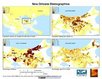
To provide gridded demographic data, including characteristics of age, race, ethnicity, and housing, for metropolitan statistical areas at a finer resolution than is available in the 30 arc-second grids used for the United States as a whole. |
U.S. Population Grids (Summary File 1): Houston Metropolitan Statistical Area, alpha (2000)Natural Disasters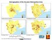
To provide gridded demographic data, including characteristics of age, race, ethnicity, and housing, for metropolitan statistical areas at a finer resolution than is available in the 30 arc-second grids used for the United States as a whole. |
|
Global 15 x 15 Minute Grids of the Downscaled Population Based on the SRES B2 Scenario, v1 (1990, 2025)Socioeconomic Downscaled Projections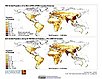
To provide a gridded data on country-level population and downscaled projections based on the SRES B2 marker scenario. |
Global 15 x 15 Minute Grids of the Downscaled GDP Based on the SRES B2 Scenario, v1 (1990, 2025)Socioeconomic Downscaled Projections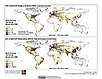
To provide gridded GDP data on country-level downscaled projections based on the SRES B2 marker scenario. |
|
Global Patterns of HANPP, v1 (1995)Human Appropriation of Net Primary Productivity (HANPP)
To assist in understanding human impacts on the environment, and especially impacts on biodiversity and ecosystem services. |
Global Patterns in Net Primary Productivity, v1 (1995)Human Appropriation of Net Primary Productivity (HANPP)
To be utilized in conjunction with a data set of human appropriation of net primary productivity (HANPP) in order to understand global energy flows and localized impacts on the environment. |
|
HANPP as a Percentage of Net Primary Productivity, v1 (1995)Human Appropriation of Net Primary Productivity (HANPP)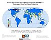
To identify spatial variations in the amount of NPP consumption relative to local production in a way that highlight humanity's growing impact on the biosphere. |
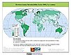
Environmental Vulnerability Index (EVI), 2004 Release (
|
|
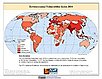
Environmental Sustainability Index, 2002 Release (
|
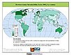
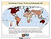
The Wellbeing of Nations, v1 (
|
|
8 of 8
Prev
|
Next
|