Data Sets (21)
|
1 of 2
Prev
|
Next
|
Delta Urban-Rural Population and Land Area Estimates, v1 (1990, 2000, 2014, 2015)Low Elevation Coastal Zone (LECZ)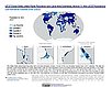
To provide country-level estimates of populations and land areas in river delta- and non-delta contexts for the years 1990, 2000, 2014, and 2015 for 246 statistical areas, focusing on greater-risk zones using the global extent of low elevation zones contiguous to the coast bounded by either 5 meters or 10 meters. |
SDG Indicator 11.2.1: Urban Access to Public Transport, 2023 Release (
|
|
SDG Indicator 9.1.1: The Rural Access Index (RAI), 2023 Release (
|
SDG Indicator 11.7.1: Urban Public Space, Availability and Access, 2023 Release (
|
|
Population, Landscape, And Climate Estimates (PLACE), v4 (2000, 2005, 2010, 2015, 2020)National Aggregates of Geospatial Data Collection (NAGDC)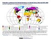
To provide tabular data to researchers without GIS capabilities who need data on population and land area by country across a range of physical characteristics. These include measures such as the number of persons living within coastal zones, the total area within a specific elevation strata, or the number of persons living within different climate zones. |
Groundswell Spatial Population and Migration Projections at One-Eighth Degree According to SSPs and RCPs, v1 (
|
|
Urban-Rural Population and Land Area Estimates, v3 (1990, 2000, 2015)Low Elevation Coastal Zone (LECZ)
To provide estimates of urban and rural populations and land areas for the years 1990, 2000, 2015 for 234 countries and statistical areas with contiguous coastal elevations of less than or equal to 5m above sea level, 5-10m above sea level, and national totals using multiple updated data sources for comparative analysis. |
Historical Urban Population, v1 (
|
|
Sea Level Rise Impacts on Ramsar Wetlands of International Importance, v1 (
|
Population, Landscape, And Climate Estimates (PLACE), v3 (1990, 2000, 2010)National Aggregates of Geospatial Data Collection (NAGDC)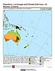
To provide tabular data to researchers without GIS capabilities who need data on population and land area by country across a range of physical characteristics. These include measures such as the number of persons living within coastal zones, the percent of a region within specific elevation strata, or the number of persons living within different climate zones. |
|
Population Count Grid, v1 (1990, 1995, 2000)Global Rural-Urban Mapping Project (GRUMP), v1To provide a time series of raster population data for ntegration with other data sets. |
Urban Extents Grid, v1 (1995)Global Rural-Urban Mapping Project (GRUMP), v1
To provide a raster representation of urban areas (or urban mask) for use with GRUMP population grids or other data sets. |
|
Land and Geographic Unit Area Grids, v1 (2000)Global Rural-Urban Mapping Project (GRUMP), v1To provide land area data for use with GRUMPv1 population and urban data as well as a quantitative measure of resolution of the input spatial units for GRUMPv1. |
Population Density Grid, v1 (1990, 1995, 2000)Global Rural-Urban Mapping Project (GRUMP), v1
To provide a time series of raster population density data for data integration. |
|
Settlement Points, v1 (1990, 1995, 2000)Global Rural-Urban Mapping Project (GRUMP), v1
To provide populated place (point) data with consistent population estimates. |
Population, Landscape, And Climate Estimates (PLACE), v2 (1990, 2000)National Aggregates of Geospatial Data Collection (NAGDC)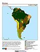
To provide tabular data on environmental conditions (elevations, climate, coastal) in which people reside. |
|
Urban-Rural Population Estimates, v1 (1990, 1995, 2000)Low Elevation Coastal Zone (LECZ)
To provide estimates of urban and rural populations and land areas in the low elevation coastal zone. |
Population Count Grid, v3 (1990, 1995, 2000)Gridded Population of the World (GPW), v3To provide a time series of raster data on population to facilitate data integration. |
|
Population Density Grid Future Estimates, v3 (2005, 2010, 2015)Gridded Population of the World (GPW), v3To provide a time series of raster data on population projected to the year 2015 to facilitate data integration. |
Population Count Grid Future Estimates, v3 (2005, 2010, 2015)Gridded Population of the World (GPW), v3To provide a time series of raster data on population projected to the year 2015 to facilitate data integration. |


|
1 of 2
Prev
|
Next
|