Data Sets (15)
|
1 of 1
Prev
|
Next
|
Groundswell Africa Spatial Population and Migration Projections at One-Eighth Degree According to SSPs and RCPs, v1 (
|
Population, Landscape, And Climate Estimates (PLACE), v4 (2000, 2005, 2010, 2015, 2020)National Aggregates of Geospatial Data Collection (NAGDC)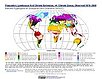
To provide tabular data to researchers without GIS capabilities who need data on population and land area by country across a range of physical characteristics. These include measures such as the number of persons living within coastal zones, the total area within a specific elevation strata, or the number of persons living within different climate zones. |
|
Groundswell Spatial Population and Migration Projections at One-Eighth Degree According to SSPs and RCPs, v1 (
|
Urban-Rural Population and Land Area Estimates, v3 (1990, 2000, 2015)Low Elevation Coastal Zone (LECZ)
To provide estimates of urban and rural populations and land areas for the years 1990, 2000, 2015 for 234 countries and statistical areas with contiguous coastal elevations of less than or equal to 5m above sea level, 5-10m above sea level, and national totals using multiple updated data sources for comparative analysis. |
|
GPWv4 Population Growth Preliminary Release, v1 (
|
Population Projections, v1 (2030, 2050)West Africa Coastal Vulnerability MappingTo provide areas in West Africa that may be particularly exposed to climate stressors owing to future high population growth. |
|
GPWv4 Population Density Preliminary Release, v1 (2010)West Africa Coastal Vulnerability MappingTo provide areas in the coastal zone of West Africa that may be particularly exposed to climate stressors owing to high population density. |
Urban-Rural Population and Land Area Estimates, v2 (1990, 2000, 2010, 2100)Low Elevation Coastal Zone (LECZ)
To provide estimates of urban and rural populations and land areas for the years 1990, 2000, and 2010; and projections to the year 2100 for 202 countries with contiguous coastal elevations in the following categories: less than or equal to 1m, 3m, 5m, 7m, 9m, 10m, 12m, or 20m; as well as national totals. |
|
Population, Landscape, And Climate Estimates (PLACE), v3 (1990, 2000, 2010)National Aggregates of Geospatial Data Collection (NAGDC)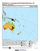
To provide tabular data to researchers without GIS capabilities who need data on population and land area by country across a range of physical characteristics. These include measures such as the number of persons living within coastal zones, the percent of a region within specific elevation strata, or the number of persons living within different climate zones. |
Population, Landscape, And Climate Estimates (PLACE), v2 (1990, 2000)National Aggregates of Geospatial Data Collection (NAGDC)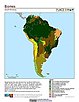
To provide tabular data on environmental conditions (elevations, climate, coastal) in which people reside. |
|
Urban-Rural Population Estimates, v1 (1990, 1995, 2000)Low Elevation Coastal Zone (LECZ)
To provide estimates of urban and rural populations and land areas in the low elevation coastal zone. |
Global 15 x 15 Minute Grids of the Downscaled Population Based on the SRES B2 Scenario, v1 (1990, 2025)Socioeconomic Downscaled Projections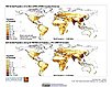
To provide a gridded data on country-level population and downscaled projections based on the SRES B2 marker scenario. |
|
Country-Level Population and Downscaled Projections Based on the SRES B2 Scenario, v1 (
|
Country-Level Population and Downscaled Projections Based on the SRES A1, B1, and A2 Scenarios, v1 (
|
|
Population, Landscape, And Climate Estimates (PLACE), v1 (1995)National Aggregates of Geospatial Data Collection (NAGDC)To provide tabular data on environmental conditions (elevations, climate, coastal) in which people reside. |

|
1 of 1
Prev
|
Next
|