Applications of Satellite Remote Sensing
|
3 of 3
Prev
|
Next
|
Central American Vegetation/Land Cover Classification and Conservation Status, v1 (
|
India Village-Level Geospatial Socio-Economic Data Set, v1 (1991, 2001)India Data Collection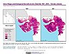
To provide data that can be used in independent spatial statistical analyses, construction of development-related indices, or in combination with remote sensing data in order to identify spatio-temporal patterns and/or changes in different demographic categories, such as male, female, urban, rural, level of education, etc. |
|
SDG Indicator 7.1.1: Access to Electricity, 2023 Release (
|
Development Threat Index, v1 (2015)Land Use and Land Cover (LULC)
To provide a future development threat map based on combining these resources: agricultural expansion, urban expansion, conventional oil and gas, unconventional oil and gas, coal, mining, biofuels, solar, and wind. |
|
Global Fire Emissions Indicators, Grids, v1 (
|
HANPP as a Percentage of Net Primary Productivity, v1 (1995)Human Appropriation of Net Primary Productivity (HANPP)
To identify spatial variations in the amount of NPP consumption relative to local production in a way that highlight humanity's growing impact on the biosphere. |
|
MA Rapid Land Cover Change, v1 (
|
Global Fire Emissions Indicators, Country-Level Tabular Data, v1 (
|
|
Global Mangrove Forests Distribution, v1 (2000)Land Use and Land Cover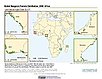
To provide data that can be used in global mangrove forest distribution modeling, land cover change analysis, global carbon accounting studies and to assist with policy-making in regards to human-environment interactions and future adaptive strategies. |
Global Human Footprint (Geographic), v1 (
|
|
Top One Percent Wild Areas (IGHP), v1 (
|
Global Human Footprint (IGHP), v1 (
|
|
Last of the Wild (IGHP), v1 (
|
Top One Percent Wild Areas (Geographic), v1 (
|
|
Last of the Wild (Geographic), v1 (
|

|
3 of 3
Prev
|
Next
|