Applications of Satellite Remote Sensing
| 2 of 3 |
Global Man-made Impervious Surface (GMIS) Dataset From Landsat, v1 (2010)Global High Resolution Urban Data from Landsat
To provide high spatial resolution estimates of global man-made imperviousness for the target year 2010, derived from global 30m Landsat satellite data and a companion dataset to the Global Human Built-up And Settlement Extent (HBASE) dataset. |
Global Monthly and Seasonal Urban and Land Backscatter Time Series, v1 (
|
|
Country Trends in Major Air Pollutants, v1 (
|
Yale Center for Earth Observation (YCEO) Surface Urban Heat Islands, v4 (
|
|
Global Database of Light-based Geospatial Income Inequality (LGII) Measures, v1 (
|
Croplands, v1 (2000)Global Agricultural Lands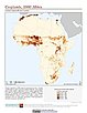
To provide data on the extent of croplands for research on human-environment interactions. |
|
Pastures, v1 (2000)Global Agricultural Lands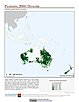
To provide data on the extent of pasturelands for research on human-environment interactions. |
Global High Resolution Daily Extreme Urban Heat Exposure (UHE-Daily), v1 (
|
|
Subset of High and Low Resolution Altimeter Corrected Elevations 2 (ACE2), v1 (
|
Subset of DMSP-OLS Nighttime Lights for Economic Activity, v1 (2010)West Africa Coastal Vulnerability MappingTo provide a measure of economic activity in the coastal zone of West Africa based on nighttime lights. |
|
India Annual Winter Cropped Area, v1 (
|
Annual Global High-Resolution Extreme Heat Estimates (GEHE), v1 (
|
|
Global Patterns in Net Primary Productivity, v1 (1995)Human Appropriation of Net Primary Productivity (HANPP)
To be utilized in conjunction with a data set of human appropriation of net primary productivity (HANPP) in order to understand global energy flows and localized impacts on the environment. |
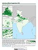
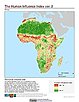
Global Human Influence Index (Geographic), v2 (
|
|
Global Human Footprint (IGHP), v2 (
|
Global Human Influence Index (IGHP), v2 (
|
|
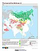
Last of the Wild (Geographic), v2 (
|
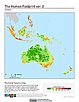
Global Human Footprint (Geographic), v2 (
|
|
Last of the Wild (IGHP), v2 (
|
MA Climate and Land Cover, v1 (
|
| 2 of 3 |