NASA Website Socioeconomic Data and Applications Center (sedac)
A Data Center in NASA's Earth Observing System Data and Information System (EOSDIS) — Hosted by CIESIN at Columbia University
Data
  • Data Sets
  • Maps
  • Web Pages
  • home
  • Data
    • · Data Sets
    • · Data Collections
    • · Featured Data Uses
    • · Data Citations
    • · Citations Database
    • · Data Submission
  • Maps
    • · Map Gallery
    • · Map Viewer
    • · Map Services
    • · Mapping Tools
  • Themes
    • · Agriculture
    • · Climate
    • · Conservation
    • · Governance
    • · Hazards
    • · Health
    • · Infrastructure
    • · Land Use
    • · Marine and Coastal
    • · Population
    • · Poverty
    • · Remote Sensing
    • · Sustainability
    • · Urban
    • · Water
  • Resources
    • · Guides
    • · Multimedia
    • · Networks
    • · News
    • · Publications
    • · Related Sites
    • · Remote Sensing
    • · Tools
  • Social Media
    • · Twitter
    • · FaceBook
    • · YouTube
    • · Flickr
    • · Blog Posts
    • · Communities
  • About
    • · About SEDAC
    • · User Working Group
    • · Privacy
    • · User Registration
  • Help
 

Urbanization and Human Settlements

Follow Us: Twitter Follow Us on Facebook YouTube Flickr   |   Share: Twitter Facebook
  • Theme Home
  • Data Sets
  • Map Gallery
  • Map Services
  • Featured Data Uses
  • Resources
    • Guides
    • Multimedia
    • Networks
    • Publications
    • Related Sites

NASA ARSET Training:“Applications of the EO Toolkit to Measure and Analyze Sustainable Development Goals”

partial image of Capetown in quad display made in PopGrid Viewer mapping tool

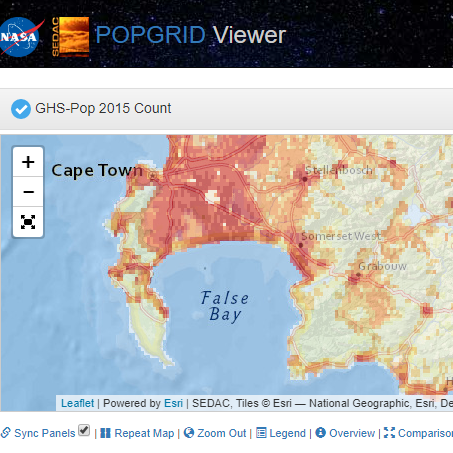
Part Two of a three-part training by NASA’s Applied Remote Sensing Training Program (ARSET), “Earth Observations Toolkit for Sustainable Cities and Human Settlements,” that provides an overview of an online knowledge resource that shares ready-to-use Earth observation data sets and tools. Held February 3, 2022, the training, “Applications of the EO Toolkit to Measure and Analyze Sustainable Development Goals,” featured CIESIN postdoctoral research scientist Cascade Tuholske, with JRC's Thomas Kemper, presenting on using gridded data to support the Sustainable Development Goals 11 (“Make cities inclusive, safe, resilient, and sustainable”). An introduction to dataset comparison featured the POPGRID data collaborative Web site and Viewer.

Code Red: Vulnerability to Extreme Heat, Floods, and Displacement

Code Red title card

For NYC Climate Week 2021, a panel comprised of CIESIN researchers highlighted their recent work on mapping extreme heat in urban areas, assessing social vulnerability to flooding, and modeling climate-induced population displacement.

PERN Webinar—Gridded Population & Settlement Products in Geospatial Population-Environment Research

screenshot of cyberseminar title

This “cyberseminar” offered October 14–18, 2019, focuses on various gridded population and settlement data products and their suitability for different application areas in population-environment studies. Hosted by the Population and Environment Research Network (PERN) and organized by CIESIN and the POPGRID Data Collaborative, which is funded by the Bill and Melinda Gates Foundation. 

GMIS and HBASE: Data Products from NASA SEDAC

GMIS and HBASE: Data Products from NASA SEDAC

This brief video introduction introduces users to the companion data sets Human Built-up and Settlement Extent (HBASE) and Global Man-made Impervious Surface (GMIS), and demonstrates how to use the mapping tool to visualize the data. HBASE and GMIS were produced as a result of a collaboration between the NASA Goddard Space Flight Center and the Department of Geographical Sciences at the University of Maryland, funded through the NASA Land Cover Land Use Change Program.

Home | Data | Data Uses | Data Citations | Maps | Map Services

News | Tools | Guides | Publications | Blog Posts

About | Help | Privacy | User Registration

Copyright © 1997–2023. The Trustees of Columbia University in the City of New York.

WDS ICSU