Data Sets (30)
|
2 of 2
Prev
|
Next
|
Global Subnational Prevalence of Child Malnutrition, v1 (
|
||
Population Count Grid, v3 (1990, 1995, 2000)Gridded Population of the World (GPW), v3To provide a time series of raster data on population to facilitate data integration. |
Coastlines, v3 (2000)Gridded Population of the World (GPW), v3To provide a set of coastlines consistent with GPWv3 raster data for cartographic purposes. |
|
Population Density Grid Future Estimates, v3 (2005, 2010, 2015)Gridded Population of the World (GPW), v3To provide a time series of raster data on population projected to the year 2015 to facilitate data integration. |
Population Count Grid Future Estimates, v3 (2005, 2010, 2015)Gridded Population of the World (GPW), v3To provide a time series of raster data on population projected to the year 2015 to facilitate data integration. |
|
Population Density Grid, v3 (1990, 1995, 2000)Gridded Population of the World (GPW), v3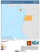
To provide a time series of raster data on population density to facilitate data integration. |
Land and Geographic Unit Area Grids, v3 (1990, 1995, 2000, 2005, 2010, 2015)Gridded Population of the World (GPW), v3To provide a quantitative measure of the input resolution of administrative units used for GPWv3. |
|
Centroids, v3 (1990, 1995, 2000, 2005, 2010, 2015)Gridded Population of the World (GPW), v3To provide a vector (point) version of the input administrative units used in GPWv3 for use in data integration. |
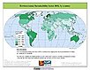
Environmental Sustainability Index, 2005 Release (
|


|
2 of 2
Prev
|
Next
|