Search » Data Sets (300)
| 4 of 15 |
Development Threat Index, v1 (2015)Land Use and Land Cover (LULC)
To provide a future development threat map based on combining these resources: agricultural expansion, urban expansion, conventional oil and gas, unconventional oil and gas, coal, mining, biofuels, solar, and wind. |
Altimeter Corrected Elevations (ACE2), v2 (
|
|
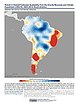
Trends in Global Freshwater Availability from the Gravity Recovery and Climate Experiment (GRACE), v1 (
|
Urban Extents from VIIRS and MODIS for the Continental U.S. Using Machine Learning Methods, v1 (2015)Urban Spatial Data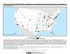
To provide representations of urban areas in the Continental U.S. in the year 2015 to support sustainable urban development planning in accordance with the growth of urban areas. |
|
Natural Resource Protection and Child Health Indicators, 2019 Release (
|
Global Fire Emissions Indicators, Grids, v1 (
|
|
Human Footprint, 2018 Release (2009)Last of the Wild, v3To provide a map of cumulative human pressure on the environment in 2009. |
Human Footprint, 2018 Release (1993)Last of the Wild, v3To provide a map of cumulative human pressure on the environment in 1993. |
|
Subset of OpenStreetMap Roads, v1 (2014)West Africa Coastal Vulnerability MappingTo provide roads linking rural production to urban markets in the coastal zone of West Africa that represent an important exposed infrastructure asset. |
Subset of Global Mammal and Amphibian Richness Grids, 2015 Release (2013)West Africa Coastal Vulnerability MappingTo provide areas of higher richness of threatened species which may be at risk from climate stressors in the coastal zone of West Africa. |
|
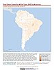
Subset of High and Low Resolution Altimeter Corrected Elevations 2 (ACE2), v1 (
|
Social Vulnerability Indices, v1 (1997, 2005, 2008, 2010, 2013)West Africa Coastal Vulnerability MappingTo provide a measure of social vulnerability and "defenselessness" in the face of climate stressors in the coastal zone of West Africa. |
|
Subset of JRC Map of Accessibility, v1 (
|
Mangrove Forests Distribution Polygon, v1 (2000)West Africa Coastal Vulnerability MappingTo provide mangrove forests in the coastal zone of West Africa that may be exposed to the threats of sea level rise and storm surge. |
|
GPWv4 Population Growth Preliminary Release, v1 (
|
Population Projections, v1 (2030, 2050)West Africa Coastal Vulnerability MappingTo provide areas in West Africa that may be particularly exposed to climate stressors owing to future high population growth. |
|
GPWv4 Population Density Preliminary Release, v1 (2010)West Africa Coastal Vulnerability MappingTo provide areas in the coastal zone of West Africa that may be particularly exposed to climate stressors owing to high population density. |
Demographic and Health Survey Data Sets, v1 (
|
|
Gridded Subset of Sub-national Poverty and Extreme Poverty Prevalence, v1 (2005)West Africa Coastal Vulnerability MappingTo provide poverty levels in the coastal zone of West Africa. |
Deforestation, v1 (
|
| 4 of 15 |