Agriculture and Food Security
|
1 of 3
Prev
|
Next
|
Global Pesticide Grids (PEST-CHEMGRIDS), v1.01 (2015, 2020, 2025)Global Agricultural Inputs, v1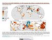
To provide a global gridded data set of commonly-used agricultural pesticides crucial to assess human and ecosystem exposure to potential toxicants for environmental modeling, assessment of agricultural chemical contamination and risk analysis, and other related research at global, regional, national, and local levels. |
||
Croplands, v1 (2000)Global Agricultural Lands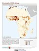
To provide data on the extent of croplands for research on human-environment interactions. |
||
Pastures, v1 (2000)Global Agricultural Lands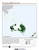
To provide data on the extent of pasturelands for research on human-environment interactions. |
||
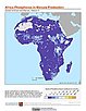
Global Human Modification of Terrestrial Systems, v1 (2016)Land Use and Land Cover
To provide a cumulative measure of human modification of terrestrial lands based on modeling the physical extents of 13 anthropogenic stressors and their estimated impacts using spatially-explicit global data sets. |
||
Global Development Potential Indices, v1 (2016)Land Use and Land Cover
To provide spatially-explicit data that relatively rank global land suitability referred to as Development Potential Indices (DPIs) for 13 sectors related to renewable energy, fossil fuels, mining and agriculture as an aid to conservation priority setting. |
MA Scenarios, v1 (
|
|
Food Insecurity Hotspots Data Set, v1 (
|
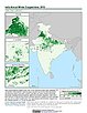
India Annual Winter Cropped Area, v1 (
|
|
Twentieth Century Crop Statistics, v1 (
|
Development Threat Index, v1 (2015)Land Use and Land Cover (LULC)
To provide a future development threat map based on combining these resources: agricultural expansion, urban expansion, conventional oil and gas, unconventional oil and gas, coal, mining, biofuels, solar, and wind. |
|
MA Rapid Land Cover Change, v1 (
|
Poverty and Food Security Case Studies, v1 (
|
|
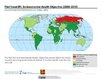
Environmental Performance Index, 2020 Release (
|
Environmental Performance Index, 2010 Release (
|
|
Environmental Performance Index and Pilot Trend Environmental Performance Index, 2012 Release (
|
Environmental Performance Index, 2014 Release (
|
|
1 of 3
Prev
|
Next
|