Infrastructure
|
1 of 3
Prev
|
Next
|
Dams, v1.01 (2011)Global Reservoir and Dam (GRanD), v1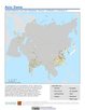
To provide a geographically explicit and reliable database of dams for the scientific community. |
Development Threat Index, v1 (2015)Land Use and Land Cover (LULC)
To provide a future development threat map based on combining these resources: agricultural expansion, urban expansion, conventional oil and gas, unconventional oil and gas, coal, mining, biofuels, solar, and wind. |
|
Global Urban Heat Island (UHI) Data Set, v1 (2013)Satellite-Derived Environmental Indicators
To provide a global data set of average summer daytime maximum/nighttime minimum land surface temperatures (LSTs) for urban extents, as well as the LST difference between the urban area and the buffer. |
Global Summer Land Surface Temperature (LST) Grids, v1 (2013)Satellite-Derived Environmental Indicators
To provide raster representations of global summer daytime maximum and nighttime minimum surface temperature for studies related to human health and climate change. |
|
Global Human Modification of Terrestrial Systems, v1 (2016)Land Use and Land Cover
To provide a cumulative measure of human modification of terrestrial lands based on modeling the physical extents of 13 anthropogenic stressors and their estimated impacts using spatially-explicit global data sets. |
Global Development Potential Indices, v1 (2016)Land Use and Land Cover
To provide spatially-explicit data that relatively rank global land suitability referred to as Development Potential Indices (DPIs) for 13 sectors related to renewable energy, fossil fuels, mining and agriculture as an aid to conservation priority setting. |
|
Reservoirs, v1.01 (2011)Global Reservoir and Dam (GRanD), v1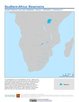
To provide a geographically explicit and reliable database of reservoirs for the scientific community. |
SSPs Literature Database, v1 (
|
|
Subset of OpenStreetMap Roads, v1 (2014)West Africa Coastal Vulnerability MappingTo provide roads linking rural production to urban markets in the coastal zone of West Africa that represent an important exposed infrastructure asset. |
Subset of JRC Map of Accessibility, v1 (
|
|
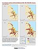
ATSDR Hazardous Waste Site Polygon Data, v2 (2010)Superfund Site FootprintsTo provide the ATSDR polygon data set of hazardous waste sites in the United States, Puerto Rico, and other territories which can be used to identify nearby populations and assess their potential risk. |
||
ATSDR Hazardous Waste Site Polygon Data with CIESIN Modifications, v2 (2010)Superfund Site FootprintsTo provide an easily accessible, corrected data set of polygons for hazardous waste sites in the United States which can be used to identify nearby populations and assess their potential risk. |
Global Roads Open Access Data Set (gROADS), v1 (
|
|
CODATA Catalog of Roads, v1 (
|
Coastlines, v3 (2000)Gridded Population of the World (GPW), v3To provide a set of coastlines consistent with GPWv3 raster data for cartographic purposes. |
|
Subnational Administrative Boundaries, v3 (1990, 1995, 2000)Gridded Population of the World (GPW), v3
To provide maps of the input administrative units used in GPWv3. |
National Identifier Grid, v3 (2000)Gridded Population of the World (GPW), v3To provide a raster representation of nation-states in GPWv3 for use in aggregating population data. |
|
National Administrative Boundaries, v3 (2000)Gridded Population of the World (GPW), v3To provide a quantitative measure of the input resolution of administrative units used for GPWv3. |
Land and Geographic Unit Area Grids, v3 (1990, 1995, 2000, 2005, 2010, 2015)Gridded Population of the World (GPW), v3To provide a quantitative measure of the input resolution of administrative units used for GPWv3. |
|
1 of 3
Prev
|
Next
|