Gridded Population of the World (GPW), v4
|
1 of 1
Prev
|
Next
|
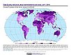
UN WPP-Adjusted Population Density, v4.11 (2000, 2005, 2010, 2015, 2020)Gridded Population of the World (GPW), v4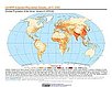
To provide estimates of population density for the years 2000, 2005, 2010, 2015, and 2020, based on counts consistent with national censuses and population registers with respect to relative spatial distribution, but adjusted to match United Nations country totals. |
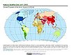
Population Density, v4.11 (2000, 2005, 2010, 2015, 2020)Gridded Population of the World (GPW), v4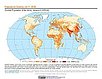
To provide estimates of population density for the years 2000, 2005, 2010, 2015, and 2020, based on counts consistent with national censuses and population registers, as raster data to facilitate data integration. |
|
Basic Demographic Characteristics, v4.11 (2010)Gridded Population of the World (GPW), v4To provide estimates of population counts by age and sex for the year 2010, consistent with national censuses and population registers, as raster data to facilitate data integration. |
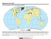
Population Count, v4.11 (2000, 2005, 2010, 2015, 2020)Gridded Population of the World (GPW), v4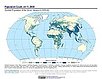
To provide estimates of population count for the years 2000, 2005, 2010, 2015, and 2020, consistent with national censuses and population registers, as raster data to facilitate data integration. |
|
Administrative Unit Center Points with Population Estimates, v4.11 (2000, 2005, 2010, 2015, 2020)Gridded Population of the World (GPW), v4To provide a vector (point) version of the input administrative units used in GPWv4 with population estimates, densities, 2010 basic demographic characteristics, and administrative name, area, and data context for use in data integration. |
||
UN WPP-Adjusted Population Count, v4.11 (2000, 2005, 2010, 2015, 2020)Gridded Population of the World (GPW), v4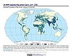
To provide estimates of population count for the years 2000, 2005, 2010, 2015, and 2020, consistent with national censuses and population registers with respect to relative spatial distribution, but adjusted to match United Nations country totals. |
||
|
1 of 1
Prev
|
Next
|