Data Sets (86)
| 2 of 5 |
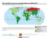
Environmental Performance Index, 2018 Release (
|
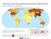
Natural Resource Protection and Child Health Indicators, 2017 Release (
|
|
Settlement Points, v1.01 (1990, 1995, 2000)Global Rural-Urban Mapping Project (GRUMP), v1To provide populated place (point) data with consistent population estimates. |
Global Human Built-up And Settlement Extent (HBASE) Dataset From Landsat, v1 (2010)Global High Resolution Urban Data from Landsat
To provide high spatial resolution estimates of global urban extent derived from global 30m Landsat satellite data for the target year 2010 and a companion dataset to the Global Man-made Impervious Surface (GMIS) dataset. |
|
Global Man-made Impervious Surface (GMIS) Dataset From Landsat, v1 (2010)Global High Resolution Urban Data from Landsat
To provide high spatial resolution estimates of global man-made imperviousness for the target year 2010, derived from global 30m Landsat satellite data and a companion dataset to the Global Human Built-up And Settlement Extent (HBASE) dataset. |
Global Gridded Geographically Based Economic Data (G-Econ), v4 (1990, 1995, 2000, 2005)Spatial Economic Data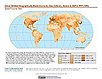
To provide global gridded Gross Domestic Product (GDP) data in both Market Exchange Rate (MER) and Purchasing Power Parity (PPP) to be used for socioeconomic, environmental, climate, and other related research. |
|
Natural Resource Protection and Child Health Indicators, 2016 Release (
|
Environmental Performance Index, 2016 Release (
|
|
Natural Resource Protection and Child Health Indicators, 2015 Release (
|
Population Exposure Estimates in Proximity to Nuclear Power Plants, Country-Level Aggregates, v1 (1990, 2000, 2010)Energy InfrastructureTo provide estimates of total, urban and rural populations and land areas in proximity to nuclear power plants. |
|
Natural Resource Protection and Child Health Indicators, 2014 Release (
|
Environmental Performance Index, 2014 Release (
|
|
Natural Resource Protection and Child Health Indicators, 2013 Release (
|
Sea Level Rise Impacts on Ramsar Wetlands of International Importance, v1 (
|
|
Natural Resource Protection and Child Health Indicators, 2012 Release (
|
Population, Landscape, And Climate Estimates (PLACE), v3 (1990, 2000, 2010)National Aggregates of Geospatial Data Collection (NAGDC)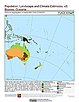
To provide tabular data to researchers without GIS capabilities who need data on population and land area by country across a range of physical characteristics. These include measures such as the number of persons living within coastal zones, the percent of a region within specific elevation strata, or the number of persons living within different climate zones. |
|
National and Regional Data Set by Source Category, v2.86 (
|
Environmental Performance Index and Pilot Trend Environmental Performance Index, 2012 Release (
|
|
Natural Resource Management Index, 2011 Release (
|
Population Count Grid, v1 (1990, 1995, 2000)Global Rural-Urban Mapping Project (GRUMP), v1To provide a time series of raster population data for ntegration with other data sets. |
| 2 of 5 |