Data Sets (116)
| 3 of 6 |
Settlement Points, v1.01 (1990, 1995, 2000)Global Rural-Urban Mapping Project (GRUMP), v1To provide populated place (point) data with consistent population estimates. |
Global Urban Heat Island (UHI) Data Set, v1 (2013)Satellite-Derived Environmental Indicators
To provide a global data set of average summer daytime maximum/nighttime minimum land surface temperatures (LSTs) for urban extents, as well as the LST difference between the urban area and the buffer. |
|
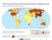
Global Gridded Geographically Based Economic Data (G-Econ), v4 (1990, 1995, 2000, 2005)Spatial Economic Data
To provide global gridded Gross Domestic Product (GDP) data in both Market Exchange Rate (MER) and Purchasing Power Parity (PPP) to be used for socioeconomic, environmental, climate, and other related research. |
Natural Resource Protection and Child Health Indicators, 2016 Release (
|
|
Environmental Performance Index, 2016 Release (
|
Natural Resource Protection and Child Health Indicators, 2015 Release (
|
|
Population Exposure Estimates in Proximity to Nuclear Power Plants, Locations, v1 (
|
Population Exposure Estimates in Proximity to Nuclear Power Plants, Country-Level Aggregates, v1 (1990, 2000, 2010)Energy InfrastructureTo provide estimates of total, urban and rural populations and land areas in proximity to nuclear power plants. |
|
Natural Resource Protection and Child Health Indicators, 2014 Release (
|
Environmental Performance Index, 2014 Release (
|
|
U.S. EPA National Priorities List Sites with CIESIN Modifications, v2 (2014)Superfund Site Footprints
To provide an easily accessible, corrected EPA data set of the geo-referenced locations displayed as points for all the National Priorities List (NPL) Superfund sites in the United States, Puerto Rico, and other territories. |
Natural Resource Protection and Child Health Indicators, 2013 Release (
|
|
Sea Level Rise Impacts on Ramsar Wetlands of International Importance, v1 (
|
Urban-Rural Population and Land Area Estimates, v2 (1990, 2000, 2010, 2100)Low Elevation Coastal Zone (LECZ)
To provide estimates of urban and rural populations and land areas for the years 1990, 2000, and 2010; and projections to the year 2100 for 202 countries with contiguous coastal elevations in the following categories: less than or equal to 1m, 3m, 5m, 7m, 9m, 10m, 12m, or 20m; as well as national totals. |
|
Natural Resource Protection and Child Health Indicators, 2012 Release (
|
Population, Landscape, And Climate Estimates (PLACE), v3 (1990, 2000, 2010)National Aggregates of Geospatial Data Collection (NAGDC)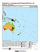
To provide tabular data to researchers without GIS capabilities who need data on population and land area by country across a range of physical characteristics. These include measures such as the number of persons living within coastal zones, the percent of a region within specific elevation strata, or the number of persons living within different climate zones. |
|
National and Regional Data Set by Source Category, v2.86 (
|
Environmental Performance Index and Pilot Trend Environmental Performance Index, 2012 Release (
|
|
Natural Resource Management Index, 2011 Release (
|
Settlement Points, v1 (1990, 1995, 2000)Global Rural-Urban Mapping Project (GRUMP), v1
To provide populated place (point) data with consistent population estimates. |
| 3 of 6 |