Data Sets » Format: map serviceRemove Facet » Theme: WaterRemove Facet
1 of 2
Prev | Next

Environmental Performance Index, 2020 Release (1950 – 2020)

Environmental Performance Index (EPI)

To provide quantitative metrics for evaluating a country's environmental performance in different policy categories relative to clearly defined targets.

Trends in Global Freshwater Availability from the Gravity Recovery and Climate Experiment (GRACE), v1 (2002 – 2016)

Satellite-Derived Environmental Indicators

To provide data on changes in freshwater availability in order to better understand impacts on regional food supplies, human and ecosystem health, energy generation, and social unrest.

Data Quality Indicators, v4.11 (2010)

Gridded Population of the World (GPW), v4

To provide context for the population count and density rasters, and explicit information on the spatial precision of the input boundary data.

Land and Water Area, v4.11 (2010)

Gridded Population of the World (GPW), v4

To provide pixel-level land and water surface area estimates.

Environmental Performance Index, 2018 Release (1950 – 2018)

Environmental Performance Index (EPI)

To provide quantitative metrics for evaluating a country's environmental performance in different policy categories relative to clearly defined targets.

Environmental Performance Index, 2016 Release (1950 – 2016)

Environmental Performance Index (EPI)

To provide quantitative metrics for evaluating a country's environmental performance in different policy categories relative to clearly defined targets.

Environmental Performance Index, 2014 Release (2002 – 2014)

Environmental Performance Index (EPI)

To provide quantitative metrics for evaluating a country's environmental performance in different policy categories relative to clearly defined targets.

Sea Level Rise Impacts on Ramsar Wetlands of International Importance, v1 (2000 – 2010)

Low Elevation Coastal Zone (LECZ)

To provide a preliminary assessment of coastal Ramsar Sites that are at risk to inundation as a consequence of sea level rise.

Dams, v1.01 (2011)

Global Reservoir and Dam (GRanD), v1

To provide a geographically explicit and reliable database of dams for the scientific community.

Reservoirs, v1.01 (2011)

Global Reservoir and Dam (GRanD), v1

To provide a geographically explicit and reliable database of reservoirs for the scientific community.

Croplands, v1 (2000)

Global Agricultural Lands

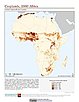
To provide data on the extent of croplands for research on human-environment interactions.

Environmental Performance Index, 2010 Release (1994 – 2009)

Environmental Performance Index (EPI)

To provide quantitative metrics for evaluating a country's environmental performance in different policy categories relative to clearly defined targets.

Fourth Assessment Report (AR4) Observed Climate Change Impacts, v1 (1970 – 2014)

Intergovernmental Panel on Climate Change

To provide a database with observed responses to climate change for multidisciplinary studies.

Global Flood Hazard Frequency and Distribution, v1 (1985 – 2003)

Natural Disaster Hotspots

To provide a means of assessing the relative distribution and frequency of global flood hazard.

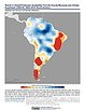
Global Drought Total Economic Loss Risk Deciles, v1 (2000)

Natural Disaster Hotspots

To provide a spatial surface of the total economic impacts of global drought hazard.

Global Drought Proportional Economic Loss Risk Deciles, v1 (2000)

Natural Disaster Hotspots

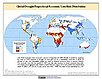
To provide a spatial surface of the proportional economic impacts of global drought hazard.

Global Drought Mortality Risks and Distribution, v1 (2000)

Natural Disaster Hotspots

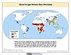
To provide a means of assessing global drought mortality risks and distribution.

Global Flood Total Economic Loss Risk Deciles, v1 (2000)

Natural Disaster Hotspots

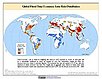
To provide a spatial surface of the total economic impacts of global flood hazard.

Global Flood Proportional Economic Loss Risk Deciles, v1 (2000)

Natural Disaster Hotspots

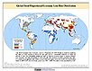
To provide a spatial surface of the proportional economic impacts of global flood hazard.

Global Flood Mortality Risks and Distribution, v1 (2000)

Natural Disaster Hotspots

To provide a means of assessing global flood mortality risks and distribution.

Data Sets » Format: map serviceRemove Facet » Theme: WaterRemove Facet
1 of 2
Prev | Next