Data Sets (94)
| 3 of 5 |
Population, Landscape, And Climate Estimates (PLACE), v3 (1990, 2000, 2010)National Aggregates of Geospatial Data Collection (NAGDC)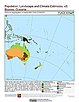
To provide tabular data to researchers without GIS capabilities who need data on population and land area by country across a range of physical characteristics. These include measures such as the number of persons living within coastal zones, the percent of a region within specific elevation strata, or the number of persons living within different climate zones. |
National and Regional Data Set by Source Category, v2.86 (
|
|
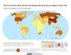
Environmental Performance Index and Pilot Trend Environmental Performance Index, 2012 Release (
|
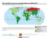
Natural Resource Management Index, 2011 Release (
|
|
Population Count Grid, v1 (1990, 1995, 2000)Global Rural-Urban Mapping Project (GRUMP), v1To provide a time series of raster population data for ntegration with other data sets. |
Urban Extents Grid, v1 (1995)Global Rural-Urban Mapping Project (GRUMP), v1
To provide a raster representation of urban areas (or urban mask) for use with GRUMP population grids or other data sets. |
|
Land and Geographic Unit Area Grids, v1 (2000)Global Rural-Urban Mapping Project (GRUMP), v1To provide land area data for use with GRUMPv1 population and urban data as well as a quantitative measure of resolution of the input spatial units for GRUMPv1. |
Population Density Grid, v1 (1990, 1995, 2000)Global Rural-Urban Mapping Project (GRUMP), v1
To provide a time series of raster population density data for data integration. |
|
National Administrative Boundaries, v1 (2000)Global Rural-Urban Mapping Project (GRUMP), v1To permit cartographic display of countries and territories that exactly match the GRUMPv1 population surfaces |
Settlement Points, v1 (1990, 1995, 2000)Global Rural-Urban Mapping Project (GRUMP), v1
To provide populated place (point) data with consistent population estimates. |
|
Coastlines, v1 (2000)Global Rural-Urban Mapping Project (GRUMP), v1To permit cartographic display of coastlines that exactly match the GRUMPv1 population surfaces. |
National Identifier Grid, v1 (1995, 2000, 2010)Global Rural-Urban Mapping Project (GRUMP), v1To permit the summation of population values by country/territory and, in combination with other data layers, the summation of population values by irregular areas represented in the other data layers and country/territory. |
|
Natural Resource Management Index, 2010 Release (
|
Environmental Performance Index, 2010 Release (
|
|
Change in Chlorophyll-a Concentration, v1 (
|
CODATA Catalog of Roads, v1 (
|
|
Environmental Performance Index, 2008 Release (
|
||
Population, Landscape, And Climate Estimates (PLACE), v2 (1990, 2000)National Aggregates of Geospatial Data Collection (NAGDC)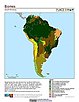
To provide tabular data on environmental conditions (elevations, climate, coastal) in which people reside. |
Urban-Rural Population Estimates, v1 (1990, 1995, 2000)Low Elevation Coastal Zone (LECZ)
To provide estimates of urban and rural populations and land areas in the low elevation coastal zone. |
| 3 of 5 |