Data Sets (94)
| 4 of 5 |
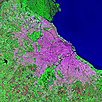
Urban Landsat: Cities from Space, v1 (
|
Synthetic Assessment of Global Distribution of Vulnerability to Climate Change, v1 (2005, 2050, 2100)Intergovernmental Panel on Climate Change
To provide geographical portraits of vulnerability designed to incorporate both exposure to climate change and national capacities to adapt. |
|
Pilot Environmental Performance Index, 2006 Release (
|
Complete Collection, v1.01 (
|
|
National Footprint Accounts, 2006 Release (2003)Compendium of Environmental Sustainability IndicatorsTo help assess a country's demand on and supply of biological capital. |
Ancillary Data, v1 (
|
|
Unsatisfied Basic Needs, v1 (
|
Global Subnational Prevalence of Child Malnutrition, v1 (
|
|
MA Scenarios, v1 (
|
||
Population Count Grid, v3 (1990, 1995, 2000)Gridded Population of the World (GPW), v3To provide a time series of raster data on population to facilitate data integration. |
Coastlines, v3 (2000)Gridded Population of the World (GPW), v3To provide a set of coastlines consistent with GPWv3 raster data for cartographic purposes. |
|
Subnational Administrative Boundaries, v3 (1990, 1995, 2000)Gridded Population of the World (GPW), v3
To provide maps of the input administrative units used in GPWv3. |
Population Density Grid Future Estimates, v3 (2005, 2010, 2015)Gridded Population of the World (GPW), v3To provide a time series of raster data on population projected to the year 2015 to facilitate data integration. |
|
Population Count Grid Future Estimates, v3 (2005, 2010, 2015)Gridded Population of the World (GPW), v3To provide a time series of raster data on population projected to the year 2015 to facilitate data integration. |
National Identifier Grid, v3 (2000)Gridded Population of the World (GPW), v3To provide a raster representation of nation-states in GPWv3 for use in aggregating population data. |
|
Population Density Grid, v3 (1990, 1995, 2000)Gridded Population of the World (GPW), v3
To provide a time series of raster data on population density to facilitate data integration. |
National Administrative Boundaries, v3 (2000)Gridded Population of the World (GPW), v3To provide a quantitative measure of the input resolution of administrative units used for GPWv3. |
|
Land and Geographic Unit Area Grids, v3 (1990, 1995, 2000, 2005, 2010, 2015)Gridded Population of the World (GPW), v3To provide a quantitative measure of the input resolution of administrative units used for GPWv3. |
Centroids, v3 (1990, 1995, 2000, 2005, 2010, 2015)Gridded Population of the World (GPW), v3To provide a vector (point) version of the input administrative units used in GPWv3 for use in data integration. |


| 4 of 5 |