Data Sets (86)
| 4 of 5 |
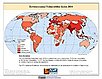
Small Area Estimates of Poverty and Inequality, v1 (
|
Global Subnational Prevalence of Child Malnutrition, v1 (
|
|
MA Scenarios, v1 (
|
||
Population Count Grid, v3 (1990, 1995, 2000)Gridded Population of the World (GPW), v3To provide a time series of raster data on population to facilitate data integration. |
Coastlines, v3 (2000)Gridded Population of the World (GPW), v3To provide a set of coastlines consistent with GPWv3 raster data for cartographic purposes. |
|
Subnational Administrative Boundaries, v3 (1990, 1995, 2000)Gridded Population of the World (GPW), v3
To provide maps of the input administrative units used in GPWv3. |
Population Density Grid Future Estimates, v3 (2005, 2010, 2015)Gridded Population of the World (GPW), v3To provide a time series of raster data on population projected to the year 2015 to facilitate data integration. |
|
Population Count Grid Future Estimates, v3 (2005, 2010, 2015)Gridded Population of the World (GPW), v3To provide a time series of raster data on population projected to the year 2015 to facilitate data integration. |
National Identifier Grid, v3 (2000)Gridded Population of the World (GPW), v3To provide a raster representation of nation-states in GPWv3 for use in aggregating population data. |
|
Population Density Grid, v3 (1990, 1995, 2000)Gridded Population of the World (GPW), v3
To provide a time series of raster data on population density to facilitate data integration. |
National Administrative Boundaries, v3 (2000)Gridded Population of the World (GPW), v3To provide a quantitative measure of the input resolution of administrative units used for GPWv3. |
|
Land and Geographic Unit Area Grids, v3 (1990, 1995, 2000, 2005, 2010, 2015)Gridded Population of the World (GPW), v3To provide a quantitative measure of the input resolution of administrative units used for GPWv3. |
Centroids, v3 (1990, 1995, 2000, 2005, 2010, 2015)Gridded Population of the World (GPW), v3To provide a vector (point) version of the input administrative units used in GPWv3 for use in data integration. |
|
Environmental Sustainability Index, 2005 Release (
|
HANPP by Country and Product, v1 (1995)Human Appropriation of Net Primary Productivity (HANPP)To provide tabular data on human appropriation of net primary productivity by country. |
|
Environmental Vulnerability Index (EVI), 2004 Release (
|
Country-Level GDP and Downscaled Projections Based on the SRES A1, A2, B1, and B2 Marker Scenarios, v1 (
|
|
Country-Level Population and Downscaled Projections Based on the SRES B2 Scenario, v1 (
|
Country-Level Population and Downscaled Projections Based on the SRES A1, B1, and A2 Scenarios, v1 (
|


| 4 of 5 |