Data Sets » Theme: SustainabilityRemove Facet
5 of 8

Annual Chlorophyll-a Concentration, v1 (1998 – 2007)

Indicators of Coastal Water Quality

To provide a gridded version of existing SeaWiFS data in GIS-compatible formats in order to determine concentrations of chlorophyll-a in the coastal water column and to facilitate the integration with other data.

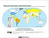
Change in Chlorophyll-a Concentration, v1 (1998 – 2007)

Indicators of Coastal Water Quality

To provide tabular data on the trends of chlorophyll-a concentration on a pixel by pixel basis for identifying areas with improving, declining, and stable coastal water quality that can provide guidance for decision making in the context of coastal management.

Effects of Climate Change on Global Food Production from SRES Emissions and Socioeconomic Scenarios, v1 (1970 – 2080)

Climate Effects on Food Supply

To provide an assessment of potential climate change impacts on world crop production.

Anthropogenic Biomes of the World, v1 (2001 – 2006)

Anthropogenic Biomes

To provide information on global land use for research on human-environment interactions.

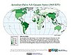
Environmental Performance Index, 2008 Release (1994 – 2007)

Environmental Performance Index (EPI)

To provide quantitative metrics for evaluating a country's environmental performance in different policy categories relative to clearly defined targets.

Population, Landscape, And Climate Estimates (PLACE), v2 (1990, 2000)

National Aggregates of Geospatial Data Collection (NAGDC)

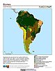
To provide tabular data on environmental conditions (elevations, climate, coastal) in which people reside.

Urban-Rural Population Estimates, v1 (1990, 1995, 2000)

Low Elevation Coastal Zone (LECZ)

To provide estimates of urban and rural populations and land areas in the low elevation coastal zone.

Synthetic Assessment of Global Distribution of Vulnerability to Climate Change, v1 (2005, 2050, 2100)

Intergovernmental Panel on Climate Change

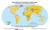
To provide geographical portraits of vulnerability designed to incorporate both exposure to climate change and national capacities to adapt.

Pilot Environmental Performance Index, 2006 Release (1994 – 2006)

Environmental Performance Index (EPI)

To provide quantitative metrics for evaluating a country's environmental performance in different policy categories relative to clearly defined targets.

Complete Collection, v1.01 (1973 – 2005)

Compendium of Environmental Sustainability Indicators

To make the acquisition, comparison and analysis of sustainability indicators easier by compiling them in a single database, incorporating multiple country codes, and condensing the indicator descriptions into short methodological summaries in an accompanying data dictionary.

National Footprint Accounts, 2006 Release (2003)

Compendium of Environmental Sustainability Indicators

To help assess a country's demand on and supply of biological capital.

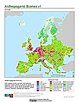
Ancillary Data, v1 (1990 – 2005)

Compendium of Environmental Sustainability Indicators

To provide population estimates, gross domestic product, and surface area data to be used in conjunction with the sustainability indicators included in the compendium.

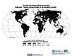
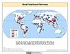
Global Flood Hazard Frequency and Distribution, v1 (1985 – 2003)

Natural Disaster Hotspots

To provide a means of assessing the relative distribution and frequency of global flood hazard.

Global Landslide Mortality Risks and Distribution, v1 (2000)

Natural Disaster Hotspots

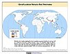
To provide a means of assessing global landslide mortality risks and distribution.

Global Multihazard Total Economic Loss Risk Deciles, v1 (2000)

Natural Disaster Hotspots

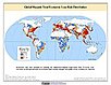
To identify areas of the world that are at greater risk of multihazard total economic loss.

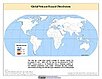
Global Multihazard Frequency and Distribution, v1 (2000)

Natural Disaster Hotspots

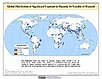
To provide insight into the frequency and distribution of multihazard events.

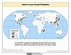
Global Cyclone Hazard Frequency and Distribution, v1 (1980 – 2000)

Natural Disaster Hotspots

To provide a means of assessing the relative distribution and frequency of global cyclone hazard.

Global Volcano Hazard Frequency and Distribution, v1 (1979 – 2000)

Natural Disaster Hotspots

To provide a means of assessing the relative distribution and frequency of global volcano hazard.

Global Drought Total Economic Loss Risk Deciles, v1 (2000)

Natural Disaster Hotspots

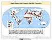
To provide a spatial surface of the total economic impacts of global drought hazard.

Global Multihazard Mortality Risks and Distribution, v1 (2000)

Natural Disaster Hotspots

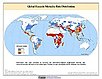
To identify areas of the world at multihazard mortality risk and to gain insight into the nature of this risk posed.

Data Sets » Theme: SustainabilityRemove Facet
5 of 8