Search » Data Sets (300)
| 12 of 15 |
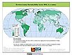
Unsatisfied Basic Needs, v1 (
|
Small Area Estimates of Poverty and Inequality, v1 (
|
|
Global Subnational Prevalence of Child Malnutrition, v1 (
|
Poverty and Food Security Case Studies, v1 (
|
|
MA Biodiversity, v1 (
|
||
MA Scenarios, v1 (
|
Global Mangrove Forests Distribution, v1 (2000)Land Use and Land Cover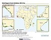
To provide data that can be used in global mangrove forest distribution modeling, land cover change analysis, global carbon accounting studies and to assist with policy-making in regards to human-environment interactions and future adaptive strategies. |
|
Population Count Grid, v3 (1990, 1995, 2000)Gridded Population of the World (GPW), v3To provide a time series of raster data on population to facilitate data integration. |
Coastlines, v3 (2000)Gridded Population of the World (GPW), v3To provide a set of coastlines consistent with GPWv3 raster data for cartographic purposes. |
|
Subnational Administrative Boundaries, v3 (1990, 1995, 2000)Gridded Population of the World (GPW), v3
To provide maps of the input administrative units used in GPWv3. |
Population Density Grid Future Estimates, v3 (2005, 2010, 2015)Gridded Population of the World (GPW), v3To provide a time series of raster data on population projected to the year 2015 to facilitate data integration. |
|
Population Count Grid Future Estimates, v3 (2005, 2010, 2015)Gridded Population of the World (GPW), v3To provide a time series of raster data on population projected to the year 2015 to facilitate data integration. |
National Identifier Grid, v3 (2000)Gridded Population of the World (GPW), v3To provide a raster representation of nation-states in GPWv3 for use in aggregating population data. |
|
Population Density Grid, v3 (1990, 1995, 2000)Gridded Population of the World (GPW), v3
To provide a time series of raster data on population density to facilitate data integration. |
National Administrative Boundaries, v3 (2000)Gridded Population of the World (GPW), v3To provide a quantitative measure of the input resolution of administrative units used for GPWv3. |
|
Land and Geographic Unit Area Grids, v3 (1990, 1995, 2000, 2005, 2010, 2015)Gridded Population of the World (GPW), v3To provide a quantitative measure of the input resolution of administrative units used for GPWv3. |
Centroids, v3 (1990, 1995, 2000, 2005, 2010, 2015)Gridded Population of the World (GPW), v3To provide a vector (point) version of the input administrative units used in GPWv3 for use in data integration. |
|
Environmental Sustainability Index, 2005 Release (
|
U.S. Population Grids (Summary File 3): Alabama, Louisiana, and Mississippi, alpha (2000)Natural DisastersTo provide gridded demographic data, including characteristics of income, poverty, education, and housing age, for Alabama, Louisiana and Mississippi. |


| 12 of 15 |