p
| 3 of 6 |
Small Area Estimates of Poverty and Inequality, v1 (
|
Global Subnational Prevalence of Child Malnutrition, v1 (
|
|
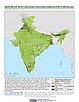
Poverty and Food Security Case Studies, v1 (
|
Georeferenced U.S. County-Level Population Projections, Total and by Sex, Race and Age, Based on the SSPs, v1 (
|
|
Latin America and the Caribbean Population Time Series, v1 (1990, 2000)Population DynamicsTo describe changing population distribution and growth in Latin America and the Caribbean using spatially consistent and comparable units at a spatial resolution suitable to regional change analysis. |
||
Population, Landscape, And Climate Estimates (PLACE), v4 (2000, 2005, 2010, 2015, 2020)National Aggregates of Geospatial Data Collection (NAGDC)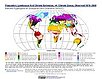
To provide tabular data to researchers without GIS capabilities who need data on population and land area by country across a range of physical characteristics. These include measures such as the number of persons living within coastal zones, the total area within a specific elevation strata, or the number of persons living within different climate zones. |
Population, Landscape, And Climate Estimates (PLACE), v3 (1990, 2000, 2010)National Aggregates of Geospatial Data Collection (NAGDC)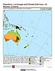
To provide tabular data to researchers without GIS capabilities who need data on population and land area by country across a range of physical characteristics. These include measures such as the number of persons living within coastal zones, the percent of a region within specific elevation strata, or the number of persons living within different climate zones. |
|
Population, Landscape, And Climate Estimates (PLACE), v2 (1990, 2000)National Aggregates of Geospatial Data Collection (NAGDC)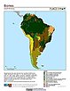
To provide tabular data on environmental conditions (elevations, climate, coastal) in which people reside. |
Population, Landscape, And Climate Estimates (PLACE), v1 (1995)National Aggregates of Geospatial Data Collection (NAGDC)To provide tabular data on environmental conditions (elevations, climate, coastal) in which people reside. |
|
MA Scenarios, v1 (
|
Urban-Rural Population and Land Area Estimates, v3 (1990, 2000, 2015)Low Elevation Coastal Zone (LECZ)
To provide estimates of urban and rural populations and land areas for the years 1990, 2000, 2015 for 234 countries and statistical areas with contiguous coastal elevations of less than or equal to 5m above sea level, 5-10m above sea level, and national totals using multiple updated data sources for comparative analysis. |
|
Sea Level Rise Impacts on Ramsar Wetlands of International Importance, v1 (
|
Urban-Rural Population and Land Area Estimates, v2 (1990, 2000, 2010, 2100)Low Elevation Coastal Zone (LECZ)
To provide estimates of urban and rural populations and land areas for the years 1990, 2000, and 2010; and projections to the year 2100 for 202 countries with contiguous coastal elevations in the following categories: less than or equal to 1m, 3m, 5m, 7m, 9m, 10m, 12m, or 20m; as well as national totals. |
|
Urban-Rural Population Estimates, v1 (1990, 1995, 2000)Low Elevation Coastal Zone (LECZ)
To provide estimates of urban and rural populations and land areas in the low elevation coastal zone. |
INFORM Global Risk Index 2019 Mid Year, v0.3.7, (2019)Intergovernmental Panel on Climate ChangeTo assess country-level vulnerability and coping capacity related to climate change based on the data set used in Chapter 8 of the Sixth Assessment Report (AR6) by the Intergovernmental Panel on Climate Change (IPCC) Working Group II (WGII). |
|
Population Count Grid, v1 (1990, 1995, 2000)Global Rural-Urban Mapping Project (GRUMP), v1To provide a time series of raster population data for ntegration with other data sets. |
||
Settlement Points, v1.01 (1990, 1995, 2000)Global Rural-Urban Mapping Project (GRUMP), v1To provide populated place (point) data with consistent population estimates. |
Urban Extents Grid, v1 (1995)Global Rural-Urban Mapping Project (GRUMP), v1
To provide a raster representation of urban areas (or urban mask) for use with GRUMP population grids or other data sets. |


| 3 of 6 |