NASA Website Socioeconomic Data and Applications Center (sedac)
A Data Center in NASA's Earth Observing System Data and Information System (EOSDIS) — Hosted by CIESIN at Columbia University
Data
  • Data Sets
  • Maps
  • Web Pages
  • home
  • Data
    • · Data Sets
    • · Data Collections
    • · Featured Data Uses
    • · Data Citations
    • · Citations Database
    • · Data Submission
  • Maps
    • · Map Gallery
    • · Map Viewer
    • · Map Services
    • · Mapping Tools
  • Themes
    • · Agriculture
    • · Climate
    • · Conservation
    • · Governance
    • · Hazards
    • · Health
    • · Infrastructure
    • · Land Use
    • · Marine and Coastal
    • · Population
    • · Poverty
    • · Remote Sensing
    • · Sustainability
    • · Urban
    • · Water
  • Resources
    • · Guides
    • · Multimedia
    • · Networks
    • · News
    • · Publications
    • · Related Sites
    • · Remote Sensing
    • · Tools
  • Social Media
    • · Twitter
    • · FaceBook
    • · YouTube
    • · Flickr
    • · Blog Posts
    • · Communities
  • About
    • · About SEDAC
    • · User Working Group
    • · Privacy
    • · User Registration
  • Help
 

s

Follow Us: Twitter Follow Us on Facebook YouTube Flickr   |   Share: Twitter Facebook
  • Theme Home
  • Data Sets
  • Map Gallery
  • Map Services
  • Featured Data Uses
  • Resources
    • Guides
    • Multimedia
    • Networks
    • News
    • Publications
    • Related Sites
    • Remote Sensing
    • Tools
2 of 5
Prev | Next
 

United Nations Holds Virtual Forum to Promote Cooperation on Sustainable Development Data

October 23, 2020

The 2020 United Nations (UN) World Data Forum was held virtually October 19–21, in place of a physical meeting in Bern, Switzerland, that has been postponed to 2021. The Forum serves as a platform for intensifying cooperation on sustainable development data across a diverse set of communities, under the auspices of the UN Statistical Commission.

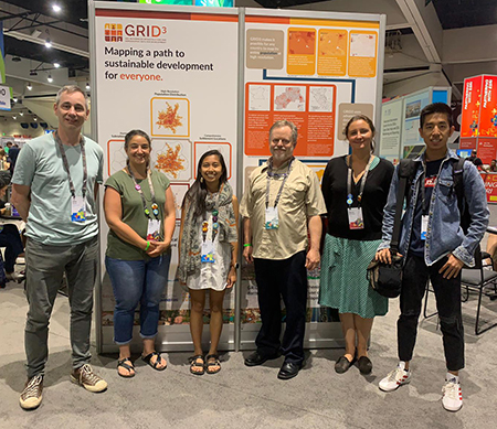
Several CIESIN staff participated actively in the Forum. On October 20, Sandra Baptista, senior research associate, and Andrea Jordan, special assistant to the deputy director, both representing the Geo-Referenced Infrastructure and Demographic Data for Development (GRID3) program, co-organized the live panel, “Use of Geospatial Data to Support COVID-19 Response,” with Colombia’s National Administrative Department of Statistics (DANE). The panel was moderated by Io Blair-Freese of the Bill & Melinda Gates Foundation and included two partners in the GRID3 program: Prince Clem Ikanade Agba, minister of state for budget and national planning of the Federal Republic of Nigeria and co-chair of GRID3′s Nigeria national steering committee; and David Moinina Sengeh, minister of basic and senior secondary education and chief innovation officer for the Government of Sierra Leone.

The Forum also included a number of pre-recorded sessions. NASA, UN-Habitat, the European Space Agency, and the Group on Earth Observations (GEO) organized a session on the use of Earth observations to make cities inclusive, safe, resilient, and sustainable. CIESIN Director Robert Chen co-authored a short presentation with Thomas Kemper of the European Commission′s Joint Research Centre on behalf of the GEO Human Planet Initiative, which he co-leads. They also participated in a pre-recorded question-and-answer session.

Recordings of Forum sessions are now available online. The UN World Data Forum was originally established in response to a key recommendation in the 2014 report, “A World that Counts: Mobilising the Data Revolution for Sustainable Development,″ prepared by the UN Secretary-General′s Independent Expert Advisory Group on a Data Revolution for Sustainable Development.

See:
  • “Use of Geospatial Data to Support COVID-19 Response” (panel)
  • “Tools to...Use Earth Observations to Deliver SDG 11 and the New Urban Agenda″ (panel)

New Data on Food Insecurity 2009–2019 and Settlement Extents in Africa Released

October 19, 2020

CIESIN has developed and released several new data sets recently. Now available from the NASA Socioeconomic Data and Applications Center (SEDAC) is the Food Insecurity Hotspots data set, which consists of gridded data identifying the level of intensity and frequency of food insecurity over ten years between 2009 and 2019, as well as hotspots of consecutive food insecurity events. The data set covers five regions: Central America and the Caribbean, Central Asia, East Africa, Southern Africa, and West Africa. The grids are at 250 meter (~7.2 arc-seconds) resolution and are based on subnational food security analyses for these regions provided by the Famine Early Warning Systems Network (FEWS NET). FEWS NET was established in 1985 by the U.S. Agency for International Development (USAID).

As part of the Geo-Referenced Infrastructure and Demographic Data for Development (GRID3) program managed by CIESIN, data on operational settlement points and/or boundaries, health facilities, and points of interests have been released for Zambia and the Democratic Republic of the Congo. Settlement extent data are now available for 41 African countries, created from Digitize Africa building footprints powered by Maxar. GRID3 has expedited settlement extent mapping to support countries in their COVID-19 response efforts. The data are broadly intended to support country decision-making in public health and education.

See:
  • Food Insecurity Hotspots Data Set, v1 (2009 – 2019)
  • GRID3 Data Available through Columbia Academic Commons

New Paper on Links between Religion and the Environment

October 2, 2020

Alex de Sherbinin, CIESIN associate director for Science Applications, Susana Adamo, research scientist, and Tricia Chai-Onn, senior geographic information specialist, are co-authors of a new study on the link between environmental challenges and religion, published in the Journal of Religion and Demography. Vegard Skirbekk of Columbia University's Mailman School of Public Health is lead author. The paper, “Religious Affiliation and Environmental Challenges in the 21st Century,” builds on a growing body of research carried out at the Columbia Aging Center, where researchers analyzed religious affiliation together with a variety of environment and climate change-related indicators at the country level.


See:
  • “Religious Affiliation and Environmental Challenges in the 21st Century”
  • “How Religion Influences Our Environment” (blog)

New Publications Released on Climate Risk, Citizen Science Data, Data Quality, and Boundary Data

September 19, 2020

Alex de Sherbinin, associate director for Science Applications, is guest editor of a special Issue of the journal Sustainability on climate risk and vulnerability mapping, with co-editor Stefan Kienberger of the University of Salzburg. He is also a co-author of one of the papers in the special issue, on using flood disaster data to validate components of social vulnerability to floods. The paper’s lead author is Earth Institute Fellow Beth Tellman.

The article, “Still in Need of Norms: The State of the Data in Citizen Science,″ has been published in the journal Citizen Science: Theory and Practice. Anne Bowser of the Wilson Center is lead author, and de Sherbinin is a co-author. The article is a major output of the CODATA-World Data System (WDS) Task Group on Citizen Science and the Validation, Curation, and Management of Crowdsourced Data, which de Sherbinin co-chaired in 2016-2018.

Senior digital archivist Robert Downs is a co-author of the report, “Laying the Groundwork for Developing International Community Guidelines to Effectively Share and Reuse Digital Data Quality Information—Case Statement, Workshop Summary Report, and Path Forward,” published in Open Science Foundation (OSF) Preprints. Ge Peng of the Earth Science Information Partners (ESIP) Information Quality Cluster is lead author. The report, which stems from a pre-workshop held in July 2020 prior to the ESIP Summer Meeting, describes the approach that will be taken to develop community guidelines for preparing and sharing data quality information.

The Geo-Referenced Infrastructure and Demographic Data for Development (GRID3) program managed by CIESIN has released the white paper, “Harmonizing Subnational Boundaries,” on GRID3 efforts to support the harmonization, production, and use of digitized legal/administrative units, operational units, and statistical areas. This work addresses three primary areas: improving and harmonizing operational units; fostering improved collaboration on boundary harmonization among disparate government bodies; and using boundaries harmonization to support census efforts. The paper focuses on case studies in Nigeria, the Democratic Republic of the Congo, and Zambia.

See:
  • Special Issue: “Climate Risk and Vulnerability Mapping″
  • Paper: “Using Disaster Outcomes to Validate Components of Social Vulnerability to Floods: Flood Deaths and Property Damage across the USA″
  • Paper: “Still in Need of Norms: The State of the Data in Citizen Science″
  • Report: “Laying the Groundwork for Developing International Community Guidelines to Share and Reuse Digital Data Quality Information—Case Statement, Workshop Summary Report, and Path Forward
  • White Paper: “Harmonizing Subnational Boundaries”

Interns Join CIESIN Projects and Programs for the Summer

July 12, 2020

Several new interns have joined CIESIN this summer, working remotely due to closure of CIESIN offices along with the rest of Columbia University during the COVID-19 pandemic.

Alexandra Hays is working with senior systems analyst/GIS developer Kytt MacManus on the third version of the Urban-Rural Population and Land Area Estimates, which is part of the Low Elevation Coastal Zone (LECZ) data collection developed by the NASA Socioeconomic Data and Applications Center (SEDAC). Hays is a senior at Columbia University majoring in economics, with a concentration in sustainable development. Interns Serena Killion and Caitlyn Linehan are also working with MacManus, on analysis of nighttime lights data and development of map services for SEDAC. Killion is a senior at Columbia, majoring in computer science; Linehan is completing her MS in geographic information systems (GIS) at City University of New York-Lehman College.

Four interns are working with Greg Yetman, associate director for geospatial applications, on a project supported by the New York State Energy Research and Development Authority (NYSERDA) to assess potential flood impacts on building infrastructure. Elizabeth Jackson and Elan Ganeles are juniors at Columbia; Jackson is majoring in sustainable development, and Ganeles is majoring in urban studies and earth science. Chris Mangnani is a senior at Columbia majoring in sustainable development. Siobhan Milán is a junior from the University of Virginia, majoring in economics with a minor in statistics.

Interns under CIESIN’s Geo-Referenced Infrastructure and Demographic Data for Development (GRID3) program include Mariem Ayadi, Zane Peycke, and Nancy Yun, who are completing their MS degrees in data science at Columbia′s Data Science Institute. Ayadi is working with data and program analyst Jolynn Schmidt and senior research associate Paola Kim-Blanco, creating a model that checks for errors in building footprints data. Peycke and Yun are both working with Schmidt; Peycke is is cleaning and compiling points of interest data for the Democratic Republic of Congo, and Yun is cleaning and compiling health facility data for countries in sub-Saharan Africa.

New Report Provides Guidance on Using Gridded Population Data

May 13, 2020

A new report from the Thematic Research Network on Data and Statistics (TReNDS) of the United Nations Sustainable Development Solutions Network (SDSN) provides guidance on the use of gridded population datasets from the POPGRID Data Collaborative. The report, Leaving No One Off the Map: A Guide for Gridded Population Data for Sustainable Development, reviews population data products from POPGRID members, including CIESIN, Esri, Oak Ridge National Laboratory, and the WorldPop Project, among others. The report was written by Hayden Dahmm and Maryam Rabiee, with input from Jessica Espey, all of SDSN TReNDS. CIESIN research scientist Susana Adamo, associate director for Science Applications Alex de Sherbinin, and CIESIN director Robert Chen also contributed to the report, along with other POPGRID participants and CIESIN staff members. POPGRID was launched in 2017 through an Earth Institute seed grant led by Chen and is supported in part by the Bill and Melinda Gates Foundation and the NASA Socioeconomic Data and Applications Center (SEDAC) operated by CIESIN.

On May 18 a live virtual debate hosted and moderated by SciDev.net and SDSN TReNDS featured panelist Alex de Sherbinin; Jessica Espey, TReNDS director; Andrea Gaughan of the University of Louisville and contributor to the WorldPop Project; and Idris Jega, assistant director with the Strategic Space Applications Department at Nigeria‘s National Space Research and Development Agency. Jega is also a member of the Nigeria secretariat for the GRID3 program managed by CIESIN. The panel discussed the importance of gridded population data and their utility in helping to achieve the Sustainable Development Goals (SDGs) established in 2015 by the United Nations.

See:
  • Leaving No One Off the Map: A Guide for Gridded Population Data for Sustainable Development
  • Short Video

Future Population Scenario Data and Global Development Potential Indices Released

April 16, 2020

The NASA Socioeconomic Data and Applications Center (SEDAC) managed by CIESIN has released several new datasets valuable in assessing future global energy development and land use and in characterizing potential long-term future population distribution in the context of climate change.

One dataset, Global One-Eighth Degree Population Base Year and Projection Grids Based on the SSPs, was developed by Bryan Jones of the City University of New York and Brian O’Neill of the University of Denver. The dataset consists of global urban, rural, and total population data for the base year 2000, and population projections at ten-year intervals for 2010-2100 at a resolution of one-eighth degree (7.5 arc-minutes). These are consistent both quantitatively and qualitatively with the Shared Socioeconomic Pathways (SSPs) that were developed in support of the Intergovernmental Panel on Climate Change (IPCC) assessments. A second dataset, Global 1-km Downscaled Population Base Year and Projection Grids Based on the SSPs, provides a downscaled version of the first dataset, at 1-km resolution (about 30 arc-seconds). This dataset was developed by Jing Gao of the National Center for Atmospheric Research (NCAR). Spatial demographic scenario data are key inputs for the analysis of future land use, energy use, and emission patterns together with potential future climate change impacts, vulnerability, and adaptation.

A third dataset, Global Development Potential Indices (DPI), was developed by James Oakleaf of The Nature Conservancy, and colleagues. This dataset ranks global land suitability in the sectors of renewable energy, fossil fuels, mining, and agriculture, to aid in setting priorities for development and conservation efforts. Each sector-based DPI is a 1-km spatially-explicit, global land suitability map that has been validated using locations of current and planned development.

SEDAC is one of NASA′s Distributed Active Archive Centers (DAACs) in the NASA Earth Observing System Data and Information System. SEDAC seeks to improve access to and use of key socioeconomic and interdisciplinary data that are or can be integrated with remote sensing data. SEDAC datasets have been cited in more than 5,000 different scientific publications during the past 20 years.

See:
  • Global One-Eighth Degree Population Base Year and Projection Grids Based on the SSPs, v1.01 (2000 – 2100)
  • Global 1-km Downscaled Population Base Year and Projection Grids Based on the SSPs, v1.01 (2000 – 2100)
  • Global Development Potential Indices (DPI)

New Map Viewer Shows Population Characteristics in Relation to Reported COVID-19 Cases

April 10, 2020
screenshot of New York City showing age distribution of defined area

A new mapping tool shows the density of population in relationship to reported coronavirus disease (COVID-19) cases at national and sub-national levels, and permits users to obtain custom estimates of the number of people by age and sex living in an area of interest, including areas not currently reporting large numbers of cases.

Developed by the NASA Socioeconomic Data and Applications Center (SEDAC), the SEDAC Global COVID-19 Viewer: Population Estimates by Age Group and Sex lets users quickly access relevant population information without having to download and analyze large amounts of spatial population data. The Viewer’s unique capability is that it allows users to obtain population estimates for specific age and sex categories for any area, such as a metropolitan region that cuts across multiple jurisdictions or countries. The Viewer displays age and sex structure charts and pyramids in response to a user-drawn circle or polygon. Data on COVID-19 cases from the Johns Hopkins University are updated multiple times per day.

The SEDAC Global COVID-19 Viewer is meant for researchers, educators, and policymakers who are interested in visualizing key population characteristics such as high concentrations of elderly individuals in urban or rural areas that are, or may become, affected by the COVID-19 pandemic. The Viewer may be especially helpful for regional analyses or for countries with limited access to spatial population data. The underlying population data are from SEDAC’s Gridded Population of the World (GPW) Basic Demographic Characteristics, v4.11, for the year 2010, with estimates to 2020. The COVID-19 data are from Johns Hopkins University & Medicine Coronavirus Resource Center. SEDAC is one of the NASA Distributed Active Archive Centers (DAACs) and is operated by the Center for International Earth Science Information Network (CIESIN) of the Earth Institute at Columbia University.

See:
  • The SEDAC Global COVID-19 Viewer

CIESIN Staff Co-Author Publications on Coastal Vulnerability Mapping and Data Risks

April 7, 2020

Associate director for Science Applications Alex de Sherbinin is a co-author of the open access article, “A Systematic Review of Coastal Vulnerability Mapping,” appearing in the journal Sustainability. The paper, by Anamaria Bukvic of Virginia Polytechnic Institute and State University, Guillaume Rohat of the University of Geneva, Alex Apotsos of Williams College, and de Sherbinin, evaluates the state of coastal vulnerability assessment mapping efforts and recommends improvements in methodological rigor, policy relevance, and alignment with other vulnerability assessment paradigms. The paper stems from previous work supported by the National Socio-Environmental Synthesis Center (SESYNC) under funding received from the National Science Foundation. The paper is dedicated to the memory of second author Rohat, who passed away unexpectedly in October 2019.

Senior digital archivist Robert Downs is also co-author of the open access paper, “Risk Assessment for Scientific Data,” published in the CODATA Data Science Journal. Authors of the paper are Matthew Mayernik of the National Center for Atmospheric Research; Kelsey Breseman of the Environmental Data & Governance Initiative (EDGI); Downs; Ruth Duerr of the Ronan Institute for Independent Scholarship; Alexis Garretson of George Mason University; Chung-Yi (Sophie) Hou of the Ronin Institute; EDGI; and the Earth Science Information Partners (ESIP) Data Stewardship Committee. The paper presents an analysis of data risk factors that scientific data collections may face, together with a data risk assessment matrix to support risk assessment and mitigation efforts.

POPGRID Data Collaborative Updates Web Site, Announces Webinar

January 24, 2020
screenshot of POPGRID Home page

The POPGRID Data Collaborative, an initiative launched by CIESIN in 2017 to improve the quality, access, and use of global-scale spatial data on human population, settlements, and infrastructure, has recently updated its Web site and announced an international Webinar to be held February 4 in collaboration with Geospatial World.

The POPGRID Web site helps users learn about the many different gridded population data sets now available, providing detailed background information and documentation, and direct links to the data and data sources. In addition, the POPGRID Viewer lets users easily compare different data products for their specific regions of interest. The updated site now includes links to recent publications and recorded Webinars about gridded population data, together with updated information from the data providers. POPGRID is collaboratively managed by CIESIN, the Thematic Research Network on Data and Statistics (TReNDS) of the United Nations Sustainable Development Solutions Network, and the Global Partnership for Sustainable Development Data, and is supported by the Bill & Melinda Gates Foundation and NASA. More than 20 different groups from both the public and private sectors are active in the POPGRID Data Collaborative. The POPGRID Viewer was developed by the NASA Socioeconomic Data and Applications Center (SEDAC) operated by CIESIN.

On February 4, CIESIN director Robert Chen and Maryam Rabiee of TReNDS presented the Webinar, “Leaving No One Off the Map: Gridded Population Data for Decision Making,″ in coordination with Geospatial World. It attracted 150 participants from around the world. The Webinar focused on how gridded population data can help decision makers and other applied users improve efforts to achieve the Sustainable Development Goals (SDGs) adopted by the international community in 2015, and in particular to help reach those who might otherwise be left behind. Recent advances in mapping make it possible to better determine the location and characteristics of human settlements and households, allowing for more effective and efficient assistance, e.g., for vaccination campaigns, development assistance, and humanitarian relief. However, the proliferation of different data sets utilizing different methods and sources may confuse users about which data sets are the most appropriate to use in different situations. The Webinar discussed ongoing efforts by the POPGRID Data Collaborative to address this issue, and ways in which the geospatial community can both benefit from, and participate in, POPGRID activities. A recording is available here.

See:
  • POPGRID Data Collaborative Web Site

Earth Science Researchers Gather for Fall Meeting of the American Geophysical Union

December 17, 2019

The largest international Earth and space science conference in the world, the annual American Geophysical Union (AGU) fall meeting, brought more than 25,000 scientists and other experts to San Francisco December 9–13. CIESIN staff members organized or co-organized seven sessions; presented more than twelve invited, oral, e-lightning, and poster papers; and served as co-authors on at least nine other papers. CIESIN director Robert Chen convened three sessions on exposure and vulnerability assessment for hazard, coastal, climate, and health risks and served as co-chair of one of them. Associate director for Science Applications Alex de Sherbinin also co-chaired the poster session in this series. Senior digital archivist Robert Downs co-organized a session on improving use of the FAIR principles (Findable, Accessible, Interoperable, and Reusable), as well as several sessions on the use of earth and space science data.

Also attending the conference were associate director for Geospatial Applications Greg Yetman, GIS developer Kytt MacManus, and Columbia College student Dorothee Cleophee Grant, a former summer intern. Yetman gave an oral presentation on population data models for settlement extents and a NASA Hyperwall talk, “Are You at Risk? Linking Hazard and Exposure Data for Research and Applications.” MacManus gave an oral presentation on new sources for the updated version of low-elevation coastal zone data, expected to be released in early 2020. He also presented a poster paper on a nighttime lights dataset recently released by the NASA Socioeconomic Data and Applications Center (SEDAC), to which Grant had contributed.

While at the conference, de Sherbinin gave invited talks and served as a panelist in three different sessions on open data digital repositories for developing countries, climate vulnerability mapping, and managed retreat due to climate change. Chen gave presentations on the FAIR principles and open data and on the use of Earth Observations to operationalize the fundamental geospatial data themes established by the United Nations. Downs gave an e-lightning talk on citing open data and presented a case study on data sharing and data management guidance developed by the Group on Earth Observations (GEO). Both Downs and Chen also served as judges on student papers.

See:
  • American Geophysical Union 2019 Fall Meeting
  • APPENDIX: Fall AGU 2019 Sessions, Papers, and Presentations with CIESIN Staff Participation ((175 PDF)

Group on Earth Observations Holds Plenary and Ministerial Summit in Canberra, Australia

November 12, 2019
CIESIN director Robert Chen (left) stands with Lawrence Friedl, NASA, (middle) and Steffen Fritz, IIASA
Lea Shanley

CIESIN director Robert Chen (left), Lawrence Friedl, NASA, (middle) and Steffen Fritz, IIASA, were participants in activities related to GEO Week 2019, held in Canberra, Australia, November 4–8.

The Group on Earth Observations (GEO) held its sixteenth plenary session and the 2019 Ministerial Summit and Roundtable in Canberra, Australia, as part of GEO Week 2019, November 4–8. The week brought together more than 1,400 representatives of GEO Member governments and GEO Participating Organizations. CIESIN director Robert Chen served as the head and only delegate of the UN Sustainable Development Solutions Network (SDSN), in his capacity as a co-chair of the SDSN Thematic Research Network on Data and Statistics (TReNDS). SDSN recently joined GEO as a Participating Organization. Senior digital archivist Robert Downs represented the International Science Council′s World Data System (ISC-WDS), which includes the NASA Socioeconomic Data and Applications Center (SEDAC) operated by CIESIN as a regular member.

On November 4, Downs participated in a workshop, “Data for Our Planet,” which was co-organized by the Earth Science Information Partners (ESIP) and held at the Australian Academy of Science. He gave the presentation, “Infrastructure for Enabling the Use of Integrated Earth Science Data by Heterogeneous Communities.″ On November 5, Chen served as a panelist in a targeted side event, “Earth Observations and Modeling: Dialogue for Added Value and Knowledge,″ that he helped organize with Danielle Wood and William Sonntag of the Massachusetts Institute of Technology (MIT). He also participated as a panelist in the key side event, “Delivering on the Sustainable Development Goals,″ moderated by Argyro Kavvada and Lawrence Friedl of NASA Applied Sciences. On November 5 Chen and Downs led and organized a meeting of the new joint GEO Data Sharing and Data Management Principles Working Group. They also participated in meetings of the organizing committee for the GEO Data and Knowledge Week, to be held in Beijing in February 2020. Information about SEDAC and a use case of the SEDAC Population Estimation Service integrated into the GeoCollaborate tool were featured at the US GEO exhibit, which had a “Jazz Observatory″ theme.

See:
  • GEO Week 2019

Integration of Statistics and Geography Addressed at European Forum

October 22, 2019

CIESIN geographic information specialist Jane Mills and senior geographic information specialist Linda Pistolesi were among the presenters at the 2019 European Forum for Geography and Statistics (EFGS), organized in Manchester, England, October 9–11. This year′s forum focused on how the integration of statistics and place can enhance understanding of diverse population and world issues. In the session, “Future Geospatial Thinking,” Mills outlined plans for the fifth version of Gridded Population (GPW) of the World now under development, and discussed progress made by the POPGRID Data Collaborative, an initiative to promote data access and use of diverse georeferenced data sets on population, human settlements, and infrastructure. For the session, “Leaving No One Behind,” Pistolesi presented two strategies implemented by the Geo-Referenced Infrastructure and Demographic Data for Development (GRID3) program to improve subnational boundaries in low- and middle-income countries. The 2019 EFGS was organized by the Office for National Statistics and Ordnance Survey Great Britain with support from the Statistical Office of the European Union and the EFGS.

See:
  • European Forum for Geography and Statistics 2019
  • Gridded Population of the World (GPW) version 5: Building and using a global collection of subnational data. European Forum of Geography and Statistics (6.75 MB PDF)
  • Mapping subnational boundaries: The GRID3 approach

Energy, Climate, and Disasters to be Addressed in New Projects

October 10, 2019

CIESIN has successfully teamed with scientists at the Lamont-Doherty Earth Observatory and with external partners on several new project awards and initiatives. Associate director for Science Applications Alex de Sherbinin is one of the co-investigators on a new four-year “convergence“ research grant from the National Science Foundation (NSF), related to climate change, food security and migration. The principal investigator of the grant is Lamont Research Professor Richard Seager, and other participants include Wolfram Schlenker of Columbia′s School of International and Public Affairs (SIPA) and Michael Puma, director of the Earth Institute's Center for Climate Systems Research (CCSR).

Associate director for Geospatial Applications Greg Yetman is the lead of a sub-award to ImageCat, Inc. on a NASA-funded disasters project on critical infrastructure data. CIESIN has had numerous collaborations with ImageCat on hazard data research and development in the past, and ImageCat is active in several CIESIN-led initiatives such as the POPGRID Data Collaborative and its NASA-supported Human Planet project.

Senior systems analyst/GIS developer Kytt MacManus has been awarded a project from the World Resources Institute, in which he is contributing to the development of new sea-level rise estimates to a new report by the Coalition for Urban Transition on addressing urban climate change issues. MacManus is also the principal investigator of a new “flexible contract” with the New York State Energy Research and Development Authority (NYSERDA) that allows for small non-competitive awards on energy and climate activities.

HazPop Mobile App Now Available for Both iOS and Android Platforms

September 27, 2019
screenshot from Hazards and Population Mapper (HazPop) mobile application

The Hazards and Population Mapper (HazPop) mobile app, a tool designed to put hazard-related data and information at your fingertips, is now available on both smartphones and tablets running iOS and Android. HazPop simplifies access to a range of distributed data services providing near-real-time data, including active fires and air pollution data (Aerosol Optical Depth) from NASA, earthquake alerts from the U.S. Geological Survey (USGS), and volcanic activity from the Smithsonian Institution's Global Volcanism Program. These data may be viewed in combination with data on population distribution and infrastructure, such as major dams and reservoirs and nuclear power plants, provided by the NASA Socioeconomic Data and Applications Center (SEDAC) operated by CIESIN.

Users interested in knowing how many people might be affected by a current or potential hazard may draw a circle around their own location or any other point of interest to obtain population estimates during the period 2000–2020.

HazPop is meant for those who need a quick assessment of the population potentially at risk from a major hazard event or developing emergency, such as disaster risk managers, humanitarian response organizations, public health professionals, and journalists. It is not intended to support in-depth risk assessment or estimation of actual disaster losses.

The app may be downloaded for free from the Apple App Store or from Google Play. It is compatible with iPhone, iPad, and iPod touch running iOS 9.0 or later, and with smartphones and tablets with Android 5.0 or later.

­

See:
  • HazPop for iOS (Apple App Store)
  • HazPop for Android (Google Play)

CIESIN Scientists Contribute to Diverse Population-Environment Publications

September 12, 2019

Several publications authored or co-authored by CIESIN staff have been published recently. Associate director for Science Applications Alex de Sherbinin is lead author of the paper, “Climate Vulnerability Mapping: A Systematic Review and Future Prospects,” appearing in the peer-reviewed journal, WIREs Climate Change. The article reports on a study to systematically assess 84 climate vulnerability mapping studies, with the goal of encouraging further methodological refinement and identifying outstanding examples that could help to guide future work in this area. The study benefited from two workshops held in 2017 supported by National Socio‐Environmental Synthesis Center (SESYNC) and funded by the U.S. National Science Foundation.

The article, “Allocating People to Pixels: A Review of Large-Scale Gridded Population Data Products and Their Fitness for Use,” has been published in the journal Earth Systems Science Data. The lead author is Stefan Leyk of the University of Colorado. CIESIN contributors are de Sherbinin, research scientist Susana Adamo, senior systems analyst Kytt MacManus, senior geographic information specialist Linda Pistolesi, and deputy director Marc Levy. Former CIESIN research scientist Deborah Balk, who is now associate director of the Institute for Demographic Research at the City University of New York (CUNY), is also a co-author. The paper is an outcome of the POPGRID Data Collaborative, an international effort to coordinate and improve the utility of global-scale gridded population data.

Former CIESIN visiting scholar Douglas Sathler is lead author of “Assessing the Regional Context of Migration in the Brazilian Amazon through Spatial Regression Modeling” in the journal Applied Geography. Co-authors include Adamo, de Sherbinin, and senior research associate Paola Kim-Blanco. The article examines spatial patterns of both in-migration and outimigration in the Brazilian Amazon during the period 2000–2010. Sathler is a researcher with the Center for Geosciences of the Interdisciplinary College in Humanities at the Federal University of Vales do Jequitinhonha e Mucuri (UFVJM) in Diamantina, Brazil.

Greg Yetman, associate director for Geospatial Applications, is a co-author on the paper, “Evaluating Nighttime Lights and Population Distribution as Proxies for Mapping Anthropogenic CO2 Emission in Vietnam, Cambodia, and Laos.” Andrea Gaughan of the University of Louisville is lead author of the paper, which was published in Environmental Research Communications. The paper stems from work organized by the WorldPop project.

Senior digital archivist Robert Downs is lead author of the Technical Note, “Reuse Readiness Assessment of Data Quality Software Products (ESDS-RFC-039),” co-authored with Hampapuram Ramapriyan of Science Systems and Applications, Inc. and Yang Wei of the Oak Ridge National Laboratory (ORNL) Distributed Active Archive Center (DAAC). The Data Quality Working Group of the Earth Science Data and Information System (ESDIS) Standards Office (ESO) recommends this assessment for use in NASA Earth Science Data Systems.

See:
  • “Climate Vulnerability Mapping: A Systematic Review and Future Prospects”
  • “Allocating People to Pixels: A Review of Large-Scale Gridded Population Data Products and Their Fitness for Use"
  • “Assessing the Regional Context of Migration in the Brazilian Amazon through Spatial Regression Modeling”
  • “Evaluating Nighttime Lights and Population Distribution as Proxies for Mapping Anthropogenic CO2 Emission in Vietnam, Cambodia, and Laos”
  • “Reuse Readiness Assessment of Data Quality Software Products (ESDS-RFC-039)”

NASA SEDAC Invites Community Submissions of Human Dimensions Data

July 30, 2019

The NASA Socioeconomic Data and Applications Center (SEDAC) operated by CIESIN has begun accepting submissions of scientific data related to human-environment interactions that may be of high utility to the human dimensions research and applications communities. In light of increased recognition of the importance of open access to research data by universities, scientific publishers, funding organizations, and other organizations, SEDAC seeks to increase the accessibility and utilization of important global- or regional-scale spatial data, especially those derived from or complementary to remote sensing data from NASA or other sources. SEDAC will also consider other types of data that meet its acquisition criteria. Priority topics of interest for data acquisition and dissemination include administrative boundaries and other reference layers, population dynamics, human settlements and infrastructure, land use/land cover change, economic development, environmental health, and policy-relevant environmental and sustainable development indicators.

Submission of candidate data sets is a two-step process. In the first step, SEDAC requests basic information on the data (e.g., nature of the data set and its primary purpose) that will help evaluate suitability for SEDAC archiving and dissemination. If the data appear appropriate, a copy of the data will be requested along with additional information for review by the SEDAC User Working Group (UWG). If feasible and appropriate, SEDAC will work with data authors and journal publishers to coordinate data release with publication of a peer-reviewed article. SEDAC will also consider valuable older data sets that may be at risk of loss if not properly archived, as well as national or sub-national data for key countries or regions, on a case-by-case basis.

See:
  • SEDAC Data Submission

CIESIN Projects Featured at Annual Esri User Conference

July 16, 2019
CIESIN staff members exhibiting a display graphic describing the goals of the GRID3 program, at the Sustainable World Showcase of the 2019 Esri User Conference.

CIESIN staff members display a graphic describing the goals of the GRID3 program, at the Sustainable World Showcase of the 2019 Esri User Conference. Left to right: geographic information specialist John Squires, senior geographic information specialist Linda Pistolesi, senior research assistant Anela Layugan, deputy director Marc Levy, geographic information specialist Olena Borkovska, and former intern Haokai Zhao. Not pictured, senior research assistant Matthew Heaton.   

CIESIN staff joined more than 17,000 other geographic information system (GIS) experts at the annual Esri User Conference, held July 8–12 at the Convention Center in San Diego, California. The conference theme was “The Intelligent Nervous System,” emphasizing the fundamental role of GIS in supporting an organization’s capabilities. For the plenary, famed researchers and conservation activists Jane Goodall and E.O. Wilson spoke with Esri founder and CEO Jack Dangermond about the critical importance of preserving biodiversity and the work they are doing towards this goal. Deputy director Marc Levy, senior geographic information specialist Linda Pistolesi, and senior research assistants Matthew Heaton and Anela Layugan took part in the Sustainable World Showcase, highlighting the GRID3 program, which CIESIN coordinates. Geographic information specialists Olena Borkovska, John Squires, and Pistolesi presented a poster in the Map Gallery, describing the development of the Basic Demographic Characteristics data set of SEDAC′s Gridded Population of the World, version 4.11 (GPW4.11) data collection. Former GRID3 intern Haokai Zhao and colleagues from the Population and Development Branch of the United Nations Population Fund (UNFPA) also participated in the conference.

See:
  • 2019 Esri User Conference

Recent Departures and Arrivals at CIESIN

June 24, 2019

CIESIN bids farewell to Kira Topik, senior research staff assistant, who has moved to the West Coast to pursue other opportunities. Topik began at CIESIN in the summer of 2017 as an intern while pursuing her MA in Columbia University’s Climate and Society program. Previously, she earned a BA in international and intercultural studies, and Spanish, from Pitzer College. Topik supported the communications and coordination needs of the Geo-Referenced Infrastructure and Demographic Data for Development (GRID3) program, helping to establish and operationalize relationships with various partners and stakeholders around the world.

Tiago Nascimento, a doctoral student hosted by CIESIN since June 2018, has completed his visit, returning to the Center for Development and Regional Planning (Cedeplar) at the Universidade Federal de Minas Gerais (UFMG) in Brazil. While at CIESIN, Nascimento conducted research on the spatial mobility of the population in response to the incidence of droughts in Brazil’s Northeast. He has a bachelor’s degree in geography and a master’s degree in demography from the Universidade Federal do Rio Grande do Norte, also in Brazil. CIESIN research scientist Susana Adamo served as his host supervisor.

Prof. Sophie Vanwambeke of the Department of Geography at the UCLouvain in Belgium is finishing her 9-month appointment as a visiting senior research scientist at the end of June. While at Columbia, she worked with Maria Diuk-Wasser of the Department of Ecology, Evolution, and Environmental Biology (E3B) on the ecology and epidemiology of vector-borne diseases and with CIESIN scientists on spatial heterogeneity of population exposure to hazards. She gave an informal talk about her work June 18 at the Lamont campus.

CIESIN has also gained three interns for the summer. Mairead Milán has returned to CIESIN after working as an Earth Institute intern during the spring 2019 semester. She graduated in May with a BA in sustainable development from Columbia College. Milán is working with senior systems analyst/programmer Kytt MacManus, continuing her work on the fifth version of the Gridded Population of the World (GPW) to be developed and released by the NASA Socioeconomic Data and Applications Center (SEDAC). Dorothee Grant is also working with MacManus, helping to integrate population data with night time lights data collected by the Visible Infrared Imaging Radiometer Suite (VIIRS) instrument on the Suomi National Polar-orbiting Partnership (NPP) satellite. Grant is a Columbia College undergraduate majoring in computer science. Sarah Smith, a graduate student in the Climate and Society program, is working with associate director for science applications Alex de Sherbinin on the West Africa Biodiversity and Climate Change (WABiCC) project, which is funded by the US Agency for International Development. She is putting together a manual for adaptation practitioners on incorporating climate information into management strategies. Smith has a BA from Lehigh University in anthropology, with a concentration in physical anthropology.

"The Pack" Takes Computational and Ecological Learning Beyond the Textbook

June 4, 2019
Image of imaginary small creatures in the game, The Pack

A new digital game for players of any age, created by the New York Hall of Science (NYSCI) and Design I/O, uses theories of playful learning to encourage computational thinking and scientific inquiry. CIESIN was a partner in the project, supported by the U.S. National Science Foundation (NSF), that sought to develop innovative ways to teach kids about ecological concepts using approaches drawn from the computer sciences.

The interactive game, The Pack, takes place in a futuristic world called Algos, where food and water are scarce. The challenge of the game is to restore ecosystem balance. The player marshalls different creatures to perform a variety of tasks—digging, moving, holding, grabbing, seeking, and bumping—in order to move water around the environment and find seeds. By arranging and repeating tasks in different order, the player can develop, test, and modify new algorithms to achieve specific objectives.

The Pack is an “open world,” meaning players can explore and choose their objectives more freely than in a linear game with directed goals. As players continue in the game, they encounter increasingly complex opportunities to develop and use their algorithmic thinking skills. For young players, the game seeks to develop a problem-solving mindset and to strengthen social and strategic-thinking skills.

The game leverages increased awareness in the education field that children learn best through play, especially in science. The NYSCI is a pioneer of “design-make-play,” an approach that is central to all of NYSCI's exhibits and activities at its museum location in Queens, New York. Based on the two concepts, awareness of the environment and computational thinking, The Pack is meant for both informal and formal settings in support of Science, Technology, Engineering, Mathematics, and Computing (STEM+C) education.

The Pack was inspired by the award-winning Connected Worlds installation, which came out of a previous NSF-funded collaboration between NYSCI, Design I/O, and CIESIN. This immersive fantastical virtual world lets visitors playfully and tactilely interact with and explore the interdependence of different habitats within a larger ecosystem. The JPB Foundation supported the final production and release of both Connected Worlds and The Pack.

The Pack is free and available for download for Mac OSX, Windows, and iOS devices (iPhone, iPad, and iPod touch). The game is intended for children 4 years old and up. It currently has a rating of 4.8 out of 5 stars in Apple's App Store.

See:
  • “The Pack” (download available for Mac OSX, Windows, and iOS)
2 of 5
Prev | Next
 

Home | Data | Data Uses | Data Citations | Maps | Map Services

News | Tools | Guides | Publications | Blog Posts

About | Help | Privacy | User Registration

Copyright © 1997–2025. The Trustees of Columbia University in the City of New York.

WDS ICSU