Population Distribution and Change
|
1 of 5
Prev
|
Next
|
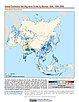
Global 1-km Downscaled Population Base Year and Projection Grids Based on the SSPs, v1.01 (
|
Population (POP), Built-Up Estimates (BUILT), and Degree of Urbanization Settlement Model Grid (SMOD), v1 (1975, 1990, 2000, 2014, 2015)Global Human Settlement Layer (GHSL)
To provide global data on human population, built up area, and degree of urbanization for the years 1975, 1990, 2000, and 2014/2015 in the World Geodetic System 1984 (WGS84) geographic coordinate system. |
|
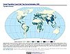
Global One-Eighth Degree Population Base Year and Projection Grids Based on the SSPs, v1.01 (
|
||
Global Human Modification of Terrestrial Systems, v1 (2016)Land Use and Land Cover
To provide a cumulative measure of human modification of terrestrial lands based on modeling the physical extents of 13 anthropogenic stressors and their estimated impacts using spatially-explicit global data sets. |
Global Development Potential Indices, v1 (2016)Land Use and Land Cover
To provide spatially-explicit data that relatively rank global land suitability referred to as Development Potential Indices (DPIs) for 13 sectors related to renewable energy, fossil fuels, mining and agriculture as an aid to conservation priority setting. |
|
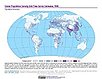
MA Population, v1 (
|
||
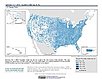
Summary File 3: Metropolitan Statistical Areas, v1 (1990)U.S. Census GridsTo provide gridded demographic data, including characteristics of income, education, and housing, for metropolitan statistical areas at a finer resolution than is available in the 30 arc-second grids used for the United States as a whole. |
||
Summary File 3: Metropolitan Statistical Areas, v1 (2000)U.S. Census Grids
To provide gridded demographic data, including characteristics of income, education, and housing, for metropolitan statistical areas at a finer resolution than is available in the 30 arc-second grids used for the United States as a whole. |
||
Summary File 3, v1 (1990)U.S. Census GridsTo provide gridded demographic data, including characteristics of income, education, and housing, for the United States for data integration. |
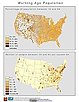
Summary File 1: Metropolitan Statistical Areas, v1 (1990)U.S. Census GridsTo provide gridded demographic data, including characteristics of age, race, ethnicity, and housing, for metropolitan statistical areas at a finer resolution than is available in the 30 arc-second grids used for the United States as a whole. |
|
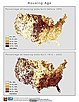
Summary File 1: Metropolitan Statistical Areas, v1 (2000)U.S. Census Grids
To provide gridded demographic data, including characteristics of age, race, ethnicity, and housing, for metropolitan statistical areas at a finer resolution than is available in the 30 arc-second grids used for the United States as a whole. |
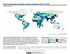
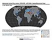
Historical Urban Population, v1 (
|
|
Georeferenced U.S. County-Level Population Projections, Total and by Sex, Race and Age, Based on the SSPs, v1 (
|
Latin America and the Caribbean Population Time Series, v1 (1990, 2000)Population DynamicsTo describe changing population distribution and growth in Latin America and the Caribbean using spatially consistent and comparable units at a spatial resolution suitable to regional change analysis. |
|
1 of 5
Prev
|
Next
|