Data Sets (296)
| 7 of 15 |
Anthropogenic Biomes of the World, v2 (1900)Anthropogenic BiomesTo provide information on anthropogenic transformation of the biosphere circa 1900 for global land use studies and research on human-environment interactions. |
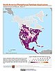
ATSDR Hazardous Waste Site Polygon Data with CIESIN Modifications, v2 (2010)Superfund Site FootprintsTo provide an easily accessible, corrected data set of polygons for hazardous waste sites in the United States which can be used to identify nearby populations and assess their potential risk. |
|
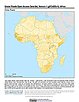
Natural Resource Protection and Child Health Indicators, 2014 Release (
|
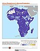
Environmental Performance Index, 2014 Release (
|
|
U.S. EPA National Priorities List Sites with CIESIN Modifications, v2 (2014)Superfund Site Footprints
To provide an easily accessible, corrected EPA data set of the geo-referenced locations displayed as points for all the National Priorities List (NPL) Superfund sites in the United States, Puerto Rico, and other territories. |
Summary File 3: Metropolitan Statistical Areas, v1 (1990)U.S. Census GridsTo provide gridded demographic data, including characteristics of income, education, and housing, for metropolitan statistical areas at a finer resolution than is available in the 30 arc-second grids used for the United States as a whole. |
|
Summary File 3, v1 (1990)U.S. Census GridsTo provide gridded demographic data, including characteristics of income, education, and housing, for the United States for data integration. |
Summary File 1: Metropolitan Statistical Areas, v1 (1990)U.S. Census GridsTo provide gridded demographic data, including characteristics of age, race, ethnicity, and housing, for metropolitan statistical areas at a finer resolution than is available in the 30 arc-second grids used for the United States as a whole. |
|
Natural Resource Protection and Child Health Indicators, 2013 Release (
|
Sea Level Rise Impacts on Ramsar Wetlands of International Importance, v1 (
|
|
Urban-Rural Population and Land Area Estimates, v2 (1990, 2000, 2010, 2100)Low Elevation Coastal Zone (LECZ)
To provide estimates of urban and rural populations and land areas for the years 1990, 2000, and 2010; and projections to the year 2100 for 202 countries with contiguous coastal elevations in the following categories: less than or equal to 1m, 3m, 5m, 7m, 9m, 10m, 12m, or 20m; as well as national totals. |
Global Roads Open Access Data Set (gROADS), v1 (
|
|
Summary File 1, v1 (1990)U.S. Census GridsTo provide gridded demographic data, including characteristics of age, race, ethnicity, and housing, for the United States. |
||
Natural Resource Protection and Child Health Indicators, 2012 Release (
|
||
Population, Landscape, And Climate Estimates (PLACE), v3 (1990, 2000, 2010)National Aggregates of Geospatial Data Collection (NAGDC)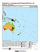
To provide tabular data to researchers without GIS capabilities who need data on population and land area by country across a range of physical characteristics. These include measures such as the number of persons living within coastal zones, the percent of a region within specific elevation strata, or the number of persons living within different climate zones. |
National and Regional Data Set by Source Category, v2.86 (
|
| 7 of 15 |