Data Sets (70)
| 3 of 4 |
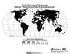
Natural Resource Management Index, 2010 Release (
|
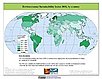
Environmental Performance Index, 2010 Release (
|
|
Change in Chlorophyll-a Concentration, v1 (
|
CODATA Catalog of Roads, v1 (
|
|
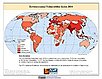
Environmental Performance Index, 2008 Release (
|
||
Population, Landscape, And Climate Estimates (PLACE), v2 (1990, 2000)National Aggregates of Geospatial Data Collection (NAGDC)
To provide tabular data on environmental conditions (elevations, climate, coastal) in which people reside. |
Urban-Rural Population Estimates, v1 (1990, 1995, 2000)Low Elevation Coastal Zone (LECZ)
To provide estimates of urban and rural populations and land areas in the low elevation coastal zone. |
|
Pilot Environmental Performance Index, 2006 Release (
|
Complete Collection, v1.01 (
|
|
National Footprint Accounts, 2006 Release (2003)Compendium of Environmental Sustainability IndicatorsTo help assess a country's demand on and supply of biological capital. |
Ancillary Data, v1 (
|
|
Unsatisfied Basic Needs, v1 (
|
Global Subnational Prevalence of Child Malnutrition, v1 (
|
|
MA Scenarios, v1 (
|
||
Centroids, v3 (1990, 1995, 2000, 2005, 2010, 2015)Gridded Population of the World (GPW), v3To provide a vector (point) version of the input administrative units used in GPWv3 for use in data integration. |
Environmental Sustainability Index, 2005 Release (
|
|
HANPP by Country and Product, v1 (1995)Human Appropriation of Net Primary Productivity (HANPP)To provide tabular data on human appropriation of net primary productivity by country. |
Environmental Vulnerability Index (EVI), 2004 Release (
|


| 3 of 4 |